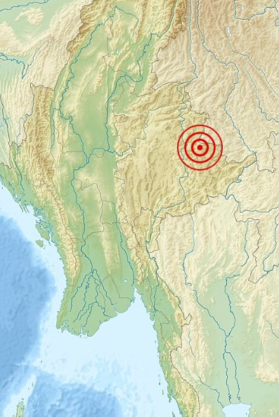
 From September 19, 1994, to May 12, 1995, a series of earthquakes with magnitudes of 4.7 MS (surface-wave magnitude) or higher shook the Myanmar-China border area. At the same time, seismologists noticed unusual anomalies in the region’s seismic data, and changes in water levels in Shidian County were seen as possible warnings of a major quake. Then, following the 6.2 ML (local magnitude scale) foreshock on July 10, 1995, the Yunnan Seismological Bureau sent a team to the area nearest the epicenter. After holding a meeting, seismologists predicted that a mainshock of around magnitude 7.0 was likely. Scientists from the Yunnan Provincial Earthquake Administration recommended an evacuation order based on this forecast, and less than 30 hours later, the mainshock hit.
The 1995 Menglian earthquake, also known as the Myanmar–China earthquake, struck on July 12 at 5:46am local time along the border between the two countries. Its epicenter was on the Myanmar side in the mountainous Shan State. Measuring 7.3 on the Chinese surface-wave scale and 6.8 on the moment magnitude scale, it reached a maximum Mercalli intensity of VIII. Because of the early evacuation, the quake only killed 11  people. It also injured 136 people, however, and destroyed over 100,000 homes in both nations, with another 42,000 seriously damaged. Some structural damage was also reported in Chiang Mai and Chiang Rai, Thailand. The relatively low death toll was credited to an early warning triggered by foreshocks and seismic anomalies, leading to evacuations before the main shock. It is considered one of the rare cases of a successfully predicted earthquake. I suppose that there would be some people who would say that it was luck, and maybe it was, but the seismologists saw something in the situation that caused them to be alarmed. And the scientists agreed and called for the evacuation. Whatever the case may be, lives were saved.
The Shan Plateau, stretching across Yunnan and Shan State, is characterized by strike-slip structures that handle the Sunda Block’s crustal rotation and deformation from the India-Asia collision, where the Indian plate is forced beneath the Eurasian plate. It was shaped by uplift along the Shan Scarp Fault Zone, an inactive shear zone and reverse or thrust fault at its western edge. To the east lies the active Sagaing Fault, a right-lateral transform fault dividing the Burma and Sunda plates. To the north, the Red River Fault extends for 1,000 km as  an active right-lateral fault. Between the Red River and Sagaing faults, bookshelf-style faulting from shear deformation has led to mostly right-lateral strike-slip faulting across the plateau. The earthquake happened due to dextral strike-slip faulting at a shallow depth in the Shan Plateau, rupturing a previously unmapped northwest–southeast striking structure near faults tied to the 1988 Lancang–Gengma earthquakes. Strike-slip faulting here results from “bookshelf-style” deformation caused by the plateau’s position between the Sagaing and Red River faults. The 1995 earthquake may have been triggered by increased coulomb stress transfer from the 1988 event. While the cause may never be fully known, the people whose lives were saved will aways be grateful for the quick actions of the seismologists and scientists who made the call.


Leave a Reply