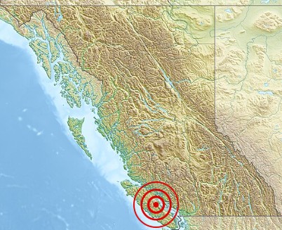
 On June 23, 1946, a powerful magnitude 7.3 earthquake struck Vancouver Island, causing significant damage but relatively few casualties thanks to its timing and location. The quake struck at about 10:13a, Pacific Time, and it remains the largest recorded onshore quake in Canadian history. The epicenter was in the Forbidden Plateau area of central Vancouver Island, near Courtenay and Campbell River. Tremors were felt from Portland, Oregon, in the south to Prince Rupert, British Columbia, in the north. The shaking sparked widespread panic, sending people rushing into the streets in cities like Victoria and Vancouver.
The earthquake caused major damage, toppling about 75% of the chimneys in nearby towns like Cumberland, Union Bay, and Courtenay. Comox, Port 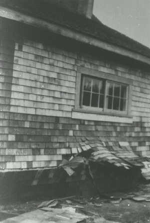 Alberni, and Powell River also saw significant destruction. Sadly, two people lost their lives…one drowned when a small boat capsized in a wave triggered by the quake, and another suffered a fatal heart attack in Seattle. The quake is thought to have been caused by a strike-slip fault linked to Vancouver Island’s geological features, though the exact tectonic forces remain unclear. The event sparked greater interest in seismology in Canada, leading to the installation of more sensitive seismometers and a systematic study of regional earthquakes.
The earthquake triggered numerous landslides across Vancouver Island and caused land subsidence, especially along the Strait of Georgia’s shorelines. Deep Bay’s seabed sank between 9 feet and 84 feet, according to the Canadian Hydrographic Service, and Read Island experienced a 9.8 feet ground shift. Ships in the area felt jolts like running aground, and undersea power lines were destroyed in Alberni Inlet and near Powell River. Lighthouse keepers reported damage such as shattered windows and broken dishes. A tsunami hit Texada Island’s west coast with two waves…one 6 feet 7 inches high and another 3 feet 3 inches high. The quake also 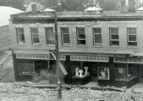 caused a landslide near Mount Colonel Foster. Fortunately, an aerial survey of Vancouver Island began shortly after in 1946, providing valuable photographs later studied in the late 1970s.
The 1946 Vancouver Island earthquake stands out as a major event in Canadian history, reminding us of the region’s seismic activity and the possibility of future quakes. It underscored the need for preparedness and awareness of geological risks in the Cascadian Subduction Zone. This quake marked a key moment in Canada’s seismic history, showing both the force of nature and the resilience of communities facing disaster.


Leave a Reply