California
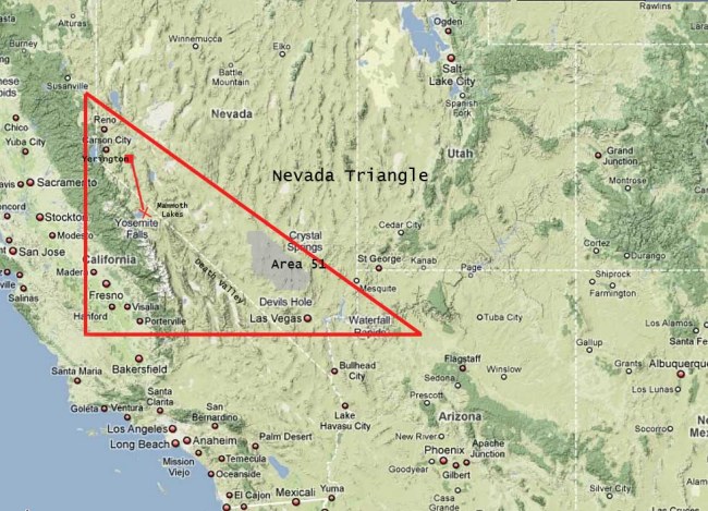
 I think we have all heard of the Bermuda Triangle, where planes and ships have mysteriously gone missing in the Atlantic Ocean for decades, but most people are not aware that there is a similar place in Alaska and one in Nevada. The Nevada Triangle lies in a region of the Sierra Nevada Mountains in Nevada and California. In that area, some 2,000 planes have been lost in the last 60 years. That may not seem significant, but when you break it down, it is about 3 crashes/disappearances a every month of those 60 years. The Nevada Triangle is more than 25,000 miles of mountain desert. It is a remotely populated area, and many of the crash sites have never found.
The triangle location is roughly defined as spanning from Las Vegas, Nevada; to Fresno, California; to Reno, Nevada. Of course, notoriously located in this wilderness area is the mysterious, top-secret Area 51…adding to the mystery of these disappearances. Along with the dozens of conspiracy theories which include UFO’s and paranormal activity that surrounds the air force base, similar theories have long been considered regarding the Nevada Triangle. Throughout these many years, many of the missing planes were flown by experienced pilots and disappeared under mysterious circumstances, with the wreckage never found. I don’t buy into most conspiracy theories, and I don’t know what I think of this situation either, but when you look at the statistics an undeniable picture of strangeness does seem to present itself.
Probably one of the most famous cashes of our current time is that of record-setting aviator, sailor, and adventurer, Steve Fossett on September 3, 2007. Fossett, who was flying a single-engine Bellanca Super Decathlon over Nevada’s Great Basin Desert, took off and never returned. Search crews combed the area for a month, before the search was called off and on February 15, 2008, Fossett was declared dead. Then on September 29th, 2008, Fossett’s identification cards were discovered in the Sierra Nevada Mountains in California by a hiker. Of course, that reactivated the search, and a few days later, the crash site was discovered, located approximately 65 miles from where the aviator initially took off. Initially, no remains were found, but two bones were later recovered a half mile from the crash site which were found to have belonged to Steve Fossett. It is assumed that his body was carried of by wild animals, hence the scattered bones.
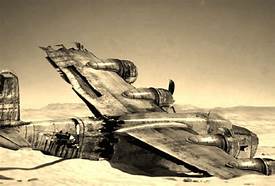
One of the earliest incidents of planes lost in the “Triangle” dates back 70 years when a B-24 bomber crashed in the Sierra Nevada mountains in 1943. The bomber, took off on December 5th, piloted by 2nd Lieutenant Willis Turvey and co-piloted by 2nd Lieutenant Robert M Hester. The plane carried four other crew members including 2nd Lieutenant William Thomas Cronin, serving as navigator; 2nd Lieutenant Ellis H Fish, bombardier; Sergeant Robert Bursey, engineer; and Sergeant Howard A Wandtke, radio operator. A routine night training mission, the plane took off from Fresno, California’s Hammer Field destined to Bakersfield, California to Tucson, and then was scheduled to return. The next day an extensive search mission began when nine B-24 Bombers were sent out to find the missing plane. The search was unsuccessful, and also brought about another mystery, when one of the search bombers went missing. On the morning of December 6, 1943, Squadron Commander Captain William Darden lifted off along with eight other B-24s. Captain Darden, his airplane, and remaining crew would not be seen again until 1955, at which point the Huntington Lake reservoir was drained for repairs to the dam. I suppose that all of the missing planes are somewhere, and might still be discovered someday, bit it is a vast area, and it is almost impossible to search all of it. Even with information concerning Captain Darden and his B-24, by survivors who bailed out at the captains orders, that the captain tried to land in a clearing that ended up being a half frozen lake, it still took twelve years to locate the plane.
The father of the original B-24’s co-pilot never gave up the search, although he was unsuccessful and died of a heart attack in 1959, about 14 years after the crash. One year after Clinton Hester passed away, the wreckage was found in July 1960 by to United States Geological Survey researchers who were working in a remote section of the High Sierra, west of LeConte Canyon in Sequoia and Kings Canyon National Parks. There, they found airplane wreckage in and near an unnamed lake. Later, Army investigators revealed the wreckage to be that of the first missing bomber piloted by 2nd Lieutenant Willis Turvey and co-piloted by 2nd Lieutenant Robert M. Hester. The lake is now known as Hester Lake.
It would seem that the Kings Canyon National Park area is a tough one to search, and seems to hold the key to may of the missing planes. As odd as some of these events sound, I find it hard to believe that they could have just disappeared. Still, I’m no expert in the matter, and these may not have been the only time something or someone just went missing. I am reminded of Enoch in the Bible, “And Enoch walked with God and disappeared because God took him.” Genesis 5:24. Whatever may have happened in these cases of missing planes, some of which we may never know, and some that may remain a mystery for years; the fact remains that this is a very difficult area to search, and so we really just don’t know. “Conspiracy theorists have long claimed the reason so many flights have disappeared is connected to the presence Area 51, where the US Air Force is known to test secret prototype aircraft. But, many experts believe the disappearances can be attributed to the areas geography and atmospheric conditions. The Sierra Nevada mountains run perpendicular to the Jet Stream, or high Pacific winds, which conspire with the sheer, high altitude peaks and wedge-shaped range to create volatile, unpredictable winds and downdrafts. This weather phenomenon is sometimes called the “Mountain 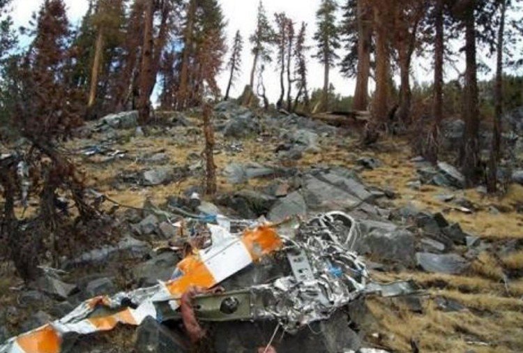
 Wave” where planes are seemingly ripped from the air and crashed to the ground.” Of course, many experts believe they are pilot error, inexperienced pilots getting caught in turbulence, and the disorienting mountain terrain. I suppose that is possible, but that is a lot of cases over the past 60 years. Then again, not every plane that flies over the area disappears either, so who am I to say.
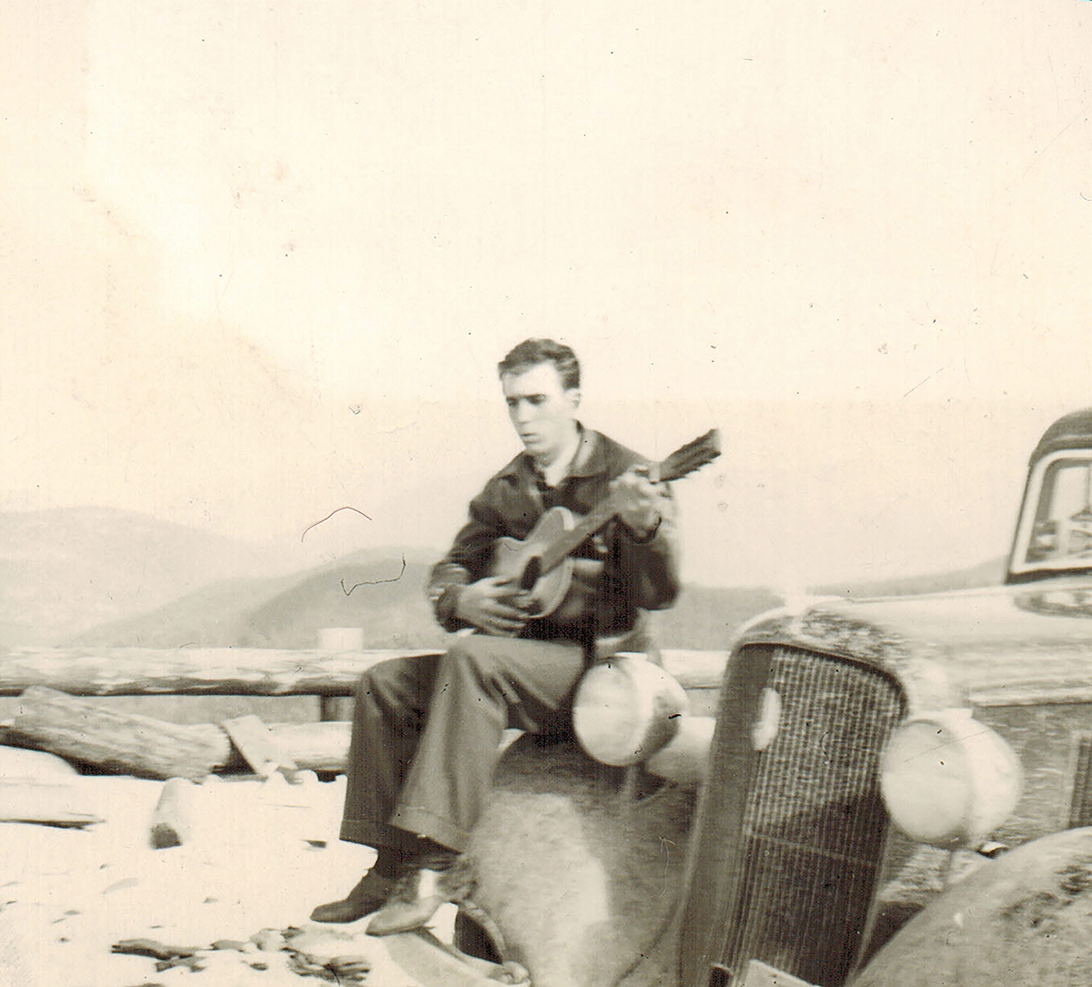 My grandson, Caalab Royce; his dad, Travis; as well as my Dad, Allen Spencer and Uncle Bill Spencer; brother-in-law, Chris Hadlock; and nephew, Ryan Hadlock all play the guitar. There may be others in the family too, but they haven’t made it public knowledge. Any time I come across a some information, on guitars or their makers, I am interested, because of these people.
Adolph Rickenbacker was born on April 1, 1886 in Basel, Switzerland as Adolph Rickenbacher. Following the death of his parents, he immigrated to the United States in 1891 with relatives. He settled in Columbus Ohio and later moved to southern California. Rickenbacher was a distant cousin to America’s top Flying Ace Eddie Rickenbacker. Rickenbacher decided that the name association would be helpful to him in his chosen career, so he Anglicized both his own name and that of his company, to Rickenbacker Manufacturing Company. His company made metal bodies for the National String Instrument Corporation. These metal bodies were used to make electric guitars. Through this connection, he met George Beauchamp and Paul Barth, and in 1931 they founded the Ro-Pat-In Company.
The three men produced the first cast aluminum versions of the lap steel guitar in 1932. In 1934, they renamed their company to the Electro String Instrument Corporation. Still, this was not to be a long term business. Music instruments tend to evolve and the resulting instrument looks little like the original. Production 
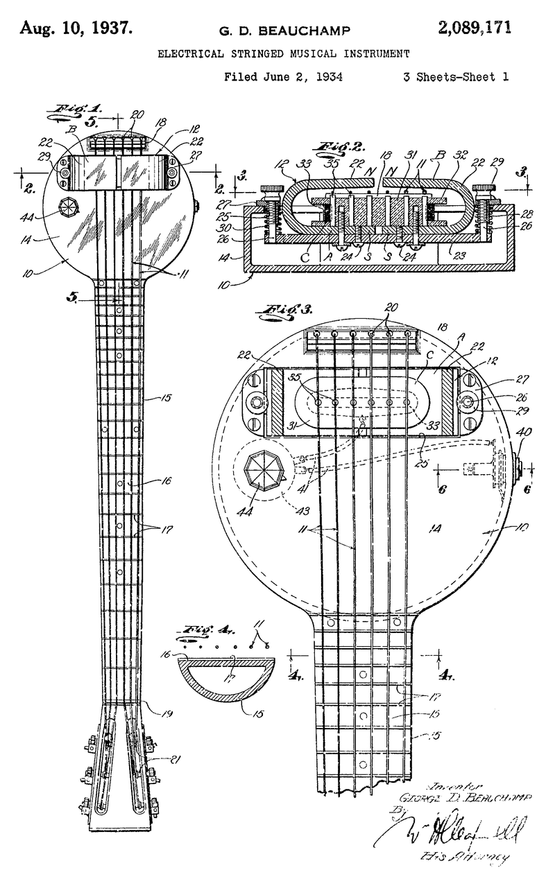 ceased in 1939, after approximately 2,700 Frying Pan guitars had been produced. Rickenbacker, who was not convinced of the guitar business’s potential, continued manufacturing until 1953. Then he sold his company to Francis Cary Hall, a forerunner of the Southern California electric guitar boom. I wonder what might have been if the Electro String Instrument Corporation had continued on. While the signature “Frying Pan Guitar” might not have held it’s popularity, many other looks have followed.
Nevertheless, the “Frying Pan Guitar” had been a wonderful career for Rickenbacker. When he finally sold the business, Adolph Rickenbacker was 67 years old. He went on to live a over 20 more years before he died from cancer in Orange County, California on March 21, 1976 at the age of 89.
 I think that many of us have thought about a hidden treasure…probably as kids, but maybe as adults too. In fact, with the number of metal detectors sold every year, maybe there are just as many adults looking for hidden treasure as kids.
Dr John Marsh was born June 5, 1799 in South Danvers, Massachusetts. In college at Harvard, he had intended to study ministry, but changed his mind and received his bachelors degree in medicine. He then studied medicine with a Boston doctor. He then decided to move to California, and became an early pioneer and settle in Alta, California. He was also the first Harvard graduate, the first to practice medicine there. He knew Hebrew, Latin and Greek, and was the first to compile a dictionary of the Sioux language. He became one of the wealthiest ranchers in California, and was one of the most influential men in the establishment of California statehood.
The Reverend William W Smith introduced Marsh to Abigail “Abby” Smith Tuck, a schoolteacher from New England, who also served as principal at a girls school in San Jose. After a brief two-week courtship, they were married on June 24, 1851. Soon after the wedding, the couple moved into the old adobe. On 12 March 1852, she gave birth to a daughter they  named Alice Frances. Shortly thereafter, Marsh set out to build his family a home. Abby had picked the spot for their home. The home that was nestled in the foothills of Mount Diablo. The home was located next to a creek that was later named Marsh Creek after the doctor. While the home was stunning, the cost of building it did not exceed $20,000.
Marsh was not only a doctor, but also a rancher, and was very successful, even though he was usually paid for medical services in the currency of the day…cowhides and tallow. Marsh might have been a bit of an eccentric, or maybe he just didn’t trust banks. Whatever the case may be, he was known to bury his money in the foothills near his home. Abby died in 1855, and maybe that was what set Marsh to burying the money. I don’t think anyone knows. It is thought that Marsh buried about $40,000 in gold coins in the area, but the money  has never been found. On September 24, 1856, while coming home from Martinez, Marsh was murdered. It happened on the road between Pacheco and Martinez. Riding by, he was ambushed and murdered by three of his vaquero employees over a dispute about their wages. Two of the killers were found ten years later and brought to trial. One man turned state’s evidence and was released without trial. The other was convicted and sentenced to life in prison, though he was pardoned 25 years later. The third man was never caught. A California Historical Landmark #722 plaque still marks the site of the murder. John and Abigail Marsh are buried in Mountain View Cemetery, in Oakland, California.
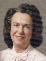
 My Aunt Ruth Wolfe was the youngest of the four children of my grandparents, Allen and Anna Spencer. She was born on November 9, 1925 in Duluth, Minnesota. Strange to think that 31 years later, she would get a niece…me, who would be so much like her…in some ways that is. My Aunt Ruth was a very talented woman. She could play any instrument that was set before her, she could paint and do crafts, she loved horses and even raced them, and of course, she was an animal lover…all animals.
Aunt Ruth was never really one to want to settle in one place for very long…until she and Uncle Jim moved to the Spokane area, that is. Once they bought their mountain top outside of Newport, Washington, she knew she was home. The family built three cabins on the mountain top, one for Aunt Ruth and Uncle Jim; one for their daughter Shirley Cameron and her husband Shorty; and one for their son, Terry Wolfe. The beauty of the mountain lulled them into a quiet, peaceful life, far away from the hustle and bustle of the California area they had left behind after losing their son, Larry Wolfe to an accidental explosion. Nothing would bring him back, of course, but the peace of the mountain top helped to heal their wounded hearts.
Aunt Ruth and Uncle Jim, while very much at home on their mountain top, never lost their love of the open road, and often took trips to several location, including Casper, Wyoming to visit my family, her brother, Allen Spencer; sister-in-law, Collene; and daughters, Cheryl Masterson, Caryn Schulenberg, Caryl Reed, Alena 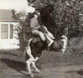
 Stevens, and Allyn Hadlock. We loved those visits. Aunt Ruth and Uncle Jim were always lots of fun, and having them in town again was a great treat. They had lived in the Casper area years before, and we were all very sad to see them move away. Those wonderful visits were cut short when Aunt Ruth became ill, and she passed away on May 11, 1992 of Cancer. Today would have been Aunt Ruth’s 94th birthday. Happy birthday in Heaven Aunt Ruth, I know you’re having a great celebration with all the loved ones who have now joined you there. We love and miss you very much.
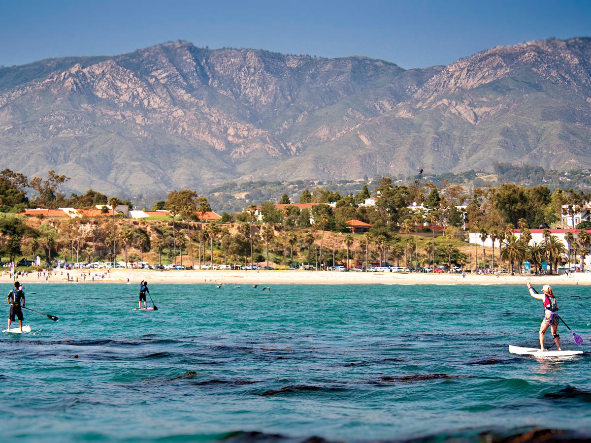
 Santa Barbara, California is a picturesque area with mountains to the east, ocean to the west, and palm trees everywhere. It seems like a perfect kind of paradise, and most of the time it probably is, but on June 29, 1925, many things changed. That morning, a magnitude between 6.5 and 6.8 earthquake hit the area of Santa Barbara. Although no foreshocks were reportedly felt before the mainshock, a pressure gauge recording card at the local waterworks showed disturbances beginning at 3:27am, which were likely caused by minor foreshocks. Then, at 6:44am the mainshock occurred, lasting 19 seconds. The earthquake’s epicenter was in the Pacific Ocean off the coast of Santa Barbara, in the Santa Barbara Channel. It is thought that the fault on which it occurred is an extension of the Mesa fault or the Santa Ynez system. The earthquake was felt from Paso Robles in San Luis Obispo County to the north to Santa Ana in Orange County to the south and to Mojave in Kern County to the east. Major damage occurred in the city of Santa Barbara and along the coast, as well as north of Santa Ynez Mountains, including Santa Ynez and Santa Maria valleys.
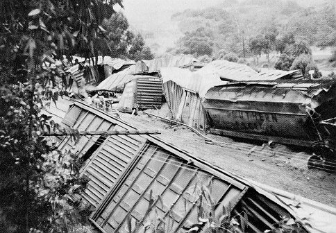
Those were 19 seconds that started a disaster of epic proportions. The earthquake was immediately complicated when the dam broke and water mains burst. The earthen Sheffield Dam had been built near the city in 1917. It was 720 feet long and 25 feet high and held 30 million gallons of water. The soil under the dam liquefied during the earthquake and the dam collapsed. This was the only dam to fail during an earthquake in the United States until the Lower San Fernando Dam failed in 1971. When it burst, a wall of water swept between Voluntario and Alisos Streets destroying trees, cars, three houses and flooding the lower part of town to a depth of 2 feet. The rushing water caused some areas of the city to be flattened. People as far away as San Francisco and Los Angeles felt the earthquake, reporting millions of dollars worth of damage across California. The earthquake was even felt in other states as far away as Montana, who reported more damage. The earthquake destroyed the historic center of the city, with damage estimated at $8 million in 1925, or about $117 million today.
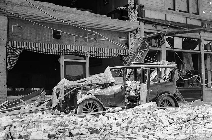
Thirteen people lost their lives that day, but it may have been far worse without the actions of three heroes. Those heroes shut off the town gas and electricity preventing a catastrophic fire. Most homes survived the earthquake in relatively good condition, with the exception of the fact that every chimney in the city crumbled. The downtown area of Santa Barbara was in complete ruins. On State Street, the main commercial street, only a few buildings remained standing after the earthquake. The City Cab building, The Californian, and Arlington garages…all large and fully occupied parking structures…collapsed. They were full of cars. Many other vehicles were crushed in the downtown area too. At least one death was the result of the San Marcos building crushing a car, as walls of buildings fell onto cars parked there. In the 36 block business district, only a few structures were not substantially damaged. Many had to be completely demolished and rebuilt. The façade of the church of the Mission Santa Barbara was severely damaged and lost its statues. Many important buildings, including hotels, offices, and the Potter Theater, were lost. The courthouse, jail, library, schools, and churches were among the buildings sustaining serious damage. Concrete curbs buckled in almost every block in Santa Barbara. Pavement on the boulevard along the beach was displaced by about a foot to a foot and a half, but oddly, the pavement in the downtown area was virtually not damaged.
Railroad tracks were damaged in several places between Ventura and Gaviota. In particular, a portion between Naples and Santa Barbara was badly damaged. Seaside bluffs fell into the ocean, and a slight tsunami was felt by offshore ships. The town was completely cut off from telephone and telegraph, and the only source of news was from shortwave radios. Because the gas was shut off, there was an absence of post-earthquake fires. This allowed scientists to study earthquake damage to various types of construction. That was a rare things for the scientists. The American Legion and the Naval Reserves from the Naval Reserve Center Santa Barbara patrolled the streets looking to inhibit looters of the damaged businesses and homes. Additional fire and police personnel arrived from as far as Los Angeles to assist the sailors and soldiers in maintaining order. Three strong aftershocks occurred at 8:00am, 10:45am, and 10:57am, but without further damage. There were many smaller shocks that continued throughout the day. An aftershock on July 3 caused additional cracked walls and damaged chimneys. Since downtown Santa Barbara suffered so much damage, there was a large-scale construction effort in 1925 and 1926 aimed at removing or repairing damaged structures and constructing new buildings. This new construction completely altered the character of the city center. Before the earthquake, a considerable part of the center was built in the Moorish Revival style. After the earthquake, the decision was made to rebuild it in the Spanish Colonial Revival style. This effort was undertaken by the Santa Barbara Community Arts Association, which was founded in the beginning of the 1920s and viewed the earthquake as the opportunity to rebuild the city center in the unified architectural style. As a result, many buildings later 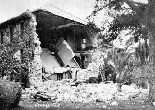
 listed on National Register of Historic Places were designed in the late 1920s, among them the Santa Barbara County Courthouse and the front of the Andalucia Building. Building codes in Santa Barbara were also made more stringent after the earthquake demonstrated that traditional construction techniques of unreinforced concrete, brick, and masonry were unsafe and unlikely to survive strong quakes.
 The Gold Rush affected many states and many people. Everyone headed west to try their luck, hoping to strike it rich. While the big strikes seemed to be in California, the Black Hills, and Alaska, there were many other places where miners struck it rich…and just as many where the miners went bust. It takes a special group of people to persevere in the gold rush years, and many went home broke, or found another way to cash in on the god rush, such as stores where the miners could buy supplies, or saloons, where they could drown their sorrows.
Wyoming had it’s share of gold mines and gold strikes too. Atlantic City was located in west central Wyoming, it was one of three mining towns in the area. The others were South Pass City, and Hamilton City. These towns sprung up as a result of the gold discovery at Spring Gulch in 1867. Hamilton City is located about three miles east of Atlantic City, but it could prove very difficult to locate, because early on in the town’s history, the townspeople unofficially renamed it to Miners Delight after the area’s largest and most productive mine, which carried the same name and was located on Peabody Hill.
The Miners Delight mine was founded by Jonathan Pugh. After a while, the town was officially changed to Miners Delight, since no one called it Hamilton City anyway. At first the mine was a rich enough producing mine to warrant a 10-stamp mill to be erected to crush the rock. The first mention of the town in newspapers appeared in July 1868 with the Sweetwater Mines newspaper describing it as: “…some thirty buildings are up, and more in course of construction. Spring Gulch is turning out the bright ore in very comfortable quantities,” and continues “Ten companies are at work in Spring Gulch…and all appear content with the result of their labors.”
Strangely, the owners of the Miners Delight mine found that recovering gold is more expensive than the gold is worth. After a short few years, the town’s population fell dramatically from its peak of some 75 residents. The Miners Delight Mine shut down in 1874, but soon reopened again…only to close again in 1882. The mining camp would endure good times and bad times over the next several decades, including the Great Depression. Over the years the mine produced over $5 million in gold ore…a relatively small amount as gold goes. The town was inhabited as late as 1960, but today it is nothing but abandoned ruins.
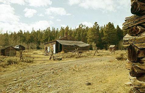
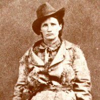
If you go there, you can expect to see rusting iron equipment, such as this old stove, and a couple of iron box screens, around the cabins of Miners Delight, Wyoming. It all seems like nothing much, but in the town’s heyday, it was even home to a couple of famous residents. Henry Tompkins Paige Comstock, would later discover the famous Comstock Lode in Nevada, and a young orphaned girl named Martha Jane Canary, who became known a Calamity Jane. As a child, Marth was adopted and moved with her new parents to Miners Delight. She liked the wild life in both Atlantic City and Miners Delight, and then in Deadwood, South Dakota.
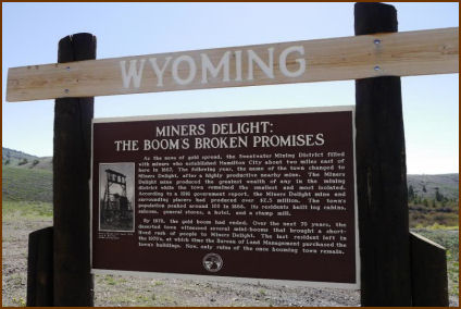
 Today, the site is located on Bureau of Land Management property. Some preservation work has been done in order to keep the few remaining buildings standing, but the site is not being restored. Miners Delight is listed on the National Register of Historic Places. The site continues to preserve several cabins, one building that was said to have been a saloon, a baker, a barn, and a couple of outhouses. They are the last remnants of a long ago era.
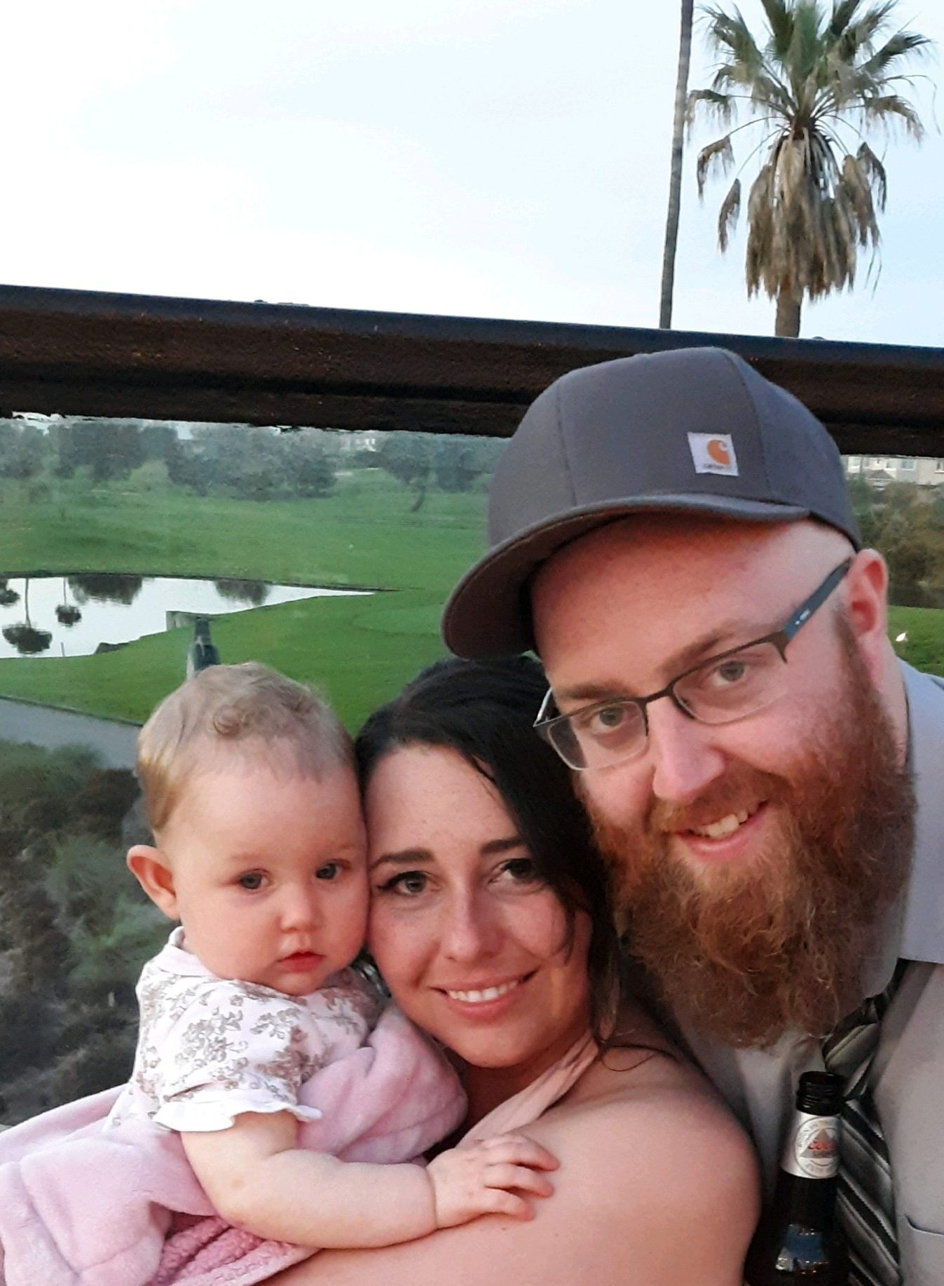
 My niece, Kayla Stevens is first and foremost a wife to my nephew, Garrett, and a mom to their daughter, 10 month old Elliott Michelle. Being a mom is a dream come true for Kayla, and she is having the time of her life. She and Elliott are very close, and now that the weather is nicer, they have been going on walks every evening after Kayla gets off work. It’s their mother daughter time. Kayla is a great mom, and Elliott is a happy, healthy baby girl, who is full of smiles.
Kayla has been busy this summer being a bridesmaid for her friend Hannah’s wedding in Huntington Beach, California. The whole family went and had a great time. It was Elliott’s first vacation, and they made some great memories there. Kayla will be a bridesmaid in two more weddings this summer, so the summer is shaping up to be quite busy. Weddings are always fun, and for Kayla to be able to help celebrate with her friends is awesome.
A couple of weeks ago, Kayla started a new job at the VA Hospital in Sheridan, Wyoming on their suicide prevention task force. She has worked hard both studying to become a social worker and in her prior job, but I think that this is going to be the culmination of the vision she had for her career. So far she likes her new job. I think is takes a special kind of person to deal with the stresses and problems of other people, but Kayla has a heart for that, and I know that she is a blessing both to her coworkers and her patients.
Kayla’s family all live in Sheridan, and she still has all four of her grandparents, so her little family has been 
 spending lots of time with all of them. They have started a tradition of getting together for lunch after church on Sundays with a lot of the family joining in. They also go to Kayla’s parents, Lynette and Wes Smiley’s house in the country for dinner on the weekends. Elliott loves to look at the cows and horses. Also, now that the weather is nice, they have been able to come to Casper to visit Garrett’s family, my sister, Alena and her husband Mike, as well as his sisters Michelle and Lacey. Alena and Mike have also had more opportunities to go to Sheridan to visit. Its a busy life in so many ways, but Kayla and Garrett feel very blessed with their little family, and their extended families. Today is Kayla’s birthday. Happy birthday Kayla!! Have a great day!! We love you!!

 I never thought that I would have much interest in how a guitar was made, but my grandson, Caalab Royce is interested in building guitars, so of course, I became interested too. You do that with your children and grandchildren. Caalab showed me pictures of the guitars he wanted to make, and told me that he could buy a kit to build one, that would include all the parts. I truly believe there will come a day that he will build a guitar, and it will be beautiful, and sound beautiful. I might be
 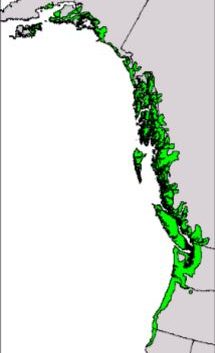 biased, but if my grandson makes it, I know it will be perfect.
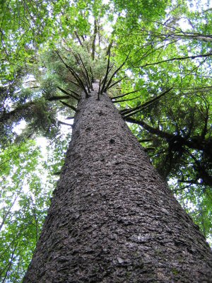
Recently, I stumbled across an article about a musical wood. That caught my attention. I wondered how wood could be musical. Of course, it couldn’t, as I already knew and went on to find out, but the Sitka Spruce tree is, nevertheless, the wood used for the vast majority of acoustic guitar, piano, violin, and other musical-instrument soundboards. That told me that the wood must have some kind of musical importance. I found out that the wood has excellent acoustic properties. The wood is light, soft, and yet, relatively strong and flexible. The Sitka Spruce is also used for general construction, ship building, and plywood.
Found mostly in Southeast Alaskan forests, the Sitka Spruce is being harvested at such a rate that the end of the instrument-quality supply is in sight. That doesn’t mean that the Sitka Spruce was becoming extinct, but it takes time to grow to some size, so the instrument-quality is becoming less available. The population of the Sitka Spruce is stable at this point, and it grows in Alaska, as well as Washington, Oregon, and California, 
 meaning that there is plenty of places to re-seed this important tree. It really is just a matter of waiting for the growth, and when you are talking about a tree, it’s very different than a puppy. You are talking years for a tree. A Sitka Spruce grows to around 88 feet in height after 50 years, to 157 feet after 100 years. That means that by the time the trees grow to usable size, the guitar builders of today will be long gone, so a new generation will be the ones to use the new growth. I hope that Caalab will have a chance to build a guitar out of Sitka Spruce before the wood is no longer available.
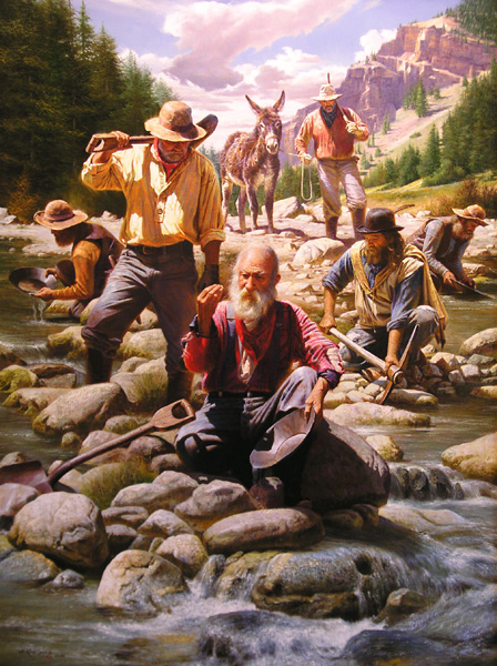 After the discovery of gold in California, people went crazy…mad really for gold. For twenty years, in fact, all the West was mad for gold. People packed up their lives, and headed west, hoping to dig their fortune out of the California dirt. At first, the people heading west were mostly men, but there were families that went too. It didn’t really matter who it was, when it came to gold, people were willing to fight to the death for what was theirs, or for what they wanted. Greed was the word of the day, and it was a disease that everyone in California had.
The Gold Rush brought honest citizens and outlaws alike to California. People had to be on guard at all times. If someone struck gold, they were an immediate target for anyone willing to steal their gold, or even to kill for it. The mad rush for gold soon spread to other areas of the United States. The gold-hunters, no longer content with California, began to prospect lower Oregon, upper Idaho, and Western Montana too. They figured that if one place had gold, why wouldn’t another place have it too. And with the slightest discovery, came the craziness of Gold Dust Fever.
With Gold Fever came the sinister figure of the trained desperado, the professional bad man. The business of 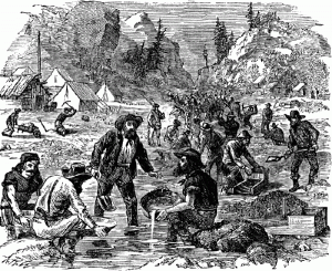 being an outlaw was turned into one highly organized profession that was relatively safe and extremely lucrative. There was wealth to be had for the asking or the taking, and these men, and sometimes women, were willing. Each miner had his buckskin purse filled with native gold. This dust was like all other dust. It could not be traced nor identified; and the old saying, ”’Twas mine, ’tis his,” might here of all places in the world most easily become true. There were no checks, drafts, or currency, as we know it now. The normal means by which civilized men keep a record of their property transactions, were unknown. The gold scales established the only currency, and each man was his own banker, obliged to be his own peace officer and the defender of his own property. It was a wild world. It was a world mad for gold.
 As long has there have been road trips with children, there have been bored children, asking, “When do we get there?” They don’t understand that one of the best parts of a road trip is the time spent on the road. The destination is the end of the adventure, not necessarily the adventure itself. Invariably, after the ten time that those precious little ones ask that dreaded question, tempers begin to flare. These days, cars come with built in DVD players to occupy the kids on the road trip, but back when I was a kid, those things didn’t exist.
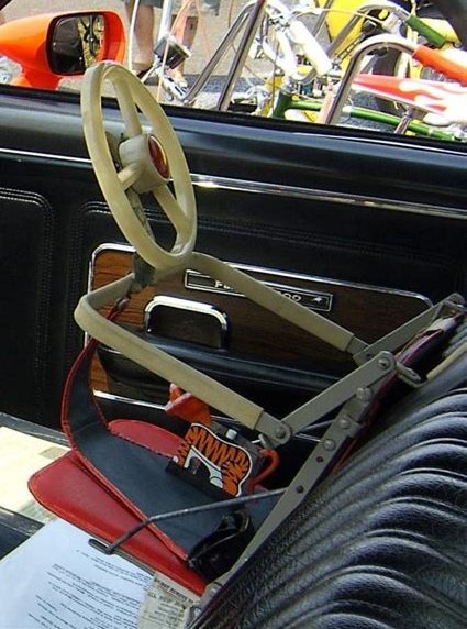
Somewhere along the way, someone…probably a frustrated parent…came up with the idea of allowing the kids to participate in the trip by giving them a steering wheel of their own, so they could help their parents drive. I do know that in January of 1955, a  man named Jack Fletcher of West Covina, California installed a plastic windshield and three miniature steering wheels in the back seat of his car to entertain his children, Janie, Johnny and Ricky, who were 3 years, 21 months, and 21 months respectively. Apparently, it was a good idea, at least for those children, because, the idea has hung around ever since. In fact, for Christmas, we got our great granddaughter a version that can sit on the floor in front of her, or even on her highchair tray. Now she can “help” her daddy drive too. As children get older, I’m sure that the novelty of a steering wheel wore off, but if you
  got a year or so of peace in the car, it’s worth the effort.
Of course, when I was a kid, there were mo car seats, and it wasn’t illegal to drive with your child on your lap. Many a child, me and my sisters included, learned to steer the car while seated on our daddy’s lap. It was great fun, and a memory we will always have. I suppose that today’s drivers, police officers, and child safety advocates would cringe at the thought of a child on the lap of the driver, and maybe it wasn’t the safest way to do things, but I don’t recall hearing about dozens of children dying in that manner either, so maybe the parents of yesteryear weren’t so careless after all. All I know, is that we had a great time on those road trips.

