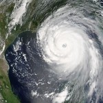
 On August 29, 2005, Hurricane Katrina came screaming into southeast Louisiana. It quickly set its sights on a large lake that many people in the rest of the United States probably didn’t even know existed, and those who did know, gave little thought to it. Nevertheless, Lake Pontchartrain was about to make national headlines, where it would remain for months to come. Hurricane Katrina and Lake Pontchartrain were about to make history. Together they were set to cause the music in the party town of New Orleans to stop. And it would be a long time before the people of New Orleans would feel much like singing. Nevertheless, the city of New Orleans would return to its former self again.
Bob and I were among those people who had really never heard of Lake Pontchartrain, and like us, if you didn’t know much about Lake Pontchartrain, you didn’t really understand the magnitude of the weakened levees. Hurricane Katrina brought heavy rain to Louisiana. Eight to ten inches fell on the eastern part of the state. In the area around Slidell even more rain fell. The highest rainfall recorded in the state was 15 inches. As a result of the rainfall and storm surge the level of Lake Pontchartrain rose and caused significant flooding along its northeastern shore, affecting communities from Slidell to Mandeville. Several bridges were damaged or destroyed, including the I-10 Twin Span Bridge connecting Slidell to New Orleans. Almost 900,000 people in Louisiana lost power as a result of Hurricane Katrina. In the end, at least 1,245 people died in the hurricane and subsequent floods, making it the deadliest United States hurricane since the 1928 Okeechobee hurricane.
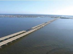
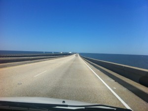
Bob and I traveled to New Orleans in April of 2012. So many changes took place between August of 2005 and April of 2012. Nevertheless, I wasn’t sure how I felt about driving across that causeway that spanned Lake Pontchartrain. Yes, it had escaped damage in Hurricane Katrina, but it still crossed the widest part of a very large lake, and since I knew that the lake’s surges had the ability to severely damage it and the surrounding area…well, I just didn’t know how I would feel about the 23.83 mile drive across…not until we started across the bridge that is. It was an amazing bridge, and an amazing ride across it. The lake was serene, and I found myself hard pressed to picture the lake surging in the fury of a hurricane. I found it hard to picture the water so wild that it could damage a bridge, but it had happened…not to this bridge, but to others. The causeway bridge had been in use from it’s opening on August 30, 1956. At the time we were there, I had no idea of the length of the history of the Causeway. The idea of a bridge spanning Lake Pontchartrain dates back to the early 19th century and Bernard de Marigny, the founder of Mandeville. He started a ferry service that continued to operate into the mid-1930s.
After the 30s, and prior to the Causeway being built, people who lived in Covington and worked in New Orleans, had a very long commute to work. The bridge, while still 23.83 miles across the lake, took a large portion of that commute away. It was truly a great asset to the cities on both sides of the lake. Since 1969, the Causeway was listed by Guinness World Records as the longest bridge over water in the world. In 2011, when 
 the allegedly longer Jiaozhou Bay Bridge in China was built, Guinness created two categories for bridges over water…continuous and aggregate lengths over water. Lake Pontchartrain Causeway became the longest bridge over water (continuous), while Jiaozhou Bay Bridge the longest bridge over water (aggregate)…because of its sections that are over land. Even if the bridge does get replaced as the longest bridge, it will nevertheless, remain a very long bridge. And the drive over the bridge was as awe inspiring as it could be.


Leave a Reply