Great Lakes
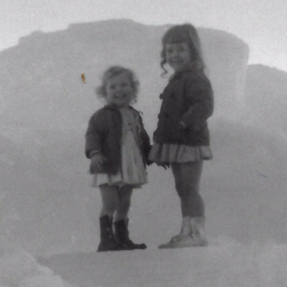
 If I told you about a snowstorm on Lake Michigan, you would very likely say, “Ok…what is so unusual about that?” Most often, you would be right. Snow squalls and icing on Lake Michigan, as well as the other Great Lakes is a common event every Winter. The Great Lakes generally attract the snow due to the fact that they tend to have almost their own weather patterns. It’s a phenomenon called lake-effect snow. “Lake-effect snow is produced during cooler atmospheric conditions when a cold air mass moves across long expanses of warmer lake water. The lower layer of air, heated by the lake water, picks up water vapor from the lake and rises through colder air. The vapor then freezes and is deposited on the leeward (downwind) shores.” Anyone who has lived near the Great Lakes, knows that “lake-effect snow” usually means much deeper accumulations and colder weather than many other places in the United States. Amazingly, the people of the Great Lakes region usually just embrace the weather and get out there to have fun, even holding festivals from time to time. My sister, Cheryl Masterson and I were for a short time in our childhood and got to attend the ice festivals while living in Superior, Wisconsin. While we don’t remember much of it, the pictures our parents took are a nice memory for us, even if it is one that we only heard about from our parents. Cheryl might remember those things, but I was pretty young at the time.
Of course, most of us have seen weather events that are out of the normal everyday events. It can happen just about anywhere in the world, and when it does, you find yourself thinking, “Well, that was odd!!” I remember in 1975 on the 4th of July (easily remembered because my daughter, Corrie Petersen was born on June 30, and so we were at home that July 4th) that for a brief time, it snowed in Casper, Wyoming. It was an odd enough event for it to stick in my mind. Nevertheless, weather phenomena are possible in any location in the world, at any time of the year.
That fact became abundantly clear in 1882, when another remarkable event occurred. This one on Lake Michigan…was an August snowstorm. According to the available reports, a thick cloud burst over the decks of a ship traveling on the lake, and it blanketed them with snow and slush. The snow and slush reached an accumulated depth of six inches. The ship wasn’t the only August snow location that day either. In addition, 
 snow showers were observed at shore points that same day. It was quite an unexpected weather phenomenon for the summer, and especially for August, which tends to be typically one of the hottest months of the year, coming in just slightly below July in Michigan. While it can happen, most snow and ice come in the depths of the winter. Still, I’ll bet it was an event the crew of that ship talked about for a long time and remembered for the rest of their lives.
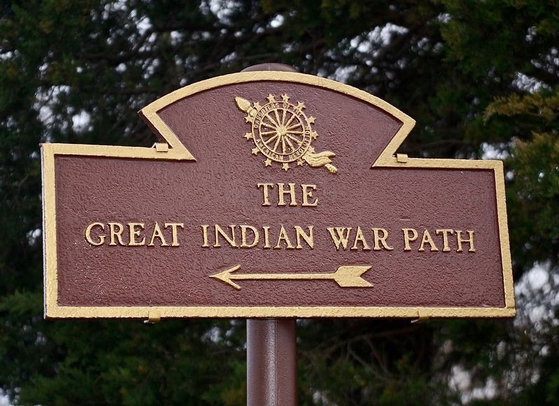
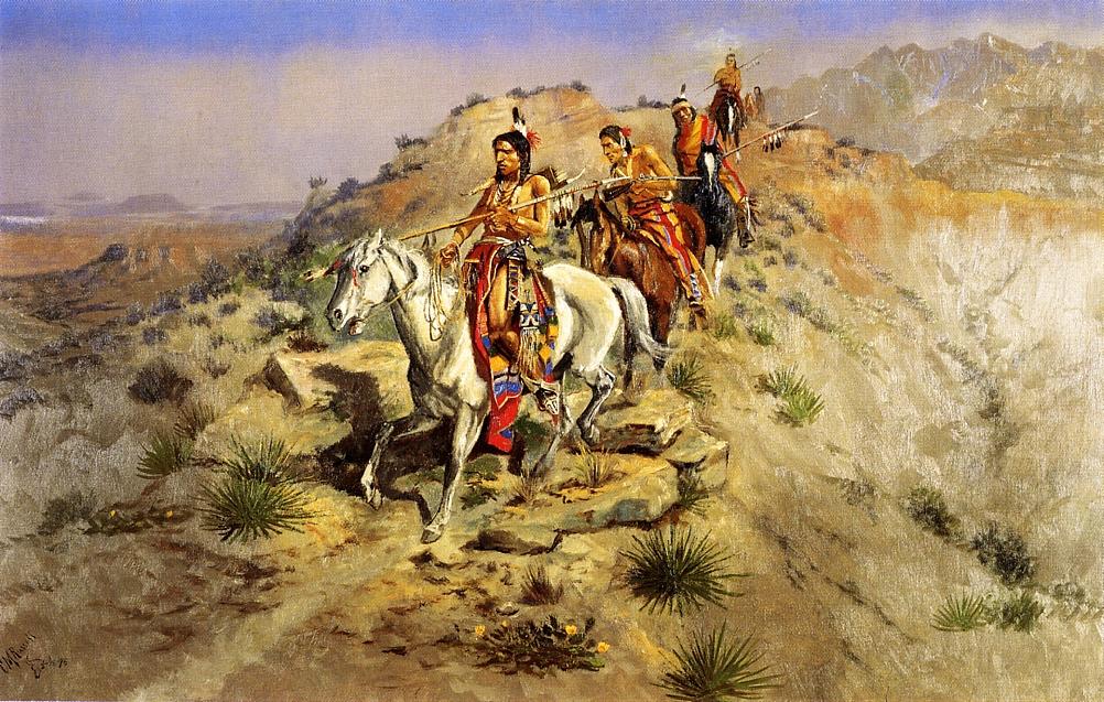 Knowing that a Native American trail called The Great Indian Warpath, also known as the Great Indian War and Trading Path, or the Seneca Trail, ran through the Great Appalachian Valley and the Appalachian Mountains, makes me wonder how many other major trails started out as or connect to smaller trails that had entirely different uses. The Great Indian Warpath was a network of ancient Indian routes with many branches. It crossed the Appalachian Trail in a number of places across several states, including New York, Pennsylvania, Maryland, West Virginia, Virginia, Tennessee, and Alabama. The Great Indian Warpath was a major north-south route of travel since prehistoric times. Parts of the trail are thought to have been used as many as 2,500 years ago when Indian traders from as far away as the Great Lakes, Rocky Mountains, and Mexico traveled parts of the trail. Various northeastern Indian tribes were known to have traded and made war along the trail, including the Catawba, numerous Algonquian tribes, the Cherokee, and the Iroquois Confederacy, even into more recent history, like the Old West.
Eventually the Europeans and the White citizen of America began to use the Great Indian Warpath trail, which seems a little bit strange when you think about it. Nevertheless, Europeans, Hernando de Soto and his party used the trail when they crossed the Blue Ridge Mountains in 1540. Then, by the late 1600s, British colonists were using portions of the trail regularly, as they traded with the Indians. The British traders renamed the trail, or gave it a nickname anyway. Their name for the route was created by combining its name among the northeastern Algonquian tribes, “Mishimayagat” or “Great Trail,” with that of the Shawnee and Delaware, “Athawominee” or “Path where they go armed.” The combination translated to the Great Indian Warpath. Later, hunters and settlers traveled the trail to explore Kentucky and Tennessee, which led to the first mass western migration in American history, as settlers followed the Wilderness Road through the Cumberland Gap.
As time went on, the people left the trail at different places to go to find their dreams. Those new trails took on new names, such as the Seneca Trail, the Great Valley Road, Kanawha Trail, Wilderness Road, Catawba Trail, Unicoi Trail, and the Georgia Road. As I think about the well-known trail in the area, the Appalachian Trail, and the number of people who travel that trail every year, it makes me wonder if they have ever noticed the trails 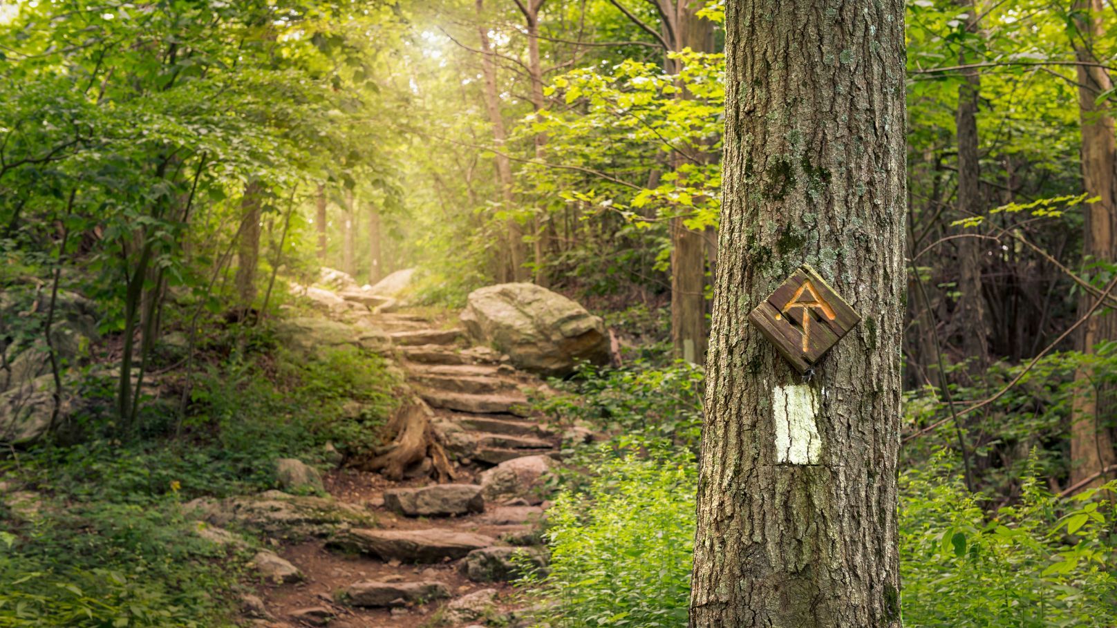
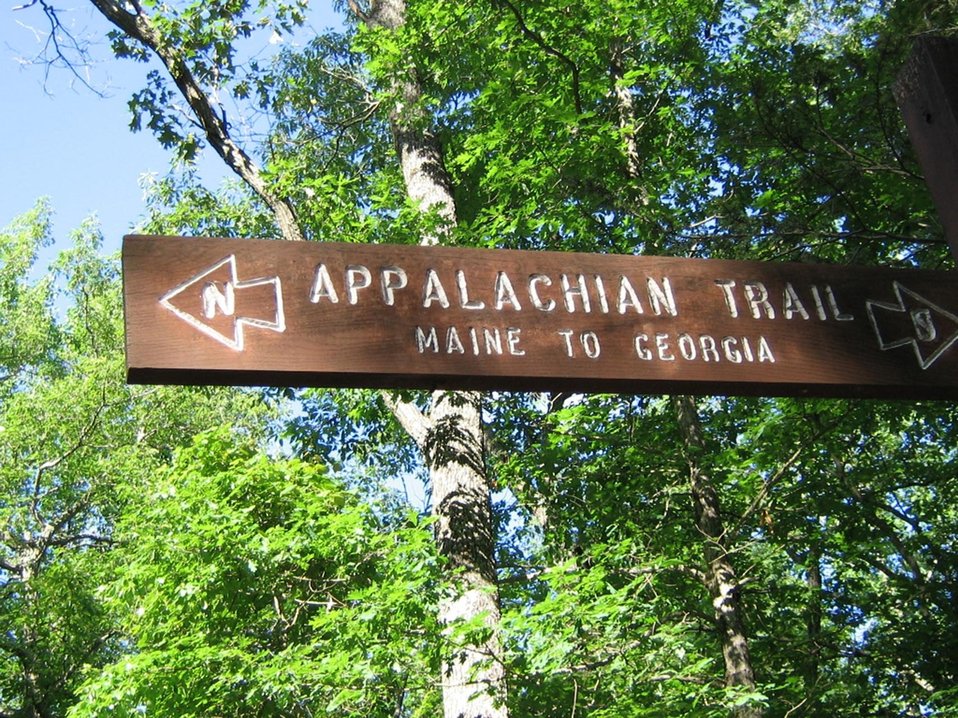 that cross it or split off of it. I have hiked along many trails over the years, and I have seen the many trails that have crossed them. Now I wonder what pioneers might have taken those trails on their journeys to wherever it was that they were headed. It’s unlikely that I will ever know the true stores, but it is nice to think about it anyway.
 I was listening to a book recently about shipwrecks on the Great Lakes and a thought came to my mind that really made me quite sad…though definitely not as sad as when I consider the loss of life that took place in those many wrecks. My Uncle Bill Spencer told me years ago that the Great Lakes are littered with ships that were lost in some of the worst storms on the lakes. In fact, he told me that if you fly over Lake Superior, which is the lake near where he lived most of his life, you could actually see the ships on the bottom of the lake. That thought always made me want to charter a small plane and go see for myself.
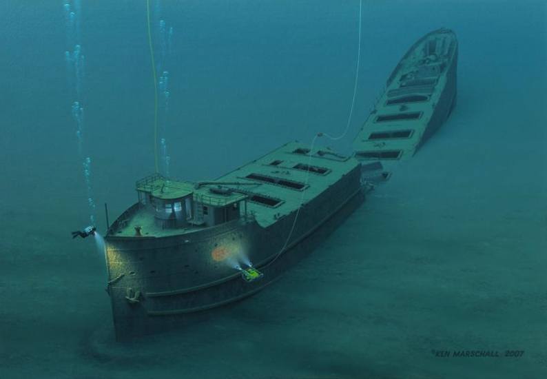
Shipwrecks aside, the book told of the different reasons that ships went down, and how the safety regulations were often extremely inadequate. From not enough lifeboats, to lifejackets that were stored to far from the posts to be reached, to companies who regularly pressured their 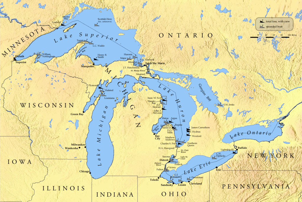 captains to take their ships out in terrible storms, the life of the sea was very dangerous. Of course, there are still shipwrecks today, although the last sinking on the Great Lakes was on November 10, 1975, when the SS Edmond Fitzgerald went down in a horrible November gale. With more recent safety regulations, the Great Lakes have been able to stave off shipwrecks in the last 45 years.
Still, it is not the number of wrecks, or even the lives lost, that has me considering a loss that is even greater…and least from the viewpoint of genealogy. As I was listening to the book, I heard that in several situations, they could not get an exact count of the lost, even if they technically knew how many were on board. The ships manifests had gone down with the ship. My mind raced. If there were people on those ships who had 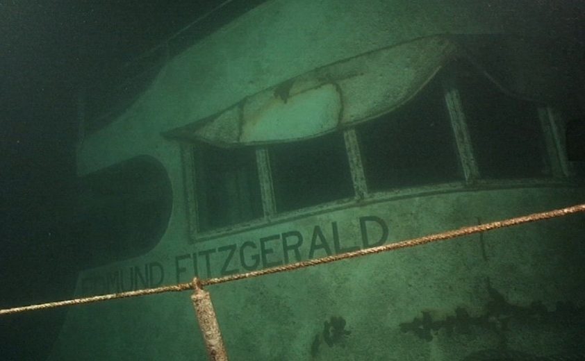 immigrated here, and their names were not recorded somewhere, they could virtually disappear and along with them, their line in the family tree they came from. I know that the many genealogy fanatics, like me, would just cringe at the thought of one of our ancestors simply vanishing. There are so many ways for a family line to get muddied. Name changes, marriages, undocumented deaths, as well as those who just left without telling anyone, are all among the lost ones, but I hadn’t considered those who meant to stay in touch, but who were never heard from, and their family back in Europe or wherever they came from, had no idea what happened. All they knew was that they were lost forever.
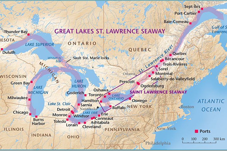 Most people know about the Great Lakes in the north-central United States, but quite possibly, many are not as familiar with the Saint Lawrence Seaway. Nevertheless, the Saint Lawrence Seaway is one of the most important parts of the Great Lakes shipping system. Prior to the Saint Lawrence Seaway there were a number of other canals. In 1871, there were locks on the Saint Lawrence River that allowed transit of vessels 186 feet long, 44 feet 6 inch wide, and 9 feet deep. The First Welland Canal, constructed from 1824–1829, had a minimum lock size of 110 feet long, 22 feet wide, and 8 feet deep, but it was generally too small to allow passage of larger ocean-going ships, which would have eliminated the majority of ships that could ship in quantity. The Welland Canal’s minimum lock size was increased to 150 feet long, 26.5 feet wide, and 9 feet deep for the Second Welland Canal, then to 270 feet long, 45 feet wide, and 14 feet deep with the Third Welland Canal, and to 766 feet long, 80 feet wide, and 30 feet deep with the fourth and current Welland Canal. Still, everyone knew that something else was going to have to be done soon.
The first proposals for a bi-national comprehensive deep waterway along the Saint Lawrence were made in the 1890s. In the following decades, developers proposed a hydropower project that would be inseparable from the seaway, 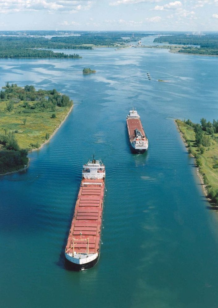 the various governments and seaway supporters believed that the deeper water to be created by the hydro project was necessary to make the seaway channels feasible for ocean-going ships, which we all know was an essential part of the shipping business for the United States and the world. United States proposals for development up to and including World War I met with little interest from the Canadian federal government…at least at first. Later, the two national governments submitted Saint Lawrence plans to a group for study. By the early 1920s, both The Wooten-Bowden Report and the International Joint Commission recommended the project.
The Liberal Prime Minister William Lyon Mackenzie King really wasn’t all for the project, mostly because of opposition to the project in Quebec, in 1932. He and the United States representative finally signed a treaty of intent. The treaty was submitted to the United States Senate in November of 1932 and hearings continued until a vote was taken on March 14, 1934. The majority did vote in favor of the treaty, but it failed to gain the necessary two-thirds vote for ratification. Additional attempts between the governments in the 1930s to forge an agreement Failed due to opposition by the Ontario government of Mitchell Hepburn, and that of Quebec. In 1936, John C Beukema, who was the head of the Great Lakes Harbors Association and a member of the Great Lakes Tidewater Commission, was among a delegation of eight from the Great Lakes states to meet at the White House with United States President Franklin D Roosevelt to get his support for the Seaway project.
After much back and forth wrangling, the two countries agreed that the Saint Lawrence Seaway was a  necessary addition to the Great Lakes shipping industry, and it would later prove to be a vital part of it. In the years that my sister, my parents, and I lived in Superior, Wisconsin, the Saint Lawrence Seaway was something that, at least our parents remember being under construction. The opening ceremony took place on June 26, 1959, and was presided over by United States President Dwight D Eisenhower and Queen Elizabeth II. Once it was opened, it created a navigational channel from the Atlantic Ocean to all the Great Lakes. The seaway, made up of a system of canals, locks, and dredged waterways, extends a distance of nearly 2,500 miles, from the Atlantic Ocean through the Gulf of Saint Lawrence to Duluth, Minnesota, on Lake Superior.
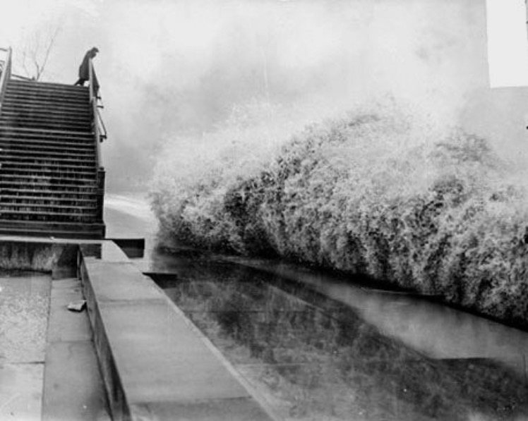 When we think of hurricanes, we think of the ocean, but on November 7, 1913, there was a storm over the Great Lakes that would go down in United States history as the largest inland maritime disaster, in terms of number of ships lost. The storm was nicknamed the White Hurricane. The storm system brought blizzard conditions to areas all around the Great Lakes, with hurricane force winds. The nature of the storm was unique and powerful, and caught even the most seasoned captain by surprise. Two low pressure centers merged and rapidly intensified over the Lake Huron, with periods of storm-force winds occurring over a four day period. Surrounding ports signaled it was a level-four storm, but for some vessels, it was already too late. Major ship wrecks took place on all the Great Lakes except for Lake Ontario. Vessels at that time could withstand 90 mile per hour winds and 35 foot waves, but it was the whiteout conditions and accumulation of ice on the ships that turned an already dangerous situation into a deadly one. Ship captains were unable to maintain navigation, resulting in 12 shipwrecks, 19 ships stranded, and an estimated 250 lives lost. On land, 24 inches of snow shut down traffic and communication, causing millions of dollars in damage.
The storm took place before the time when weather forecasters had the luxury of computer models, the detailed surface and upper air observations, weather satellites, or radar needed to make the most accurate predictions. Had weather forecasters then been able to access modern forecasting equipment, they may have been able to determine the likely development of this type of storm system in advance, as they did with Superstorm Sandy in 2012. As part of the forecast for Sandy forecasters were able to predict storm force winds over the lower Great Lakes five days in advance. The technology and forecast models available to forecasters today led to a more accurate forecast which saved mariners, recreational boaters, and businesses millions, as they were able to make preparations in advance of Sandy’s storm force winds and near 20 foot waves.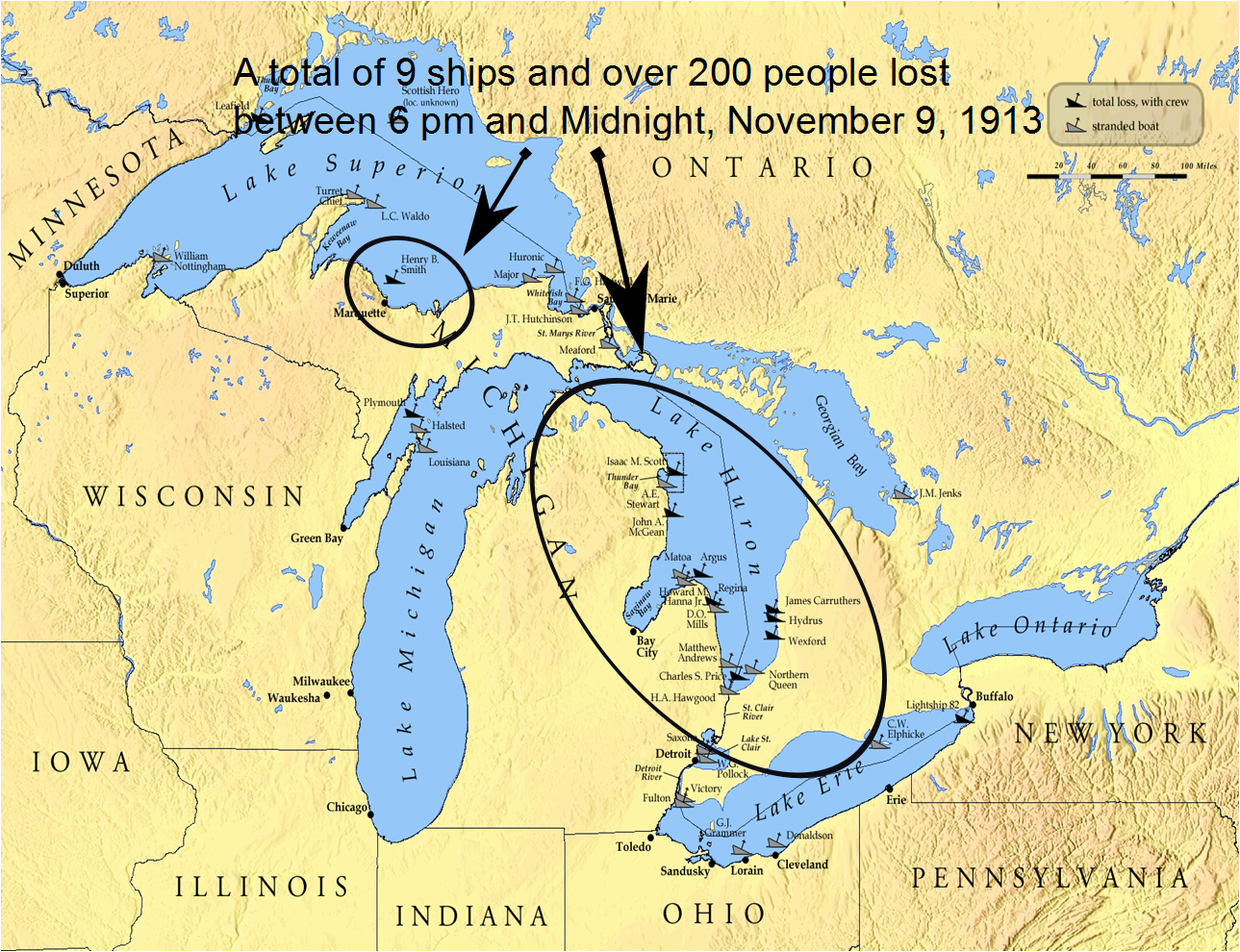
One hundred years later, the National Oceanic and Atmospheric Administration, in the Great Lakes is commemorating the Storm of 1913, not only for the pivotal role it played in the history of the Great Lakes, but also for its enduring influence. Modern systems of shipping communication, weather prediction, and storm preparedness have all been fundamentally shaped by the events of November 1913. It’s strange to think that one storm could make such a lasting impact on so many systems, but then it is the need for something better that spurs great inventive minds to invent a solution to a serious problem.
The National Oceanic and Atmospheric Administration plays a major role in protecting maritime relics of the past. Included are many of the ships lost in 1913. They have remained preserved deep below the surface of the Great Lakes. The National Oceanic and Atmospheric Administration’s Thunder Bay National Marine Sanctuary is a 48-square-mile area of protected territory with one of America’s best preserved and nationally significant collections of shipwrecks. Located in northwestern Lake Huron, Thunder Bay is adjacent to one of the most treacherous stretches of water within the Great Lakes system. Unpredictable weather, murky fog banks, sudden gales, and rocky shoals earned the area the name “Shipwreck Alley.” To date, more than 50 shipwrecks have been discovered within the sanctuary including the Isaac M. Scott, a 504 foot steel freighter lost in the storm of 1913.
This storm holds an interest for me, because at that time in history, my grandparents, Allen and Anna Spencer were living in the Great Lakes area. My grandfather was not part of the crew of any ship, and so any effect to them would have come in the form of very deep snow. My Aunt Laura would have been just 16 months old at 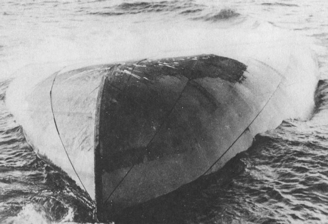 the time. I’m sure that the thought of being stranded in her home, was not a pleasant one for my grandmother, considering Aunt Laura’s very young age, but they survived the White Hurricane, as did most other people, at least those on land anyway. It still seems incredible to me that a storm of that magnitude could have brewed in an inland setting, but then anyone who knows the Great Lakes will tell you that they are so big that they might just as well be considered a sea. The November Gales have long been known as killers, especially over Lake Superior, the largest of the Great Lakes. I’m glad that modern weather forecasting equipment had at least lessened the possibility of ships and lives being lost in the Great Lakes, as well as the oceans.
 My life began in Superior, Wisconsin. Superior is a small town located at the tip of Lake Superior, which is the largest of the Great Lakes. I have always felt close ties to Superior and to Wisconsin, in general, because while I have not lived there since I was three years old, it was the place of my birth, and the place where my Uncle Bill Spencer and his family lived for many years, as well as many of my great grandparents’ family.
In the early years of the area, the Native American Indian Tribes called it home. The first Europeans to live there were the British and French, and the American settlers who lived in Wisconsin when it was a territory. One tribe, the Meskwaki Indians were particularly hostile toward the French, but many of the Indians got along well with the pioneers. The Great Lakes area increased dramatically after the decline of the British influence following the War of 1812. This was a land with a mix of pioneers and Indians. Of course, like most areas, the Indians were eventually placed on reservations.
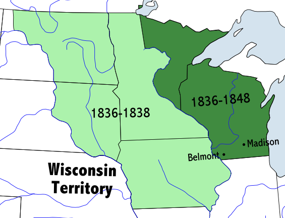
Like every state in the United States, Wisconsin started as a US Territory, and when there were enough people to make statehood a necessity, each one became a state. Wisconsin initially became a terriroty on this day, April 20, 1836. Initially, it included all of the present-day states of Wisconsin, Minnesota, Iowa, and part of the Dakotas east of the  Missouri River. Much of that territory was part of the Northwest Territory, which was ceded by Britain in 1783. The portion which is now the Dakotas was originally part of the Louisiana Purchase. Eventually, the states would separate their areas, leaving Wisconsin with the area it now occupies.
My people would arrive in the area much later, but many of them would stay in the area of Wisconsin and Minnesota for generations, and even to this day. For me, there will always be a place in my heart for Wisconsin, especially Superior, and the Great Lakes, especially Lake Superior. It is a beautiful area that my family has called home for generations, and I will always love it.
 Kelli is my nephew’s wife, and has been a part of our family for almost 10 years now. She has always liked the idea of living in the country and raising donkeys, but lately she is focusing her interests on country music and traveling to concerts. Kelli has a blog, called Thoughts From A Gypsy Soul, and she writes about her travels, and her latest favorite songs. Check it out if you get a chance.
I think Kelli is right when she calls herself a Gypsy Soul, because she really wants to live somewhere in the South, probably Texas. Some people just don’t like the cold weather of the north, and Kelli is one of those people. I don’t know if her dreams will ever be realized, because, somehow we seem to end up where we are supposed to in life, I think, but time will tell how this turns out for Kelli.
Kelli is a kind soul too. During my sister-in-law, Brenda’s recent hospitalization, that lasted about a month, Kelli was a regular visitor. Her smiling face brightened Brenda’s days, and mine too. Whenever we were there together, we shared many laughs, and it was a lot of fun. Kelli has a great laugh…it’s fun to be around her when she is laughing a lot.
Kelli has a fascination with celebrities, and the royal family in particular. She would love to be related to them, and recently with the connection I made to the Schulenberg family to the Spencer family, she can now say that she is a cousin of Princess Diana and the rest of the current royal family, so that dream has finally been realized. I am still looking for a connection from her own side of the family, but haven’t found one as yet. Maybe, I will soon. Kelli hails from Reading, Michigan, and my family came from the Great Lakes area too, so you just never know. Today is Kelli’s birthday. Happy birthday Kelli!! Have a wonderful day!! We love you!!
 Winter can be a long, dreary time…especially for a young boy. And winter around the Great Lakes Region has a tendency to last longer than some other areas. That is the region that my dad and his brother and sisters grew up in. Now, while winter is an ok time of year for a kid, it can limit some of the activities that young boys are most interested in.
When a boy is three or so, and they have a tricycle, their whole world is about being mobile, and the deep snow that you get in the area of the Great Lakes…well, lets just say that a tricycle doesn’t go too well. My Uncle Bill was always an adventurous boy. I remember him and my dad talking about their antics, from the time they were little until they left home. Let’s just say that sitting still was not a phrase that spent much time in their vocabulary, and since Uncle Bill was two years older than my dad, my guess is that at least in the early days, he took the lead on what the day would hold for them.
When he was three, however, Uncle Bill was pretty much on his own for fun, and the winter time put him stuck with nothing to do, and anyone who has had a child stuck at the house, with nothing to do, knows how bored they can get. So, after fussing repeatedly at his mom, begging to go outside, I can imagine that she finally gave in and he hauled his tricycle outside hoping to be able to ride, only to find that sitting on it was going to be as far as he would go. Knowing my Uncle Bill, I’m sure, and if you look at the picture, you can see that this was depressing to him. What comes to my mind is that he is thinking…”when will Spring get here.”
Sometimes, you don’t really know the story behind a picture, but if you look closely you can picture the scene in your head, or see something in their eyes that tells the story. And while I don’t remember my grandmother, who died when I was two, I can imagine that she must have seen something in this scene that prompted her to take this picture. My guess is that she saw just about the same thing I did…a boy viewing the snow is disgust, because he knew that there was no way his little tricycle could move through it, so he sat there, thinking of the coming spring, and wishing it would hurry up.
 My dad always enjoyed fishing, like many people do. I never could see the big draw, but everyone is different. Dad always seemed to think it was relaxing, and I suppose it would be. I think it is in some people’s blood. Dad always loved everything about the outdoors. Camping, being in the woods, and of course any kind of travel, were the kind of things he wanted to do. He wanted to give his family the gift of seeing this great country and the world if we wanted it. And he didn’t want it to be seen from 30,000 feet in the air. He always felt like this world was best seen in a car.
I remember camping near a creek or a river. It always seemed the ideal place. It provided a place to fish and clean up the kids, not to mention cooling off if it wasn’t too deep. And once in a while, we went to a lake. I remember the only time I really enjoyed fishing. We were at some kind of a company gathering, I believe. It was at Ocean Lake, and we were fishing from a boat for sun fish. Oh my gosh…they couldn’t keep our hooks bated. I was competing with another girl to see who would catch the most fish. We were out there for…maybe an hour, and I came back with 14 and she had 12. That was amazing. And I guess that is my problem with normal fishing…too slow paced. Mostly you fight for 1 or 2 fish…not 14. I guess I want more action. Maybe that is why I prefer hiking. I think Dad was blessed to have some sons-in-law who liked to fish, because for most of his life…at least when his girls were young…he didn’t have too many fishing buddies, so when the sons-in-law came around, it was his turn to have that guy stuff.
 My dad was born in Superior, Wisconsin, right at the tip of Lake Superior, and lived in that area all of his young life. Like most boys who grew up in the Great Lakes Region, I suppose, fishing was a way of life, and my dad and his brother, Bill, were no exception. They were adventurous boys, and I have seen several pictures of them through those young years with their various catches. From a catch of a dozen or more fish, to this BIG beauty when they were 2 or 3 and 4 or 5 years old, they were just very successful fiushermen. So I guess, fishing was just in their blood. They had many duties around the old place, so I guess I can see how for two boys, the best way to relax was just fishin’.

