flooding
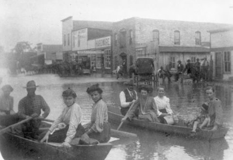
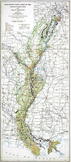 The Mississippi River is a is the widest river in the United States. It’s mere size and the amount of water in it, makes one expect that at some point, it is going to flood. In fact, it has flooded many times over the years, but none was anything like the Great Mississippi Flood of 1927. It was the most destructive river flood in the history of the United States. In all, 27,000 square miles of land were inundated with water up to a 30 feet depth. In all, 630,000 people were affected by the flood. About 94% of them lived in the states of Arkansas, Mississippi, and Louisiana, most in the Mississippi Delta. At least 15 inches of rain fell in 18 hours causing the Mississippi River to brake out of its levee system at 145 locations. Ten states were affected…Arkansas, Illinois, Kentucky, Louisiana, Mississippi, Missouri, Tennessee, Texas, Oklahoma, and Kansas. Arkansas was the worst affected with 14% of the state flooded.
It was Good Friday, April 15, 1927, the disaster began when 15 inches of rain fell in New Orleans in 18 hours. More than 4 feet of water covered parts of the city. A group of influential bankers in town met to discuss how to guarantee the safety of the city, as they had already learned of the massive scale of flooding upriver. A few weeks after, they arranged to set off about 30 tons of dynamite on the levee at Caernarvon, in an effort to flood a less populated area and save the cities that would have been severely damaged. I’m not sure how much this effort helped, and in the end, about 500 people lost their lives anyway. It wouldn’t be the last Mississippi River flood, but it would be the worst.
As a result of the flooding, many of the misplaced people joined the Great Migration from the south to northern and midwestern industrial cities rather than return to rural agricultural labor. I would think that the idea of such a massive amount of cleanup would be more than many people could take. This massive population movement increased from World War II until 1970. Of course, this volume of population movement would not be good for the states who were losing people. To try to prevent future floods, the federal government built the world’s 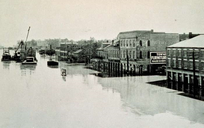
 longest system of levees and floodways. By August 1927, when the flood subsided, hundreds of thousands of people had been made homeless and displaced; properties, livestock and crops were destroyed. Flooding on the Mississippi is not an unusual event, and no matter how many precautions we take, there will still be losses when the river overflows its banks.
 Rain…it waters the earth, and as we all know, without it, we could not survive. Nevertheless, as vital as water is to life on this planet, too much of it can be deadly. People can drink too much water, we can over-water our plants, and too much rain can bring flooding. Such was the case on July 13, 1951. Above-average rainfall began in June and continued through July 13th, dumping well over 25 inches on some areas in eastern Kansas. From July 9th to 13th, nearly 6 inches of rain fell. The Kansas, Neosho, and Verdigris rivers began taking on more water than their normal carrying capacity a couple of days into the storm, but as the rain persisted, flooding began all over the region.
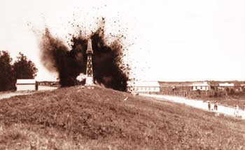
The major towns of Manhattan, Topeka and Lawrence took the biggest hit. As is 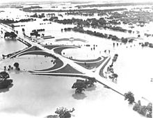 the case in any area where absorption is hampered by cement and asphalt, the rain could not soak in, and the ground was are already saturated anyway. The rain had nowhere to go, and the area was in trouble. Prior to the July 13 river crest, previous highs were dwarfed by four to nine feet. Two million acres of farmland were lost to the flood, which would trigger a crisis of its own, by a shortage of food. The flooding also caused fires and explosions in refinery oil tanks on the banks of the Kansas River. Passenger trains traveling through the area were stuck for nearly four days. In all, $760 million in damages were caused by the flood, and 500,000 people were left homeless, while 24 people died in the disaster. It was the greatest destruction from flooding in the Midwestern United States up to that time.
A often happen, tragedy brings change. Following the great 1951 flood, a series of reservoirs and levees were constructed all over the area. In 1993, these were credited with minimizing the damage from another record flood. Water is an element that is necessary for life, but lest we forget, water in an overabundance can kill and destroy. People need to pay attention to evacuation warnings, and get out of an area where a flood is eminent. You may lose some things, but if you leave the area, you will most likely to walk away unscathed, and as we know, things can be predicted, and those who head out of unsafe areas will most likely live to tell the tale.
 As a kid, I remember that whenever we were sitting at an intersection that was very busy, causing us to have to wait seemingly forever to be able to get across the intersection, one of my parents would say something like, “Wow!! Who opened the floodgates?” Of course, I didn’t know what a floodgate was then, and I just thought they were referring to a flood of vehicles, which they were, and they probably didn’t think about what a real floodgate was either. It was just a funny saying to us, but in reality, a floodgate is a very important flood preventative tool. I guess that our version of floodgates meant the same thing, except in vehicles and not in water.
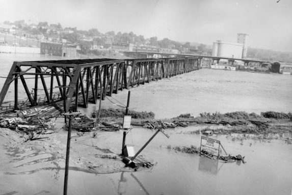
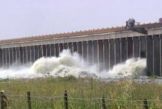
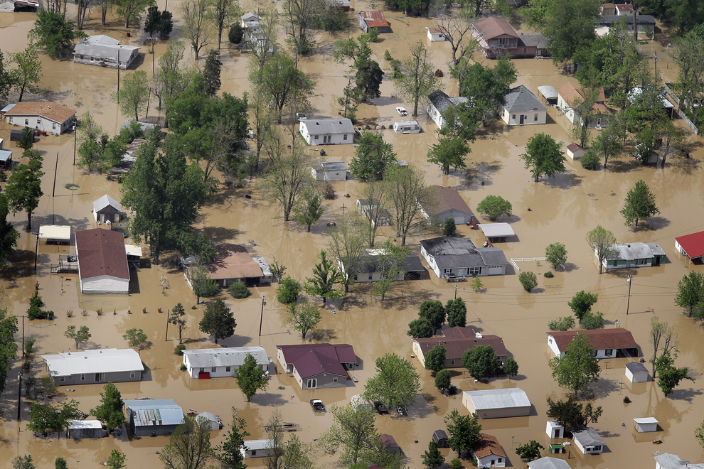
On May 15, 2011, the United States Army Corps of Engineers opened the floodgates in the state of Louisiana along the Mississippi river. This was an effort to save larger cities located along the Mississippi, like Baton Rouge and New Orleans, from flooding. The Mississippi was already heading for critical stages, and it was only expected to get worse. The flooding was expected to cover up to three thousand square miles, and it had the potential to affect up to 25,000 people. This was the first time in forty years that the river levels have forced the opening of the floodgates. I don’t know how often floodgates are utilized in other areas to prevent flooding, but when people live in flood prone areas, they have to use whatever mean necessary to protect themselves and their property from damage and death.
The Mississippi River floods in April and May 2011 were among the largest and most damaging recorded along that river in the past century. The flood was comparable in extent to the major floods of 1927 and 1993. From April 14–16, the storm system that was responsible for one of the largest tornado outbreaks in US history also produced large amounts of rainfall across the southern and midwestern United States. Then two more storm systems, each with heavy rain and tornadoes, hit in the third week of April. In the fourth week of April, from April 25–28, another and even more extensive and deadly storm system passed through the Mississippi Valley dumping more rainfall resulting in deadly flash floods. The unprecedented extensive rainfall from these four storms, combined with springtime snow melt from the Upper Midwest, created the perfect conditions for a 500-year flood along the Mississippi.
The purpose of opening the floodgates was to take some of the pressure off of the levees, in the hope of preventing the breech of the levees. Most of the time, it works pretty well, like when the city of Casper, Wyoming, where I live opens up the gates at the area lakes and while the river runs high for a time, there are 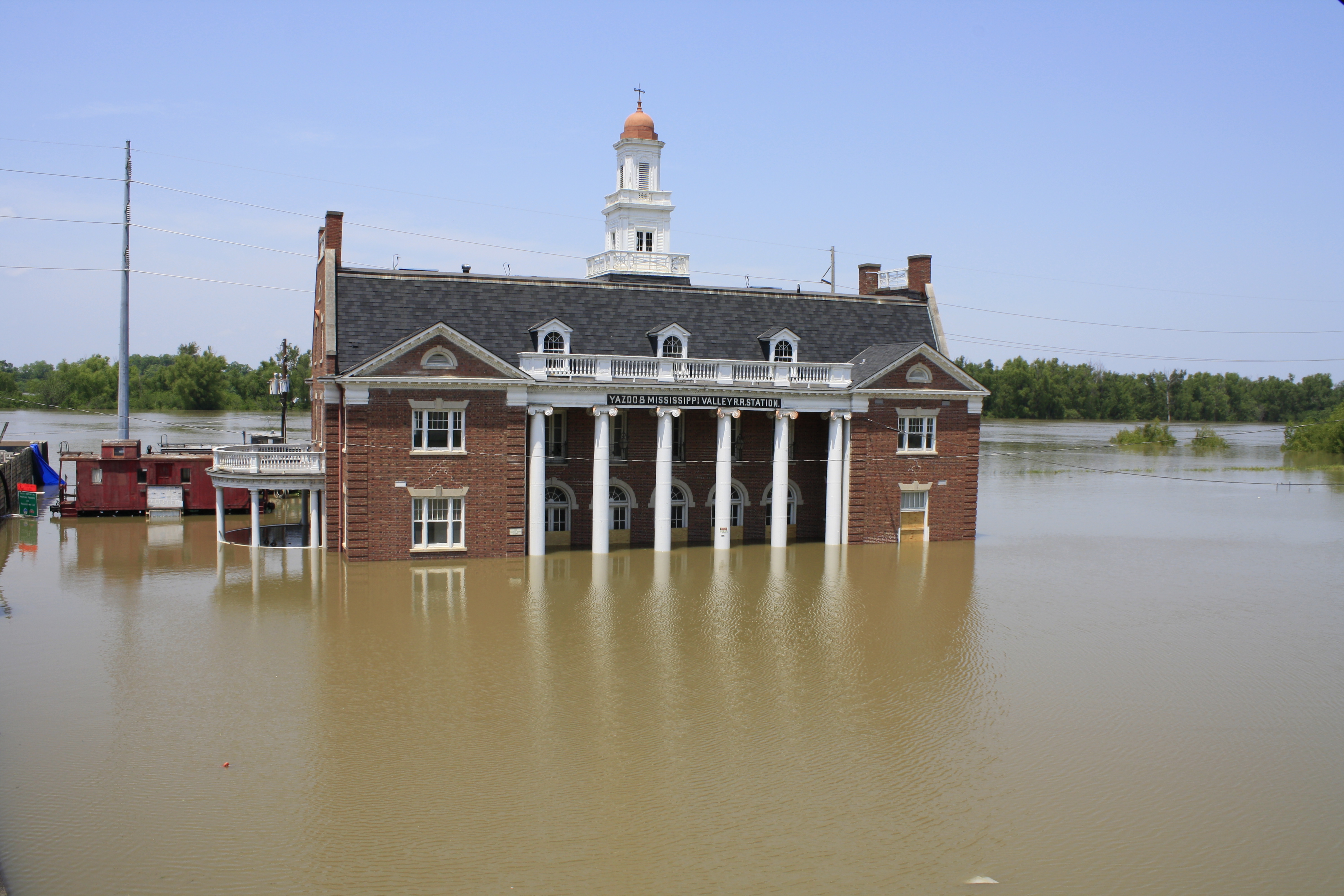
 very few places where it spills over the bank. Unfortunately, the Mississippi river still spilled over its banks, and broke levees. I don’t think anyone could have really prevented the monster floods that hit the area in 2011, or even in 1927 or 1933, but they couldn’t focus on that right then, because they had to do whatever they could to prevent. In the end, the flood came and the damage was done.
 Every year and every storm, we hear the same things. Everyone says, “We need the moisture.” I realize that it is a habit to say that and often it is true, but not always. The last couple of years here have been wet years, and while I realize that we have been in a draught, and it takes time to pull out of that, it seems to me that when we are sandbagging and the river is almost touching the underside of the bridges, we can safely stop saying, “We need the moisture.”
Wyoming joins other states who all have one thing in common…too much water. Our snow pack is a 200% of normal in many places. Our rivers are high, our lakes are full, and our ground is saturated to the point of mudslides. We are far beyond needing the moisture and into flooding or the danger of flooding. One of the trails Bob and I like to walk on is already partly under water, and we are told that when Pathfinder spills over the dam this weekend, the river will rise another foot.
The road between Alpine and Hoback junctions is closed due to a mudslide. I guess that might have happened in Wyoming before, but I don’t remember it. No word yet on when that mud might be  removed from the highway…I suppose it will depend on when it stops sliding. Right now the ground is so saturated and the rain just keeps on coming, so it may very well be a while. And will something like this happen on other roads…maybe, we just don’t know.
What surprises me, in this day of easy access to mountains of infomation, and instant information about current events, that there are still people who don’t realize what the current situation here is. All I know is that if, when the next storm hits, I hear one more person say, “we need the moisture”, I will just scream.

