conditions
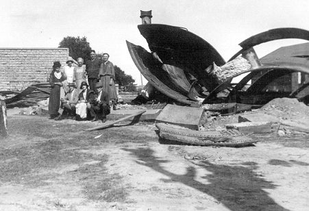
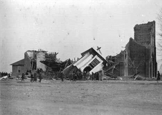
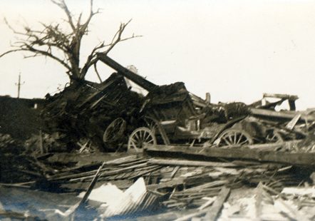 Over the centuries, tornadoes have managed to wreak havoc on various areas of the world, not to mention the thousands of lives they have taken. With advancements in the early warning systems and on weather conditions, the deaths have decreased, but in 1920, no such systems existed. It was March 28, 1920…Palm Sunday, when at least 37 tornadoes, 31 of which were significant, raged across the Midwest and Deep South states. The tornadoes left more than 380 dead, as well as at least 1,215 injured. Many communities and outlying farmers alike were caught off guard as the storms moved to the northeast at speeds that reached over 60 miles per hour. Georgia saw most of the fatalities with over 200 deaths. Indiana had 56 deaths and Ohio had 55, while the other states saw fewer fatalities. Without ways to monitor the tornadoes, very little is known about many of the specific tornadoes that occurred.
Early in the morning of March 28th, severe thunderstorms began developing in Missouri, moving quickly to the northeast towards Chicago, Illinois. The first tornado injured five people 35 miles southeast of Springfield, Missouri, in Douglas County. This first tornado was a warning of things to come as the morning went on and the atmosphere began to destabilize, due to the abundance of sunshine that preceded the cold front in the warm sector, which covered the lower Great Lakes region extending southward, well past the Ohio River Valley. According to meteorologist and weather historian Charles Merlin Umpenhour, the climatic conditions on Palm Sunday 1920 were favorable for all the atmospheric ingredients to come together that were needed to create the classic setup for long-track tornadoes. The forecasting…or communications technology and public awareness about Severe Weather was nearly nonexistent in 1920. That technology would not begin for another 33 years, when the US Weather Bureau implemented its Public Watch.
The residents of the Great Lakes region and Ohio Valley areas, had as their only source of weather information, the rather vague forecasts that were issued in the local newspaper the day before or by word of mouth. The use of the word “tornado” was strictly prohibited in public weather forecasting until the 1950s because of the fear and panic it might cause. This policy would come under fire in the years to come especially after the Tri-State Tornado in 1925 that stands today as the deadliest tornado in American history…as it should have. It would be insane not to let the people know of such deadly weather, simply because someone might get scared. That really is the point of it. To “scare” people into action!! It saves lives.
Weather forecasters and the public alike in the Chicago, Dayton, Fort Wayne, Lansing, South Bend, and Toledo areas were unaware of the likelihood of a significant tornado outbreak that would follow a beautiful Palm Sunday afternoon. The weather maps in use in March 1920 showed a rather large and deep cyclone over northern Iowa, and they knew it would be moving across central Lower Michigan by nightfall with a cold front right behind it. Meteorologists knew rain showers, and very likely thundershowers, were a good possibility, but were unaware that the helicity (which is a property of a moving fluid which represents the potential for helical flow…or a flow which follows the pattern of a corkscrew to evolve. Helicity is proportional to the strength of the 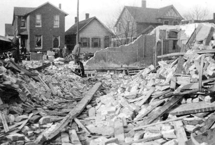
 flow, the amount of vertical wind shear, and the amount of turning in the flow known as a vorticity), the lifted index, and upper level winds which were being guided by a strong jet stream with a probable negative tilt. When all that is put together, it creates conditions that are favorable for the development of tornadoes, and thereby, a seriously dangerous situation. Had the people known all that in 1920, perhaps most of the lives lost, could have been saved.

