flood
 Probably because of the smaller cost of the materials and the ease of transporting material to the site, there are many earthen dams today. I suppose they were properly packed down, and with the addition of vegetation, they seem to hold up well…for the most part. The Toccoa Falls Dam (later known as the Kelly Barnes Dam) was constructed ninety miles north of Atlanta, Georgia. Toccoa is a Cherokee word meaning beautiful. The dam was built across a canyon in 1887, creating a 55-acre lake 180 feet above the Toccoa Creek.
R A Forrest established the Christian and Missionary Alliance College along the creek below the dam in 1911. It is said that he bought the land for the campus from a banker with the only $10 dollars he had to his name, offering God’s word that he would pay the remaining $24,990 of the purchase price later. I guess that the banker either trusted Forrest’s ability to pay the 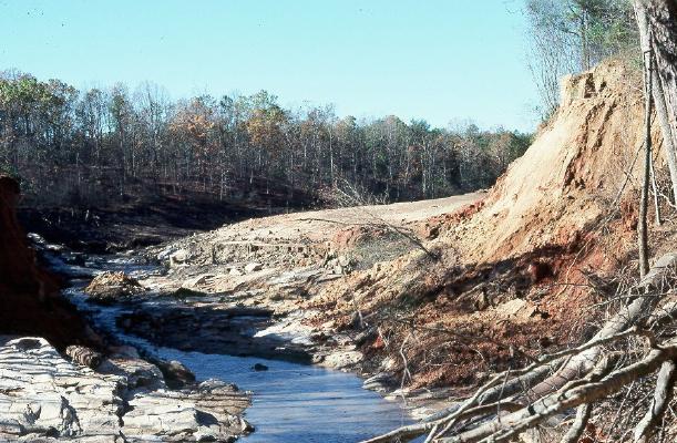 balance, or decided that a Christian college would a good gift to give, whether Forrest was ever able to pay it off or not.
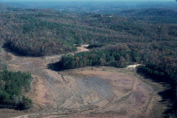
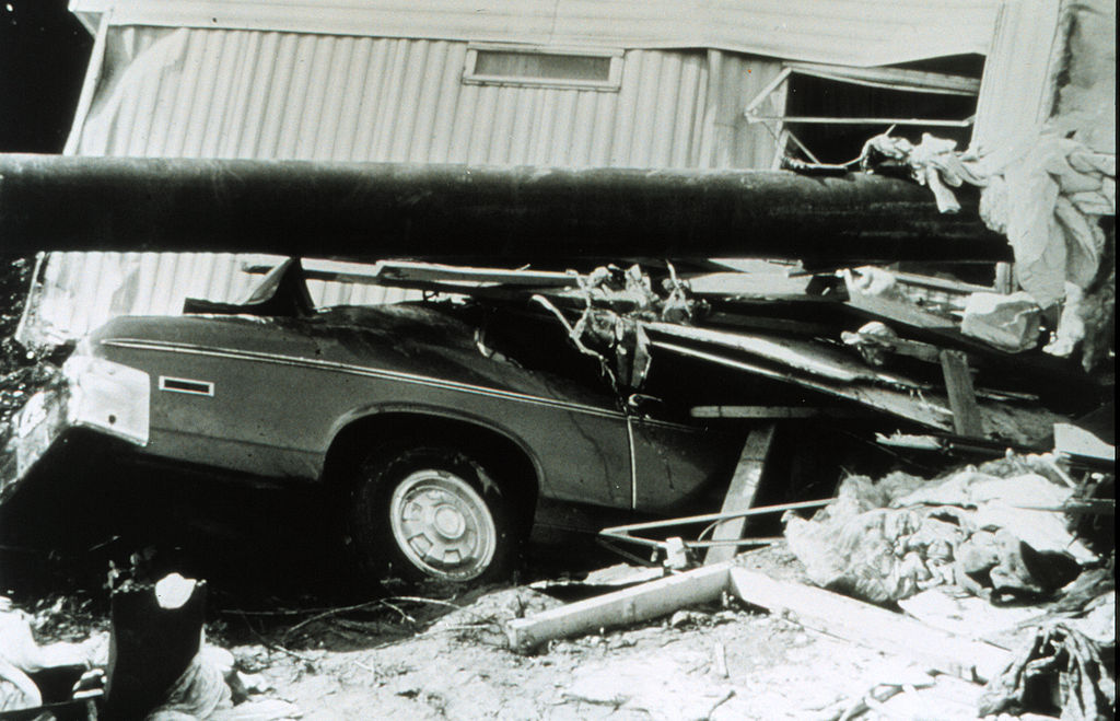
The Christian and Missionary Alliance College had been on the site for 66 years in 1977. On November 5, 1977, a volunteer fireman inspected the dam and found everything in order. A few hours later, in the early morning of November 6, the dam suddenly gave way. With a great roar, water thundered down the canyon and creek, approaching speeds of 120 miles per hour. Still, the residents of the college had no time to evacuate. Within minutes, the entire community was slammed by a wave of water. One woman, a mother of three daughters, managed to hang onto a roof torn from a building. The wave carried her for thousands of feet. She survived, but her three daughters, were among the 39 people who lost their lives in the flood.
The investigation that followed, cited several possible or probable causes for the disaster. The failure of the dam’s slope may have contributed to weakness in the structure, particularly in the heavy rain of the previous four days. The rain swelled Barnes Lake, which normally held 17,859,600 cubic feet of water, to an estimated 27,442,800 cubic feet of water. When the low-level spillway collapsed, it exacerbated the problem. A 1973 photo showed a 12 foot high, 30 foot wide slide had occurred on the downstream face of the dam, which may have also contributed or foreshadowed the dam failure. Basically, the dam was in poor condition and the design was poor and outdated. It was a disaster waiting to happen.
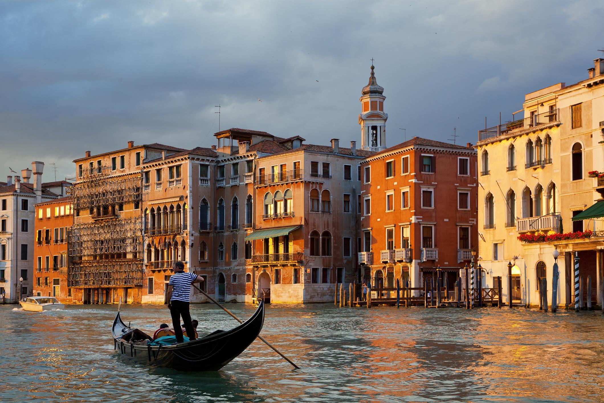 When people think of Venice, Italy, they think of the canals and the boats. I think most of us think the city is pretty much streets of water, and buildings that somehow stand in the water…strong and immovable against the water. Venice is the center of the lagoon of Venice, which extends over a length of 25 miles around the city. While it seems like the city is covered in water, only 11% of the lagoon is permanently covered with water, while the rest of the lagoon is islands or mudflats and marshes (Laguna Morta). The water stays fresh because, seawater from the Adriatic flows into the lagoon through three large passages, Bocca di Lido, Bocca di Malamocco, and Bocca di Chioggia, twice daily. This process provides a natural water exchange. Still, 11% water can sure look like a lot, especially when every touristy picture we see involves the canals and gondolas. So, to think of a situation whereby a flood could become tragic in Venice, is a strange thought for anyone who doesn’t really know Venice…like me.
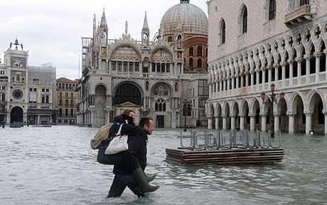
On December 1, 2008, Venice experienced the biggest flood in more than twenty years. The waters rose more than five feet above normal levels. As with any flood, many of Venice’s streets, including Saint Mark’s Square, were submerged. Venice has flooding for about two hundred days every year, and the Venetian authorities were working to complete an underwater dam by 2011. Unfortunately, that fact didn’t help the city in 2008. Even with unusually high tides because of the new moon, residents were not surprised to see the usual low-lying lanes under water. Nevertheless, this day was different. Pretty much the entire city was covered by the lagoon. People stayed inside to wait out the water, only going outside when they were sure the water was definitely going down. The townspeople went outside to take pictures and explore the current townscape…to see what was underwater now. They were quite surprised at the scene before them.
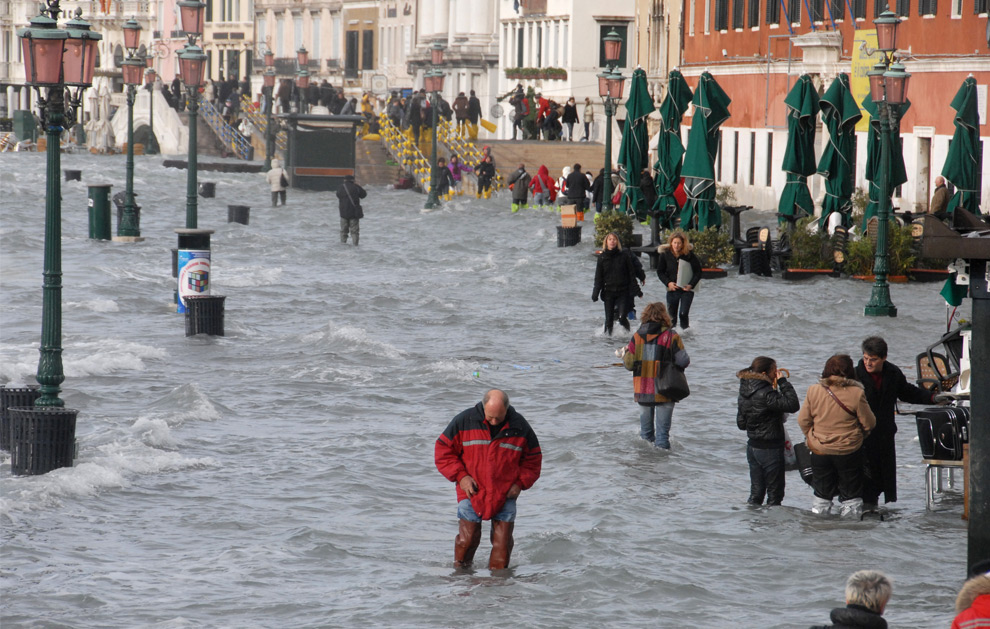
By mid-afternoon, the water had gone down to more normal levels, but all over the world, the papers made it seem like the whole city was sinking. The high tide would come again on December 2nd, but it was nothing like December 1st. Cleanup was still underway on December 2nd, of course, but most businesses were open again. I suppose that if your city spends it’s life in one stage of flood or another, this extra high tide was just something to be taken in stride. Yes, people were surprised at the higher than normal flood waters from the tide, but they weren’t panicked. It was just another day in the life of Venice.
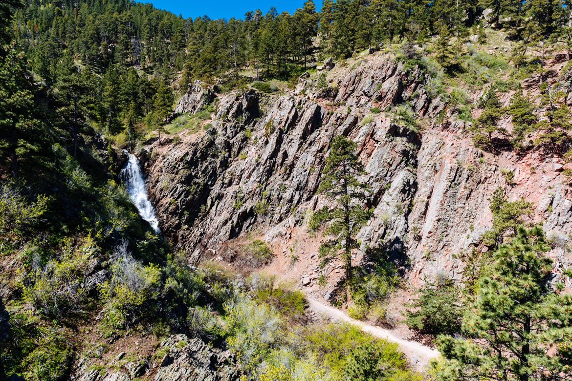
 Those of us who live in Casper, Wyoming know about Garden Creek and Garden Creek Falls. It is a beautiful area, filled with trees and picnic tables. Hiking trails take off from the area, some of which follow the creek. Rotary Park is often full of picnickers and hikers. Everyone is out to have a great time. The Garden Creek area was a much different place in 1891, however. What we know as a day picnic area was a resort area and was lined with camps. A hotel was located at the head of Garden Creek and was a loved summer resort, frequented by local picnic parties. It was frequented by families from near and far.
On, July 31, 1891, a cloudburst occurred over Casper Mountain, right about the area of the head of Garden Creek. The creek is about seven miles long from mouth to source, and it was lined with camps. The heavy rains triggered a flash flood. The swollen creek rushed down the mountainside. The first thing the flood waters reached was the resort at the head of Garden Creek. The buildings were crushed and swept away, and the original site of the hotel was buried beneath wreckage twenty or more feet deep. The rushing floodwaters followed the creek on down the mountain, sweeping away anything in its path. Water marks indicate a volume of water 40 feet high and 495 feet wide must have passed through a narrow area about 2 miles form the mountain proper.
As the water rushed down the side of the mountain, it crashed down upon many campers up and down the creek. Many were either sleeping or just about ready to go to bed for the night. Campers, the Newby family, were sleeping when they suddenly found themselves surrounded by water. Newby heard his wife scream for help, grabbed for her, but missed, and in the next second he found himself being carried off by the rushing water. He never saw his wife or baby son alive again. Newby caught the limbs of a floating tree, He was carried about 200 yards, before he was thrown onto a bank. The body of Mrs Newby was found the next morning beneath a pile of rubble, but the Newby’s baby boy was never found. Near the Newby camp was the camp of Samuel Harrison of Alliance, Nebraska. Harrison’s two children were caught in the flood, and carried away. The bodies of the children were recovered the next morning. The tents and wagons of all the campers up and down the creek were destroyed, and at least fifty persons escaped with nothing but their pajamas. The citizens of Casper quickly stepped forward to bring food, clothing, and comfort to the survivors.
The quick response of the citizens of Casper doesn’t surprise me, because this is a city that often steps up in the face of tragedy. The flooded creek doesn’t surprise me either, because I have seen first hand just how quickly a rain storm on Casper mountain can result in a flood…even in the city proper. All that water has to go somewhere, and Sage Creek near my house is often the recipient of a large portion of that water. Thankfully it quickly drains into the Platte River, and the area returns to normal. Our mostly dry climate helps too, I suppose. The thirsty ground absorbs the water quickly. Still, it shocks me…not that Garden Creek flooded, but more, the vast difference in that area between 1891 and 2019.
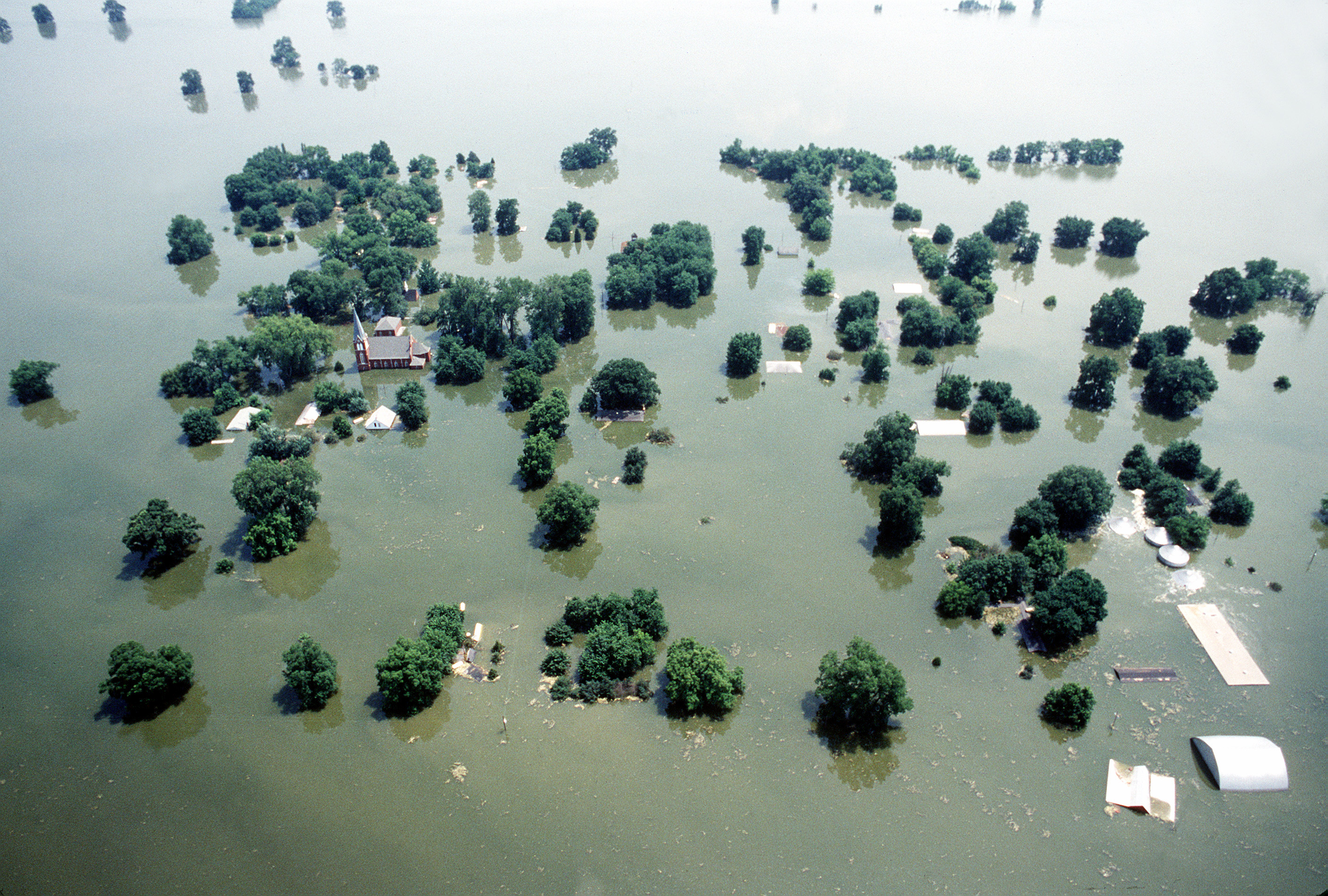 For many years, levee systems were built along rivers to hold back flood waters. They work very well…until they don’t. When a levee ruptures, the resulting flood is usually devastating. From June through August of 1993, the midwestern United States received an unusually large amount of rain…far more than normal. The rain led to severe flooding, particularly along the Illinois and Missouri shores. Then, on July 22, 1993, the levee holding back the flooding Mississippi River at Kaskaskia, Illinois, ruptured. The town’s people were forced to flee on barges. In all, more than 1,000 levees burst in late July, but, the incident at Kaskaskia was the most dramatic event of the flood. The town, which was virtually an island, was protected by a levee that the town attempted to shore up even after the bridge connecting the town to the riverside was wiped out by the rising river. At
 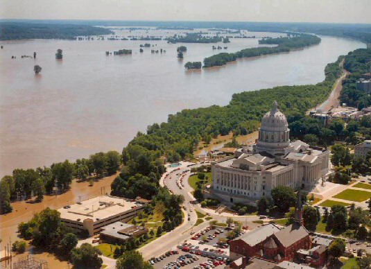 9:48am, the levee broke, leaving the people of Kaskaskia with no escape route other than two Army Corp of Engineers barges. By 2pm, the entire town was underwater.
The rupture of the levee at Quincy, Illinois, left no way to cross the Mississippi River for 250 miles north of Saint Louis. In Grafton, Illinois, flood waters reached two stories high. Other towns fared somewhat better, but the flooding was bad everywhere. In Saint Genevieve, Missouri, the entire town turned out in a desperate attempt to raise the levee. Prisoners were even brought in to assist the effort. The river crested at a record 49 feet, just two feet below the improved levee. The flood inundated 1 million acres of prime farm land and wreaked havoc on the area’s economy. Miles of wheat fields were too saturated to harvest that season. In addition, the herbicides from the farms washed down the river and severely damaged fish farms in Louisiana. Many other people lost their jobs when barge traffic on the river was suspended for two months. The Mississippi 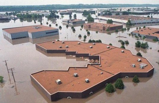 flood of 1993 caused $18 billion in damages and killed 52 people.
Levees can save lives, but when levees fail…people die, and property is destroyed. Sometimes, there is some warning, but other times, the flood that was expected, brings with it an unexpected consequence. And I can’t think of a worse unexpected consequence, than having far more water inundate an area that the flood could possibly have brought in. That was the case in 1993, and especially the case in Kaskaskia, Illinois. No one was prepared for the massive amount of water, and for 52 people, there was no way of escape.
 Weather has always been a subject of interest to people, even if we still don’t completely have a full grasp of it, not even after all these years and all our technology. The main difference I see now is that we hear about weather all the time. It’s on television, the radio, and even our phones. There are warnings for everything…thunder storms, tornadoes, snow storms, flash floods, and hurricanes. Nevertheless, all the meteorologists can truly do is predict a weather event. It may or may not materialize.
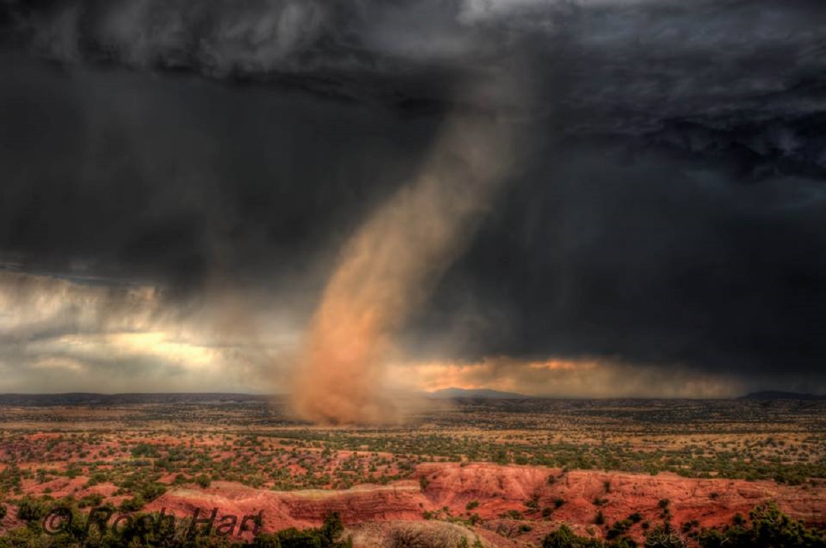
Now, flash back to, oh say 1680 or even to 1521. Other than looking at the sky, how did the people predict the weather? Yes the sky can be a great predictor of coming storms, but unless you knew something about weather 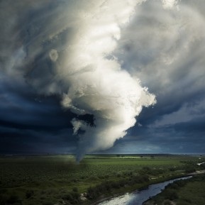 patterns, you would be unlikely to have any idea that something like a tornado, flood, or hurricane were coming. Especially in 1680 or 1521. Those dates are rather important in the world of weather. In August of 1521, a meteorological phenomenon occurred in the Basin of Mexico. There were no cameras back them, no cell phones or computers to record the event. The only known description appears in Book XII of the Florentine Codex, which is an account of the Spanish conquest of Mexico written in Nahuatl in the mid-sixteenth century. The account states that just before the fall of Mexico-Tenochtitlan a heavy storm which included a whirlwind struck the basin. The whirlwind hovered for a while above Tlatelolco, Tenochtitlan’s twin city. Then it moved to the lake where it disappeared.
When the experts of today look at the account of the phenomenon in the context of the Nahua culture, and 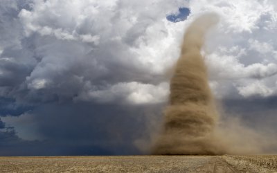 comparing it with European descriptions of tornados and waterspouts, they can determine that the phenomenon was indeed a tornado. Their conclusion is further supported by eighteenth and nineteenth century pictorial and written evidence showing that tornadoes do occur in the territory now occupied by Mexico City. Since the tornado of Tlatelolco predates the Cambridge, Massachusetts, tornado of July 8, 1680, which had been thought to be the first recorded tornado in the Americas, the Tlatelolco tornado actually represents the earliest documented tornado in the Americas. Either way, since people didn’t really have much information to go on back then, I’m sure they first said some version of “What is that?!!?” At least, I know I would have.
 Since my daughter, Amy Royce and her family moved to Western Washington State, I keep coming across historic facts about the area. Of course, they were there before, but probably just didn’t grab my interest then. One such fact is that Seattle was home to the world’s first floating concrete bridge. Washington governor Clarence Martin and Lacey V Murrow, the Washington Toll Bridge Authority director, broke ground on the Lake Washington Bridge in December of 1938. The Lake Washington Floating Bridge was also known as the Mercer Island Bridge, it spanned Lake Washington from Seattle on the west to Bellevue to the east. The bridge was renamed Murrow Bridge in honor of Lacey Murrow in 1967. The bridge was a project financed by the Public Works Administration to give work to
 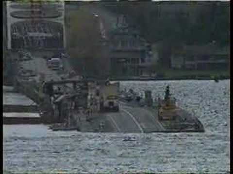 unemployed Washingtonians and to make the towns across the lake from Seattle more accessible to suburban development.
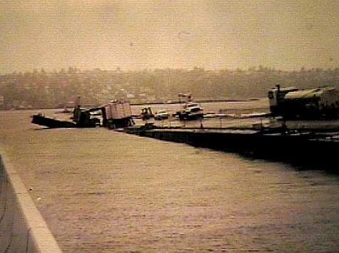
When the finished bridge opened in 1940, the Seattle Times called it “the biggest thing afloat.” It’s hard to imagine that 100,000 tons of steel, could float on more than 20 hollow concrete pontoons, and carry 5,000 cars per day. By 1989 the number of cars grew to 10,000 cars. Since the bridge would become such an important road between the two cities, the flood of November 1990 was especially devastating, in that it completely destroyed the bridge. While the bridge was closed for repairs, construction workers punched giant holes in the pontoons that kept it afloat and went home for the weekend. 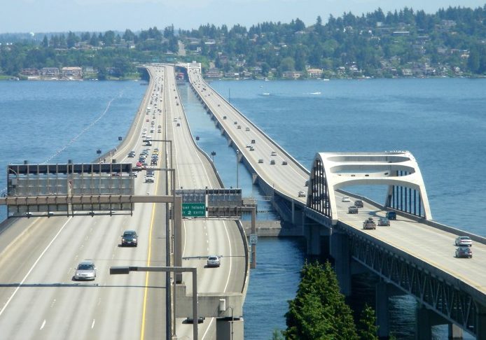 A few days of rain and high winds filled the pontoons with water, and the broken bridge sank.
This would not be an easy fix. As the pontoons filled with water and the bridge sank, it pulled about a half a mile of highway into the lake. There was simply no way to fix it. The bridge would have to be rebuilt from scratch. In the end, it would take three years to rebuild at a total cost of $93 million. When the bridge reopened, it would complete the coast to coast Interstate 90. On this day, September 12, 1993, the rebuilt Lacey V Murrow Bridge opened. This bridge was the east bound lane of I-90 from Seattle to Bellevue. The westbound lane is on the Homer M Hadley Bridge, which was not destroyed by the flood.
 After my husband, Bob’s 2nd great grandma, Mary LuLu Taylor remarried, following the death of her first husband, James Leary, on March 26, 1888, she and her second husband had three children, bringing to four the total number of her children. Her life had taken her from Forsyth, Montana to Shelby, Missouri, where she met James Begier, who became her second husband. Later, they would move to several other times, but Montana always seemed to be in her blood and she would return there several times. Her daughter Mabel Claire Begier met and married her husband, Edward Anthony Brown in Rosebud, Montana. I’m not positive at what point Mabel became a telephone operator, but she did, and as it turns out, that’s where she was working during one of the floods that took place in Montana. That job, at that time in history, put her right in the middle of a serious situation, and in a position to help those in need of assistance.
When we think of any disaster…be it fire, earthquake, tornado, or flood, our first instinct these days is to dial 911 on our phones. That has become the go to number for all kinds of help in times of need. That wasn’t always the case though. Years ago, it was the operator you called for help. You simply dialed “0” to get in touch with someone who could connect you with any branch of emergency help there was…as well as to let everyone else in town know about the emergency…at least back then they could. Privacy laws would have prevented that these days. Of course, if it was a big emergency, letting everyone know would be her job.
 Mabel Begier was an operator during an emergency that would have qualified as one in which it was acceptable to let people know, but then my guess is that most people already knew that it was coming. Floods in towns where you live near a river are common in the Spring, especially after a particularly high snowfall year. People who live near rivers already know that Spring means that you have to watch the water levels, stay prepared to evacuate, and stay informed at all times. At that time in history, when a warning needed to be sent out, you called the operator to get the warning out. That was where Mabel came in, and she loved her job. I think the job that she had was very important, and she was a key part of the emergency efforts of that era.
 These days, most tsunami waves come with prior warning…at least since the 1946 wave that hit Alaska and Hawaii. Nevertheless, there are disastrous waves that are largely unpredictable, and those can be as deadly as the ones that the Pacific Tsunami Warning System warns people about. One in particular I had never heard of, until my sister Cheryl Masterson heard about it and mentioned it a few days ago. It happened in Boston, Massachusetts on January 15, 1919, and while it was of a very different variety than most tsunamis, it was deadly nevertheless. This tsunami was so strange, in fact, that most people wouldn’t even believe that this is a true story, but it did happen.
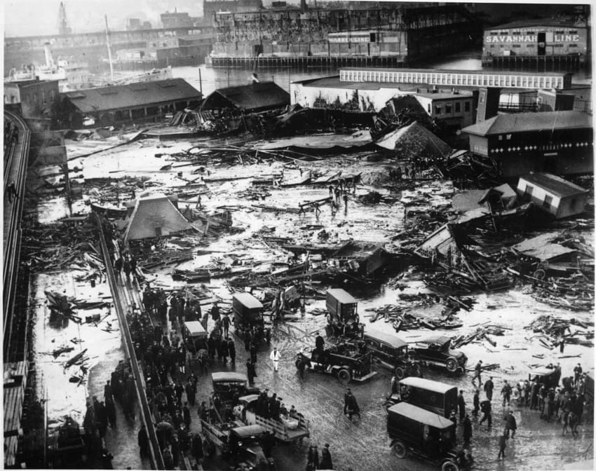
Around 12:40pm on January 15, 1919, a storage tank holding 2.3 million gallons of molasses exploded at the Purity Distilling Co. in the North End of Boston, sending waves of molasses rushing through the streets at almost 35 miles per hour. I’m sure that many people wouldn’t even think of this event as being at all dangerous, I mean after all, it’s just molasses. Nevertheless, a 25 foot high wave of molasses coming at you going 35 miles per hour is as deadly as being hit be a car. There was no warning, and in reality, there couldn’t 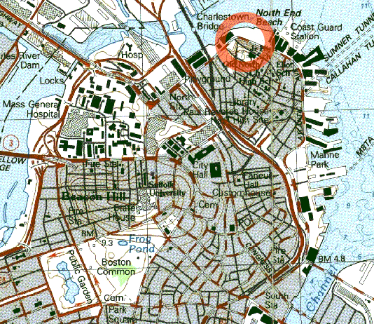 be. The molasses was being stored in the tank awaiting transfer to another plant and, due to its quickly rising temperature, it set off a tragic and previously unheard of chain of events. According to witnesses, the ground shook as if a tornado or freight train were coming down the street.
According to The Boston Globe, citizens “were picked up by a rush of air and hurled many feet.” A truck itself was picked up by the gushing wave and thrown into Boston Harbor. The force of the wave was so destructive, it almost tipped a railroad car off of Boston’s elevated railway tracks.” And The Boston Post described the gruesome scene, “Molasses, waist deep, covered the street and swirled and bubbled about the wreckage. Here and there struggled a form — whether it was animal or human being was impossible to tell. Horses died like so many flies on sticky fly-paper. The more they struggled, the deeper in the mess they were ensnared. Human beings — men and women — suffered likewise.”
The final death toll was set at 21, while 150 people were injured. The dead were either crushed by debris filled molasses, or drowned by the molasses itself. People and animals were seen struggling, some for which nothing could be done. The clean up was massive. Fire trucks were brought in to hose down the streets, and welders to 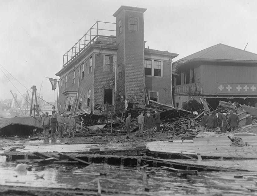 cut the tank up. The harbor was brown until summer. The molasses seeped into every crack, and it is said that on hot summer days, you could smell it for decades. I’m not sure how that could be, but maybe their minds played tricks in them too. In the end, the public outcry made a lawsuit necessary. The townspeople brought a class-action suit against the United States Industrial Alcohol Company, which had recently bought the Purity Distilling Company. Three years of hearings later, the USIAC was found guilty and forced to pay $600,000, which would equate to almost $10 million today, in settlements for negligence. The wave was as deadly as any tsunami could have been, but in reality, no warning could have prevented this tragedy.
 When I come across a husband and wife, who both died on the same day, my curiosity kicks into overdrive. That just seems so unusual. Nevertheless, such was the case for my husband, Bob’s 4th great grandparents, Cloudsbury and Elizabeth Kirby, both of whom died on August 29, 1878 in Mount Ayr, Ringgold County, Iowa. At first, I wondered if it was an error, and I suppose it could be, but that is the information I have at this point, so that is what I have to go with.
My first thought was to check for disasters in the area, like tornados, fires, or floods, but I was unable to find anything that specifically happened in Mount Ayr, Iowa on August 29, 1878. Looking for these kinds of specific things can be a long and frustrating process, but I just can’t imagine too many situations where both halves of a couple would pass on the same day. I searched and found that there were tornadoes during that year, but nothing specifically on that day, so I doubt that a tornado is the culprit here.
When the possibility of a disaster was removed, I began to think about illness, so I looked up and epidemics in the area. That is when I came across a definite possibility…the Yellow Fever Epidemic of 1876 to 1878, which took many lives in the southern United States. Yellow fever, known historically as yellow jack or yellow plague is an acute viral disease, that is usually spread by the female mosquito. Symptoms include fever, chills, loss of appetite, nausea, muscle pains particularly in the back, and headaches. Many people improve after a few days, but when the symptoms return, they can cause kidney damage, liver failure (causing yellow skin, probably the reason for the name Yellow Fever), bleeding, and ultimately death. These days there is a vaccine against Yellow Fever and some countries require it for travelers. Other countries try to control the virus by killing off as many mosquitoes as possible. Nevertheless, Yellow Fever causes 200,000 infections and 30,000 deaths every year with nearly 90% of those occurring in Africa, these days. Since the 17th century, several major outbreaks have occurred in America, Africa, and Europe. In the 18th and 19th centuries yellow fever was seen as the most dangerous of infectious diseases.
I can’t say for sure that Yellow Fever is what took the lives of Bob’s 4th great grandparents, but with the epidemic that occurred during that time, I have to think that it is a possibility. I have looked at the lists of people know to have died of Yellow Fever during that epidemic, and did not see Cloudsbury and Elizabeth Kirby on the list, but the list was incomplete, with many people only listed as a number. At this time, unless more information somehow surfaces, I will probably never know for sure, but the epidemic, which apparently came in from Cuba caused 100,000 people to become ill, and killed 20,000 people, so it is likely that they were too busy, trying to help people get better, to keep really great records as to the names of the dead. I have to feel really sorry for people of that time. They didn’t really know what was causing the epidemic and would not have had a way to do much about it anyway, so many lives were lost. Thankfully for the people of this century, Yellow Fever can be prevented by vaccination, and it is usually found in Africa, so we don’t really see much of it here.
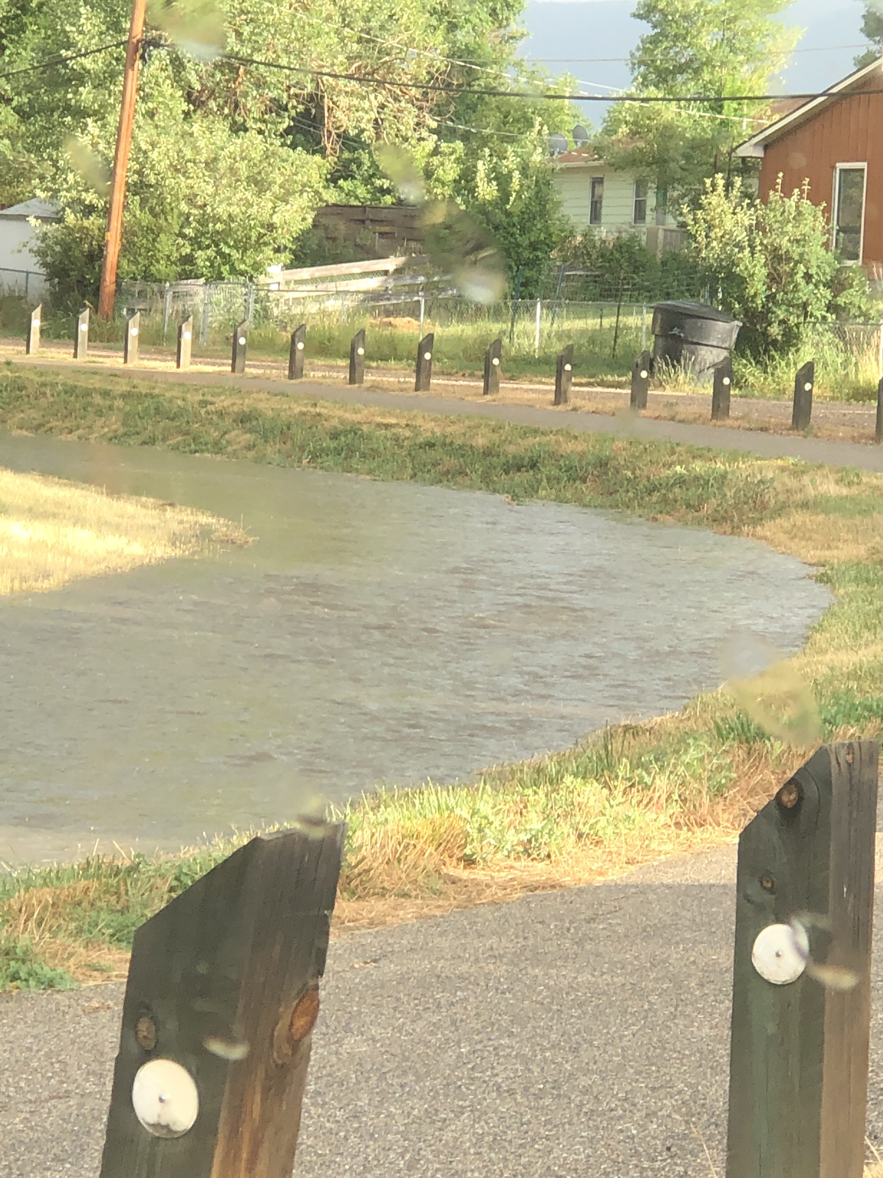
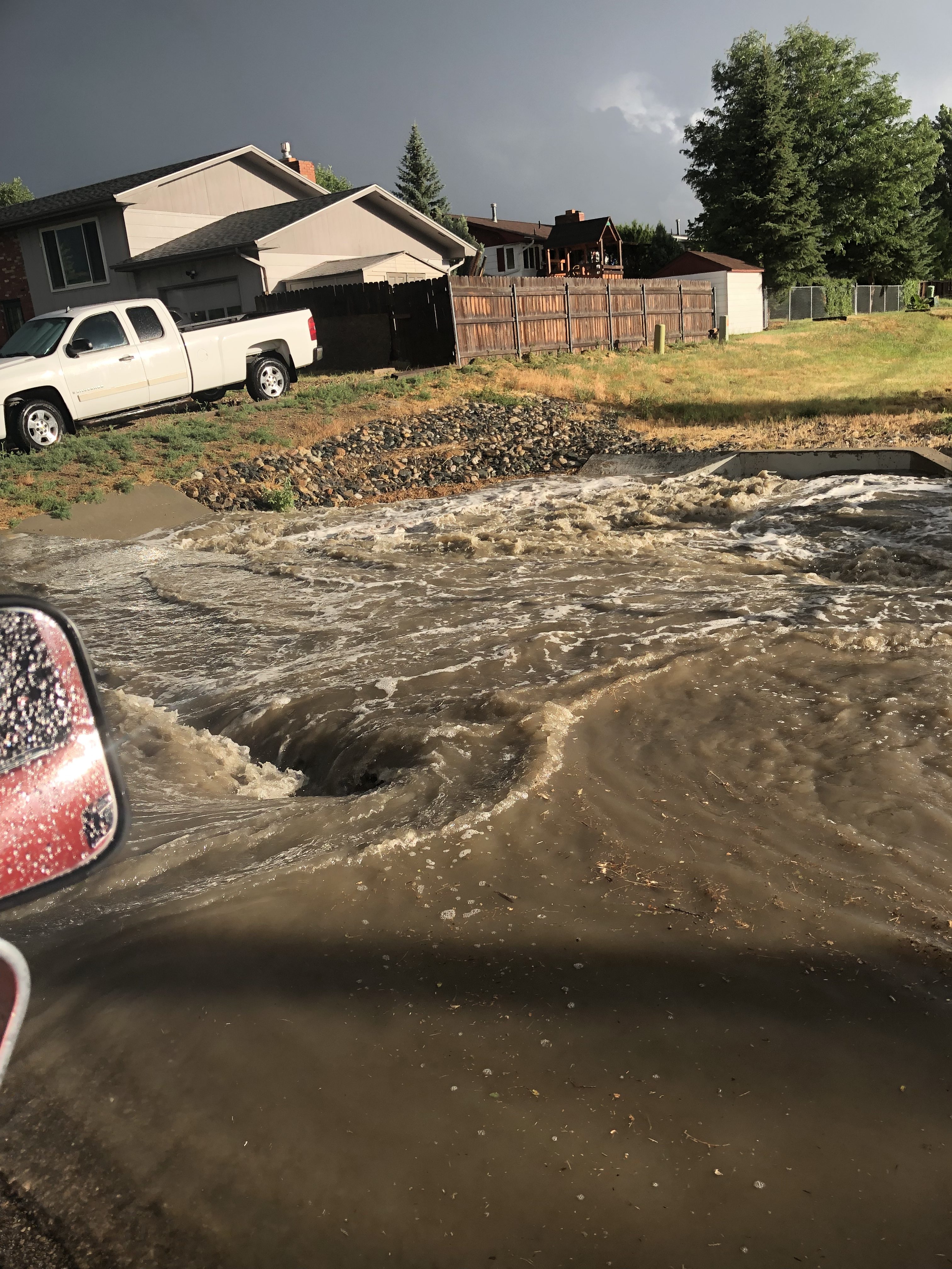
 I have been intently watching the flooding this past week in Colorado, and especially Boulder, which is very near where my cousin Tim and his family live. Rain has poured into the state, and the flooding rivals the July 31, 1976 Big Thompson flood in many areas. In that flood, 12 to 14 inches of rain fell in 4 hours, flooding the canyon…144 people lost their lives, and 150 were injured. So far in this flood, only 4 people have died, thankfully, and hopefully that will be all, but only time will tell. Roads have been washed out, and I-25 is under water in some areas, causing it’s closure along with the closure of many other roads. Neighbors have stepped up to help save the homes of other people, some of whom they don’t even know, and often working for hours without even being asked. It has been a real show of the human spirit and its ability to care for those in need. Outside help is probably scarce, because no one can get there, leaving them somewhat isolated, except for helicopters that have been able to come in from other areas. Schools are closed, and many people have been told not to attempt to go to work. Two people were
 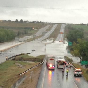 stranded in the mountains in whiteout conditions, because
 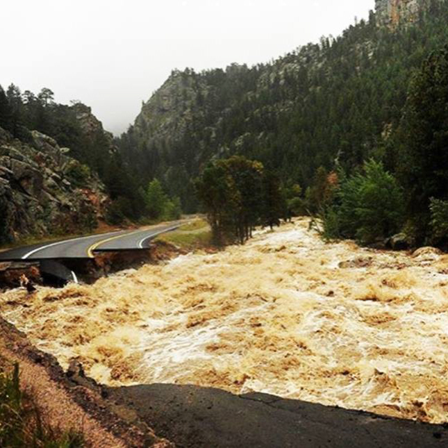 rescue resources were limited. They were rescued after 48 hours in the storm. Tim told me that the barrel they have in their back yard, to measure the rain, shows 10 inches over 3 days, with most of it coming over a 12 hour period. The huge snow storm in the mountains could cause continuing problems if it begins to melt.
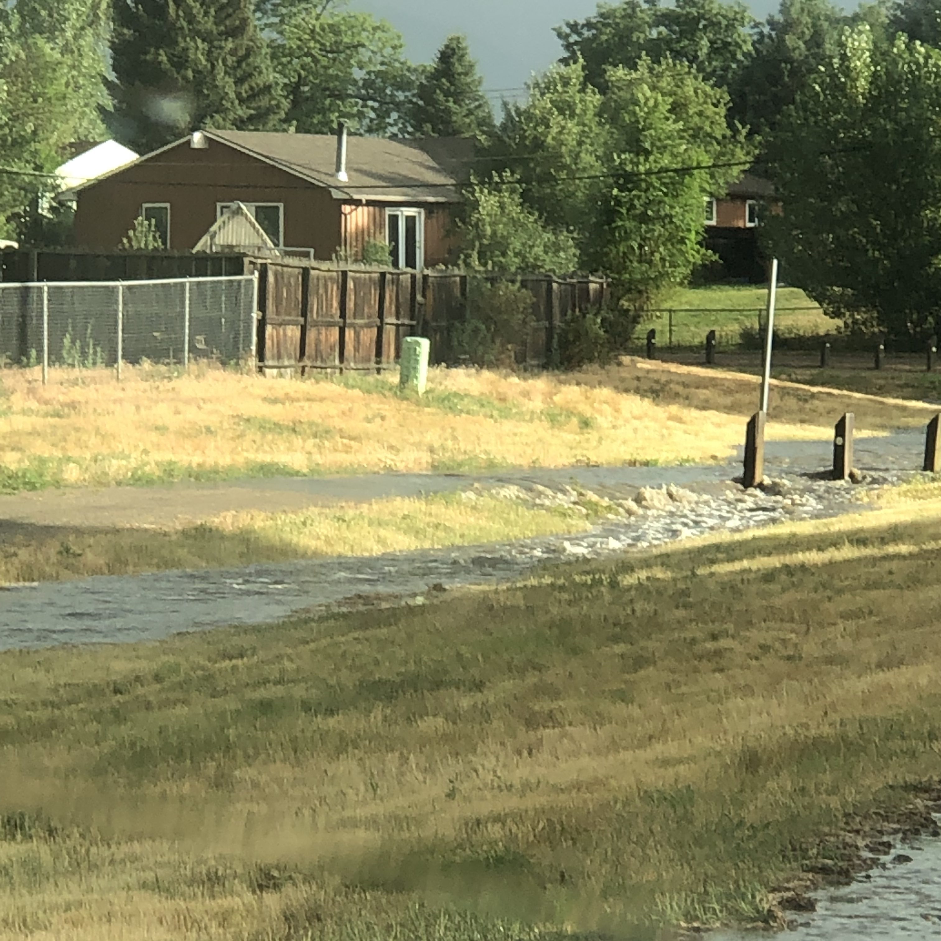
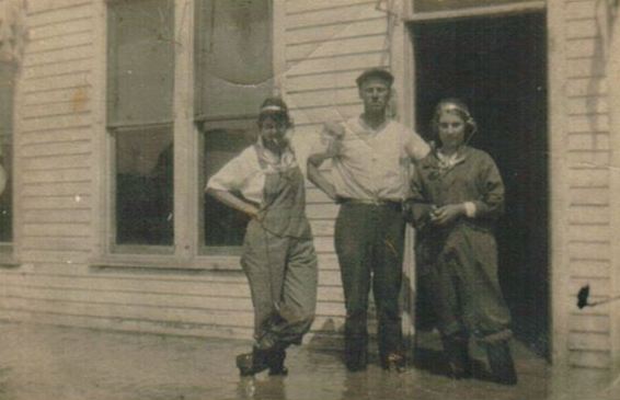
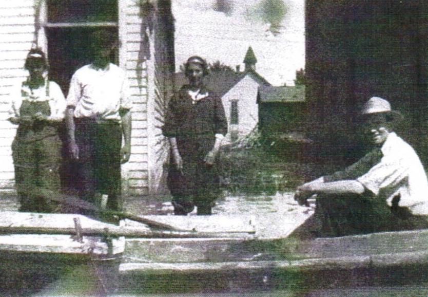
This flood also reminded me of an old photograph in my grandmother’s album. I’m not sure where this taken, but it does appear that they had quite a bit of water. Sadly, in those days, homes weren’t sealed as well, and so I’m sure there was extensive damage. Add to that, the fact that they didn’t have some of the clean up tools and chemicals to prevent mold, and you have a recipe for a big mess. They also didn’t have warning systems to tell them of the possiblity of a flash flood, and there were may people who lost their lives in 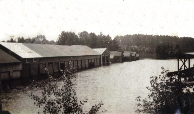 those situations. The things that have not changed over the years are the incredible human spirit and peoples’ will to survive. Neighbors will continue to help their neighbors, and people will fight to survive and rebuild their lives after each new disaster hits them. Floods are one of the most dangerous situations people can be in, and I am thankful that we have resources today to help more and more of them survive that danger. I will continue to pray for all those people who’s lives have been touched by the 2013 Colorado floods.

