earthquake
 These days, scientist and inventors have collaborated to develop early warning systems for just about any possible disaster, and when everything works as it should, and people heed the warnings, loss of life can often be avoided. Having the technology is great, but technology can’t make human beings do the right things…unfortunately. On May 22, 1960, twelve years after tsunami warnings were developed, and with the warning system in good working order, a massive 9.5 earthquake struck off the coast of Chili. It was the largest earthquake ever recorded. Unfortunately, we don’t really have an earthquake warning, and so without warning, 1655 people lost their lives in Chili and 3,000 injured in the quake. Two million people were made homeless, and damage was estimated at $550 million. The earthquake, involving a severe plate shift, caused a large displacement of water off the coast of southern Chile at 3:11pm. Traveling at speeds in excess of 400 miles per hour, the tsunami moved west and north. On the west coast of the United States, the waves caused an estimated $1 million in damages, but were not deadly. Everyone assumed that the worst was over.
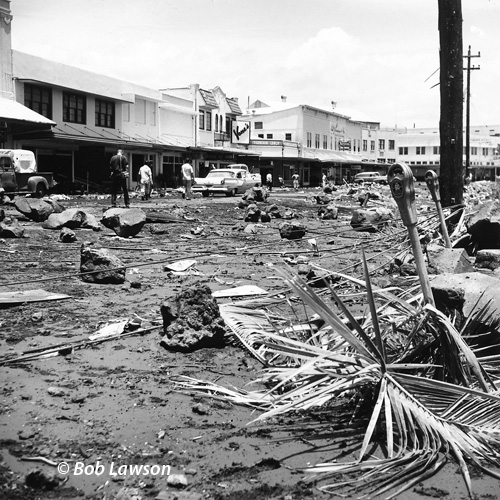
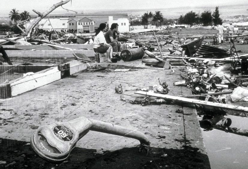
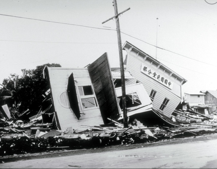
Nevertheless, warnings were sent to the Hawaiian islands. The Pacific Tsunami Warning System properly and warnings were issued to Hawaiians six hours before the wave’s expected arrival. The response of some people, however, was reckless and irresponsible. Some people ignored the warnings, and others actually headed to the coast in order to view the wave. Arriving 15 hours after the quake, only a minute after predicted, the tsunami destroyed Hilo Bay, on the island of Hawaii. Thirty five foot waves bent parking meters to the ground and wiped away most buildings, destroying or damaging more than 500 homes and businesses. A 10 ton tractor was swept out to sea. Reports indicate that the 20 ton boulders making up the sea wall were moved 500 feet. Sixty-one people died in Hilo, the worst-hit area of the island chain. Damage was estimated at $75 million. This tsunami caused little damage elsewhere in the islands, where wave heights were in the 3-17 foot range. The tsunami continued to race further west across the Pacific. Ten thousand miles away from the earthquake’s epicenter. Japan, received warning, but wasn’t able to warn the people in harm’s way. At about 6pm, more than a day after the quake, the tsunami hit the Japanese islands of Honshu and Hokkaido. The 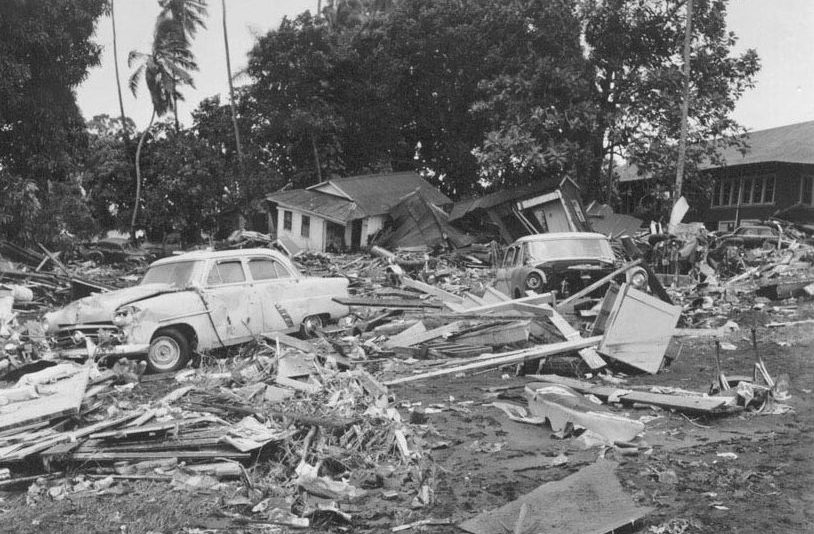 crushing wave killed 180 people, left 50,000 more homeless and caused $400 million in damages. The Philippines, also hit, saw 32 people dead or missing.
Tsunami warnings definitely save lives, but only if people will heed the warnings. As long as people decide that the warning doesn’t apply to them, and give in to their curiosity to go have a look, there will continue to be deaths. It seems a great shame that inventors and scientist work so hard to make a warning to save lives, and then some people refuse to do what is necessary to be safe after they have been warned. I simply don’t understand how people can ignore these warnings and take a chance with their lives.
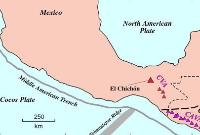 El Chichón was a volcano, in southern Mexico, that had not erupted for 130 years, meaning that no one who was alive on March 29, 1982 had ever seen it erupt. For most of the residents, who lived in the shadow of El Chichón, also known as Chinhonal, the 4,500 foot mountain seemed to pose no danger. Even when it did erupt, 130 years earlier, the eruption was minor. The people assumed that it was a dead volcano, and so ignored its potential for destruction and enjoyed the fertile soil its volcanic past provided.
Then, in late 1981, two geologists, who were intrigued by hot springs and steaming gaps in the earth near the volcano, began an investigation that revealed increased seismic activity and the possibility of a major eruption of the volcano. Unfortunately, their report was ignored, because of the volcano’s quiet past. Thier complacence would 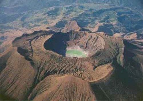 prove to be their downfall. Even when the ground began shaking on the night of March 28, the people did not heed the warning signs.
Then, at 5:15am the following morning, March 29, 1982, no one could miss the combination earthquake and eruption that exploded the mountain. The combination of the earthquake and the volcanic eruption turned the mountain into a crater. Ash was sent flying 60,000 feet in the air. About 150 people were killed when their roofs collapsed under raining volcanic debris. Two days later, ash from the eruption fell in Austin, Texas, many hundreds of miles to the north. The eruptions continued for over a week.
Most of the approximately 2,000 people killed by the eruption died from exposure to the pyroclastic flow, a 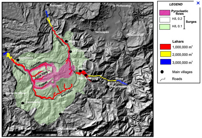 volatile mix of hot particles and gas. El Chichón lost its entire top, leaving only a large crater 1,000 feet deep, and less than 700 feet high, which was now shorter than the surrounding hills. Two more major eruptions occurred on April 3rd and 4th. In these eruptions, the debris was sent so high that it came down as virtual landslide on the surrounding villages. Trees and buildings were no match for the dirt and rocks. The debris also blocked streams, causing flooding in the area. Nine entire villages were destroyed and more than 100 square miles of farmland were unusable for years. Overall, the energy released by the eruptions, which were similar in scope to the Mount Saint Helens eruptions in Washington in 1980, was the equivalent of 8,000 one kiloton atomic bombs.
 The majority of earthquakes are minor and cause little damage, They are quite common, and for the most part, we never hear about them. On the other hand, on January 23, 1556 an earthquake hit Shaanxi, China. While this didn’t even come close to being the largest earthquake ever recorded, it remains the deadliest to this day. Scientific investigation revealed that the magnitude of the quake was approximately 8.0 to 8.3. The largest earthquake in history was the 1960 Valdivia earthquake, registering 9.4 to 9.6. The Valdivia was without doubt much larger that the Shaanxi China quake, but the size of a quake isn’t the only thing that makes it the worst.
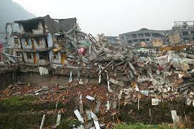
The epicenter of the Shaanxi quake was in the Wei River Valley in the Shaanxi Province, near the cities of Huaxian, Weinan and Huayin. In Huaxian, every single building and home collapsed, killing more than half the residents of the city, a number estimated in the tens of thousands. It was a similar 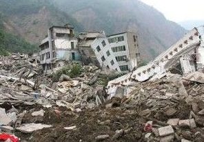 story in Weinan and Huayin. In some places, 60-foot-deep crevices opened in the earth. Serious destruction and death occurred as much as 300 miles away from the epicenter. The earthquake also triggered landslides, which contributed to the massive death toll. In all, an estimated 830,000 people lost their lives in the Shaanxi earthquake. Counting casualties is often imprecise after large-scale disasters, especially prior to the 20th century, but this disaster is still considered the deadliest of all time.
The quake struck in late evening, with aftershocks continuing through the following morning. A magnitude 8.0 to 8.3 earthquake isn’t close to the strongest tremor on record. However, the quake struck in the middle of a densely populated area with poorly constructed buildings and homes, resulting in the horrific death toll. Even if the number of deaths caused by the Shaanxi earthquake has been overestimated slightly, it would still rank as the worst disaster in history by a considerable margin. The earthquake and tsunami in Indonesia in 2004 is 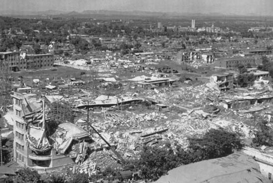 generally considered the second deadliest disaster in history.
The local records indicate that, in addition to inspiring searches for the causes of earthquakes, this particular quake led the people in the region affected to search for ways to minimize the damage caused by such disasters. Many of the casualties in the quake were people who had been crushed by falling buildings. Thus, in the aftermath of the 1556 quake, many of the stone buildings that had been leveled were replaced with buildings made of softer, more earthquake-resistant materials, such as bamboo and wood. By all accounts, this was an earthquake like no other.
 For some reason, there are certain areas on the United States, and the world, where earthquakes are…unexpected. There are just no real fault lines in these places, and no man-made reasons for it, like mining or drilling. So often people think they live in an area that is completely safe from an earthquake. Nevertheless, that does not mean that an earthquake can’t happen, as the people of Charleston, South Carolina found out on August 31, 1886.
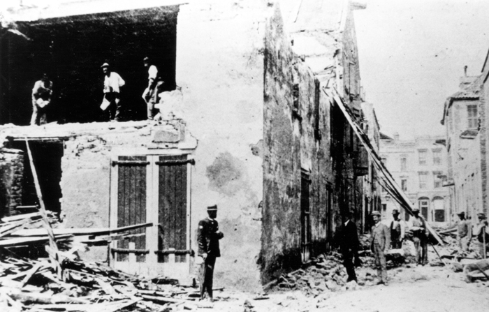
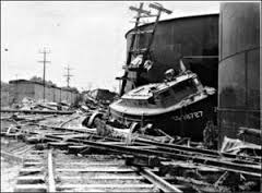
The first indicator that something strange was going on, came on August 27 and 28, when foreshocks were felt in Summerville, South Carolina, where my first cousin once removed, Stephanie Willard and her family live. While the tremors were odd, the people of the area didn’t think they were a warning for what was coming. Then, at 9:51pm on August 31, the rumbling began. The 7.6 magnitude quake was felt as far away as Boston, Chicago and Cuba. Buildings as far away as far away as Ohio and Alabama were damaged. But, it was Charleston, South Carolina, that took the biggest hit from the quake. Almost all of the buildings in town were seriously damaged. About 14,000 chimneys fell from the earthquake’s shaking. It caused multiple fires, and 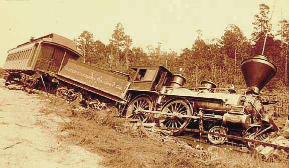 water lines and wells were ruptured. The total damage was in excess of $5.5 million, which would be about $112 million today.
While that was a disaster in itself, it was the loss of life that was felt the worst. More that 100 people lost their lives that fateful day, and countless others were injured, in what is still the largest recorded earthquake in the history of the southeastern United States. The quake damaged as many as 2,000 buildings, including buildings as far away as central Alabama, central Ohio, eastern Kentucky, southern Virginia and western West Virginia. The strange part about this quake is the fact that there were no apparent surface cracks as a result of this tremor, railroad tracks were bent in all directions in some locations. Acres of land were liquefied. This quake remained a mystery for many years since there were no known underground faults for 60 miles in any direction. Then, as science and detection methods got better, scientists have recently uncovered a concealed fault along the coastal plains of Virginia and the Carolinas. While this fault is now known, scientists think that another quake of this magnitude remains highly 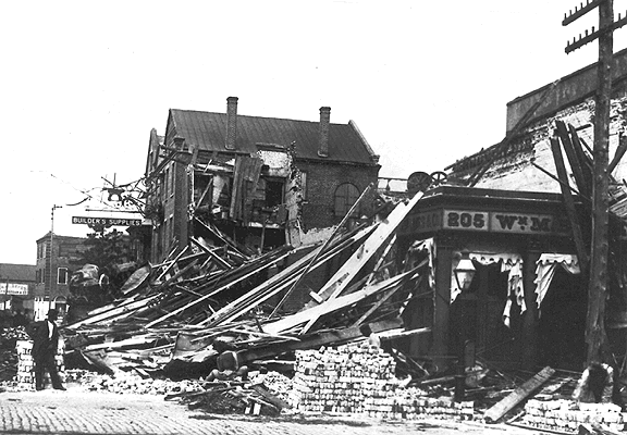 unlikely, though not impossible, in this location.
I guess I don’t quite understand that concept, except to say that if it is the only fault and has nothing to connect to, maybe there is less chance of a small tremor turning into a big quake, and maybe that is why they don’t expect another quake of that magnitude. Still, it is always good advise to realize that no place is immune to earthquakes. Oklahoma has found that out in recent years, as underground mining work has created quake situations that weren’t there before. It is still my hope that the Charleston area never has another quake like the one they had in 1886.
 When most of us think about April Fool’s Day, we think of playing some funny prank on our family or friends, but on April Fool’s Day 1946, the Earth played a prank, if it could be called that, on Hawaii. It was a prank that wasn’t funny, and it would claim the lives of 159 people. Early in the morning of that April Fool’s Day, a 7.4 magnitude earthquake struck in the North Pacific, 13,000 feet beneath the ocean surface, and off Unimak Island in the Aleutian chain, that makes up the tail of Alaska. The quake triggered devastating tidal waves throughout the Pacific, and particularly aimed at Hawaii. The first tidal wave hit Unimak Island shortly after the quake struck. The wave was estimated to be almost 100 feet, and it crashed into a lighthouse 30 feet above sea level. Five people lived in the lighthouse. It was smashed to pieces, and all five were killed instantly. The wave then headed toward the Southern Pacific at 500 miles per hour. The situation was like a freight train carrying an atomic bomb.
Hawaii was 2,400 miles south of the quake’s epicenter, and Captain Wickland of the United States Navy was the first person to spot the coming wave at about 7:00am, four and a half hours after the quake struck in the Aleutian Islands. His position on the bridge of a ship, 46 feet above sea level, put him at eye level with a “monster wave” that he described as two miles long. The first wave came in and receded, then the water in Hilo Bay seemed to disappear. The boats that were docked there, settled on the sea floor, surrounded by flopping fish. Then…the second wave hit…and it was massive!! The city of Hilo was hit by a 32 foot wave that devastated the town. Nearly a third of the city was completely destroyed. The bridge that crossed the Wailuku River was picked up by the wave, and pushed 300 feet away. In Hilo, 96 people lost their lives in the tsunami. Other parts of Hawaii were hit even worse. In some places, the waves reached heights of 60 feet. A schoolhouse in Laupahoehoe was crushed by the tsunami, killing the teacher and 25 students inside.
The massive wave was seen as far away as Chile, where, 18 hours after the quake near Alaska, unusually large waves crashed ashore, but there were no casualties. This tsunami prompted the United States to establish the Seismic SeaWave Warning System two years later, which is now known as the Pacific Tsunami Warning System. 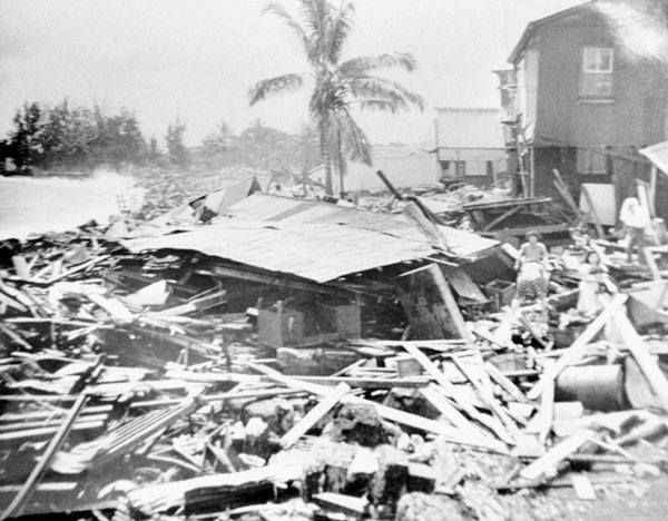
 It uses undersea buoys throughout the ocean, in combination with seismic-activity detectors, to find possible killer waves. The warning system was used for the first time on November 4, 1952. That day, an evacuation was successfully carried out, but the expected wave never materialized. Still, like the fire drills we all know about from school, maybe Tsunami Drills wouldn’t be a bad thing either, especially if it would prevent the kind of loss of life that Hawaii experienced on that awful April Fool’s Day in 1946.
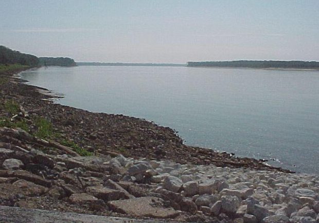 Most people know that with an earthquake underwater, comes the possibility of a tsunami. Tsunamis can cause as much or more damage that the original earthquake. I think we all know that living in a coastal area puts the residents in possible danger when these offshore earthquakes hit, but what happens further inland? The tsunami doesn’t normally travel too far inland…unless it is a fluvial tsunami. This was a type of tsunami I had never heard of before. Nevertheless, on this day, February 7, 1812, there was a series of earthquakes in Missouri. They were the most violent and powerful quakes in the history of the United States. The series of tremors, which took place between December 1811 and March 1812. The Seismic activity was quite unusual for the area around the city of New Madrid, located near the Mississippi River in present day Arkansas, which had about 1,000 residents at the time, most of whom were farmers, hunters, and fur trappers. It all began on December 15, 1811with unusual tremors. Then, at 7:15am, an even more powerful quake erupted, now estimated to have been an 8.6 magnitude quake. This quake literally knocked people off their feet and many people experienced nausea from the extensive rolling of the earth. Given that the area was sparsely populated and there weren’t many multi-story structures, the death toll was relatively low. However, the quake did cause landslides that destroyed several communities, including Little Prairie, Missouri.
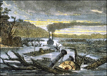
The quake also caused fissures…some as much as several hundred feet long…to open on the earth’s surface. Large trees were snapped in two. Sulfur leaked out from underground pockets and river banks vanished, flooding thousands of acres of forests. On January 23, 1812, an estimated 8.4-magnitude quake struck in  nearly the same location, causing disastrous effects. Reportedly, the president’s wife, Dolley Madison, was awoken by the quake in Washington, DC. The death toll was smaller for this quake, because most of the survivors of the first earthquake were now living in tents, so they could not be crushed. The strongest of the tremors followed on February 7, 1812, and was estimated at an amazing 8.8 magnitude…probably one of the strongest quakes in human history. Church bells rang thousands of miles away in Boston, Massachusetts, from the shaking. Brick walls were toppled in Cincinnati, Ohio. In the Mississippi River, water turned brown and whirlpools developed suddenly from the depressions created in the riverbed. Waterfalls were created in an instant and in one report, 30 boats were helplessly thrown over falls, killing the people on board. Many of the small islands in the middle of the river, often used as bases by river pirates, permanently disappeared…possibly a poetic end to their crimes. Large lakes, such as Reelfoot Lake in Tennessee and Big Lake at the Arkansas-Missouri border, were created by the earthquake as river water poured into new depressions in the ground. But, probably the most unusual activity, was what happened to the Mississippi River next. Because of the quake’s proximity to the Mississippi River, the quake had an effect that was probably unheard of until that time…a Fluvial Tsunami. A Fluvial Tsunami is something I never knew existed, but apparently it does. The quake and the ensuing fluvial tsunami in the Mississippi River, actually made the river run backward for several hours. I’m sure people were stunned and frightened at what they saw.
The exact death toll from this series of deadly quakes is difficult to determine because of a lack of an accurate record of the Native American population in the area at the time. The series of quakes ended in March of 1812, with aftershocks continuing for years. In the end, it was decided that approximately 1,000 people died because of the quakes, but it could be much higher. As I researched this crazy tsunami, I found out that fluvial refers to a river tsunami, the Mississippi River has actually flowed backward multiple times, and fluvial tsunamis are actually not that rare, they occur whenever a quake causes the water in a river to flow backward it rush in is normal direction.
 Recently, I saw an article on an app I have on my phone, called QuakeFeed. It is, of course, an app that tells me when there are earthquakes anywhere in the world, but my settings alert me if they are bigger 5.0. It’s not that earthquakes scare me or even concern me especially, because I don’t live in a really high earthquake area. I’m just naturally curious, and when a quake happens, I go to the map part of the app to see where it was. The app also has stories about the quakes that occur, especially is there was any damage or loss of life. Periodically, I look at the article part of the app, and that was where I saw the article concerning Mount Everest.
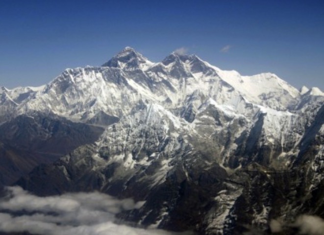
The article talked about an anomaly that I had not considered before. Now, maybe anomaly isn’t really the right word, but in my mind, that’s what it is. It mentioned that there was a possibility that due to earthquakes in the area, Mount Everest might have…shrunk. In case you didn’t know, Mount Everest is located in India and is part of the Himalayan mountain range. Mount Everest sports the crown 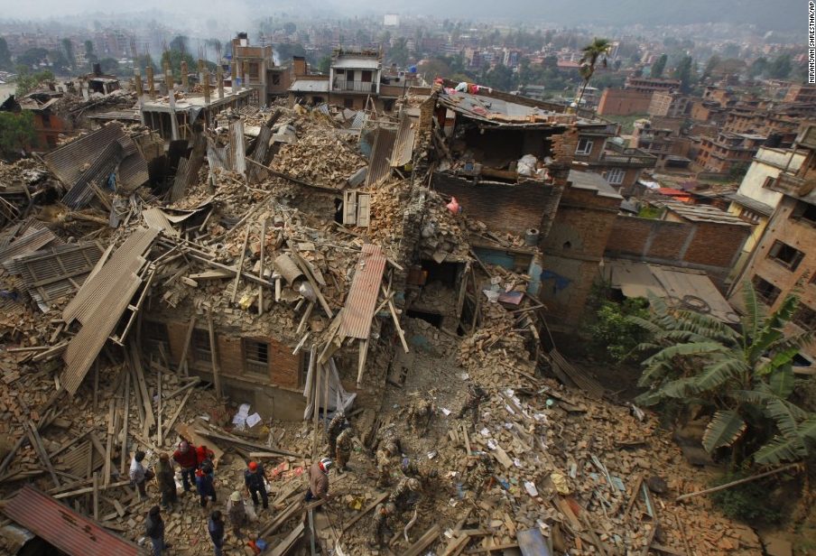 as the world’s highest elevation, at 29,028 feet. The next highest elevation in a mountain is K2 in Pakistan. At 28,251 it is a full 777 feet lower than Mount Everest…at last measurement anyway. On April 25, 2015, a 7.8 earthquake hit Nepal at 11:56am, Nepal Standard Time. Known as the Gorkha earthquake, it killed nearly 9,000 people and injured nearly 22,000. Now, the Smithsonian Magazine is reporting that shortly after that quake, Satellite data was used to determine that large swaths of land in Nepal had risen more than 30 feet, while others had dropped. The school of thought is that the possibility exists that Mount Everest has actually shrunk. As I said, to me that seems like an anomaly, but it’s quite possible that Mount Everest, and all the other mountains of the world, have repeatedly changed in altitude. Somehow, I guess I had it in my head that mountain heights are permanent, but that isn’t even logical. The mountains were created by earthquakes. Their size must be subject to change by an earthquake too. It is the only logical conclusion.
The last time Mount Everest was measured was more than six decades ago, so I guess I wasn’t the only one 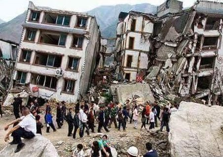 who thought it wouldn’t change. Nevertheless, now India’s surveyor-general, Dr Swarna Subba Rao has plans to send an expedition to Mount Everest. Their mission is to “re-measure the hulking rock.” They do not expect that Everest has shrunk below 29,000 feet, but the technology has changed on the last 60 years, so it is possible that there might be some discrepancies. These days, scientists will measure Everest’s height using GPS equipment and triangulation techniques. “The observational data would take a month to collect and another 15 days to compute,” said Rao. I for one am excited to hear what their findings are. And, to be honest, I hope that the elevation has changed. To me, that would be like watching history in the making.
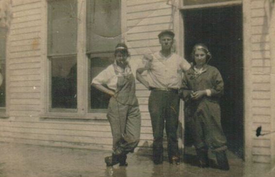 After my husband, Bob’s 2nd great grandma, Mary LuLu Taylor remarried, following the death of her first husband, James Leary, on March 26, 1888, she and her second husband had three children, bringing to four the total number of her children. Her life had taken her from Forsyth, Montana to Shelby, Missouri, where she met James Begier, who became her second husband. Later, they would move to several other times, but Montana always seemed to be in her blood and she would return there several times. Her daughter Mabel Claire Begier met and married her husband, Edward Anthony Brown in Rosebud, Montana. I’m not positive at what point Mabel became a telephone operator, but she did, and as it turns out, that’s where she was working during one of the floods that took place in Montana. That job, at that time in history, put her right in the middle of a serious situation, and in a position to help those in need of assistance.
When we think of any disaster…be it fire, earthquake, tornado, or flood, our first instinct these days is to dial 911 on our phones. That has become the go to number for all kinds of help in times of need. That wasn’t always the case though. Years ago, it was the operator you called for help. You simply dialed “0” to get in touch with someone who could connect you with any branch of emergency help there was…as well as to let everyone else in town know about the emergency…at least back then they could. Privacy laws would have prevented that these days. Of course, if it was a big emergency, letting everyone know would be her job.
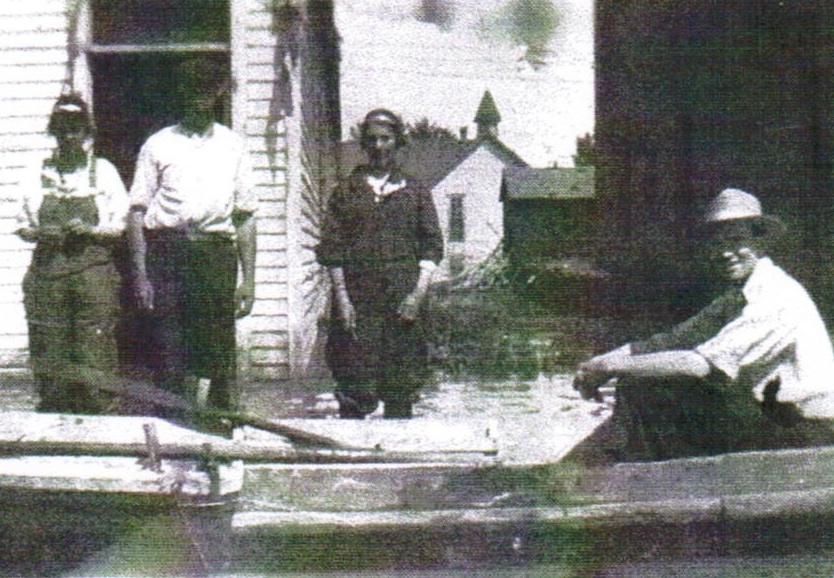 Mabel Begier was an operator during an emergency that would have qualified as one in which it was acceptable to let people know, but then my guess is that most people already knew that it was coming. Floods in towns where you live near a river are common in the Spring, especially after a particularly high snowfall year. People who live near rivers already know that Spring means that you have to watch the water levels, stay prepared to evacuate, and stay informed at all times. At that time in history, when a warning needed to be sent out, you called the operator to get the warning out. That was where Mabel came in, and she loved her job. I think the job that she had was very important, and she was a key part of the emergency efforts of that era.
 I was watching the news tonight about an American family that had just found out that their daughter was among the casualties of the tragic earthquake and tsunami a little over a week ago. Taylor Anderson, an accomplished English teacher who had been living in Japan and teaching English to young students there, used what precious time she had to escape, to make sure her students were safe. It was a brave and selfless act that cost her her life in the end. She was the first American known to have been killed in the disaster.
Losing their daughter was probably the single worst event in the lives of her family, but to add to the tragedy of that loss, is the fact that, as often happens in the aftermath of a disaster, information can get mixed up. Taylor’s family had been told that she had survived and was safe, only to find out later that they had been misinformed. A devastating turn of events. Almost impossible to believe.
I know how this family feels, and my heart goes out to them. My family also experienced a similar devastating situation of misinformation. My Great Aunt Gladys was one of the victims in the 1989 crash of United Airlines flight 232 in Sioux City, Iowa. Our family was also told that she had survived, and it was even on television…but it wasn’t to be. Somehow her purse had arrived at a hospital with another woman, so they thought it was her. We couldn’t believe it, and even continued to watch the reports, hoping against hope that they had been wrong.
Losing a loved one in any kind of disaster is unbearably hard, but when you are told they made it, and then find out they didn’t…well, it’s like losing them twice. It is no one’s fault, of course, and those people who have told someone their loved one is safe, only to have to tell them they were mistaken, are torn to shreds too. It is devastating to all involved, and my heart goes out to each and every one of them.
 While watching the news concerning the earthquake in Japan, and the ensuing tsunami in Japan, Hawaii, and the US west coast this week, I am once again shocked and saddened by the chances people take. The people is Japan had virtually no warning, and so they couldn’t prepare for the tragic events that happened that awful day, but the man that was swept out to sea in California while taking pictures of the waves, knew the chance he was taking.
I’m quite sure that if the people in Japan had been able to get away, they would have. There simply wasn’t time, and as a result, many lives were unavoidably lost. My heart goes out to everyone affected by this tragedy. Those left behind have a monumental job ahead of them to rebuild in the midst of so much grief.
The people in Hawaii and the US west coast, had enough warning, however, and were told to stay away from the coast line. So why do we feel the need to go out there and get pictures of the event, simply to say we were there. My mind wanders to the thoughts going through the mind of that poor man being swept out to sea, knowing that his impending death was due entirely to his own foolish choices. Obviously, if he could do it all over again, knowing what he now knows, he would literally run in the opposite direction. I’m sure he thought of his loved ones toward the end, with much regret for putting them in a position of such grief. I know it was not his intent to end up this way, but the love of the all elusive historic photo to document the day, overtook his good sense concerning his own safety.
As I watched the footage, I saw a wave coming in to a Santa Cruz, California marina, and hitting the boats parked there. People were walking on the docks there! It was unbelievable! The reporter was saying that these people had been told not to be there, but once again the thought that “it won’t happen to me” kicked in and curiosity won out. Even if you aren’t swept away, getting caught between two colliding boats would take the same toll. People, please…think of your loved ones, if you can’t think of yourself. Please don’t take the risk. It isn’t worth it.

