waves
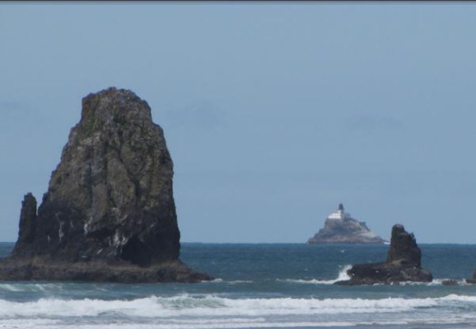 “Terrible Tilly” came by her name honesty, because from the start, the lighthouse seemed to be nothing but trouble. “Terrible Tilly” is the nickname of the Tillamook Lighthouse sits on top of a sea stack of basalt, more than a mile off the banks of Oregon’s North Coast. Looking to put up a lighthouse in the area Tilly’s story began in 1878 when a solid basalt rock was selected as the location for a lighthouse off the coast of Tillamook Head. Any construction work can have its dangers, but construction a mile offshore in all kinds of weather, can be particularly dangerous. Such was the case with “Terrible Tilly” when even before the work began, a master mason surveying the location was swept out to sea, never to be seen again.
Even with the dangers and the loss, work began in 1880, and the lighthouse went into operation in 1881. In those days…the days before GPS, lighthouses were a vital part of the shipping business. The ships couldn’t see the 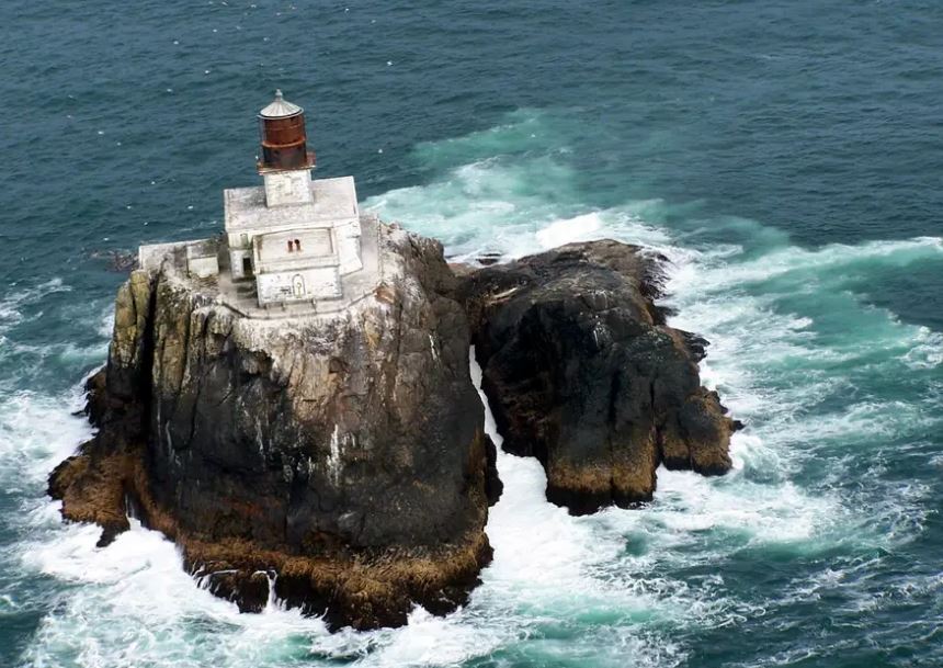 dangers that lurked in the night, so knowing what was just below the surface, or even above the surface of the water was very important. As ships got closer to shore, the possibility of hitting rock or small island could be disastrous. Never was that more evident that the disaster that occurred just a few weeks before the lighthouse opened. A ship sailed too close to the shore because of low visibility, and crashed, killing all 16 crew members. The need for the lighthouse was proven once again, in a very sad way.
While you might think that making the lighthouse operation would have ended the tragic connections with “Terrible Tilly,” but that really wasn’t the case. The conditions on the lighthouse were extremely rough, and one lighthouse keeper even allegedly went insane. Being even just a mile offshore, made life very isolated. The storms beat on the lighthouse, and I’m sure they sometimes wondered if the lighthouse could take it. The howling wind can be enough to drive some people crazy. Living in Wyoming, I know that there are times when 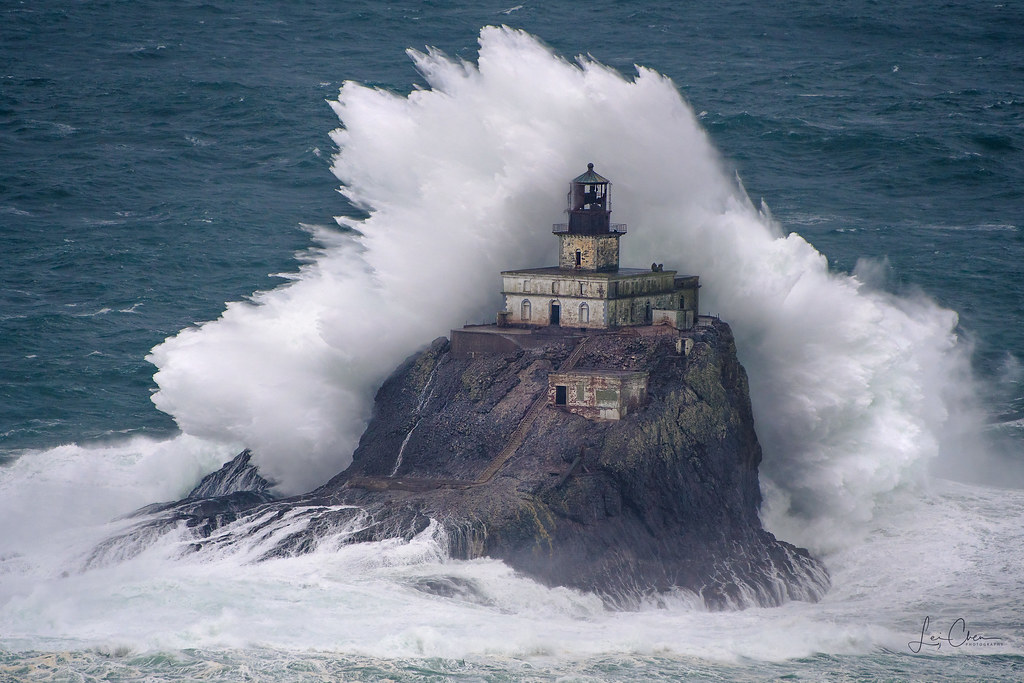 we wonder if the wind will ever quit. When it finally does, it is almost shockingly quiet. Not everyone can take the howling wind.
As GPS came into being, the need for lighthouses is becoming less and less. It’s rather a sad fact, because these icons of history, are fading into the past, and for me, that feels very sad. Decades after the lighthouse was decommissioned in 1957, it was turned into a columbarium, which is a storehouse for urns of cremated remains. To this day, the remains of 30 people are still stored inside the lighthouse. “Terrible Tilly” was closed down in 1957 and remains off limits to the public to this day.
 I would never have considered that an earthquake in Chili could affect Hawaii, which is 6,593 miles away, but on May 23, 1960, that seemingly huge distance suddenly became very small. When a 9.5 magnitude earthquake hit Chili on May 22, 1960, thousands of people lost their lives, and a giant tsunami was triggered. By the next day, that tsunami had traveled across the Pacific Ocean and killed an additional 61 people in Hilo, Hawaii. That distance and the amount of devastation seems incredible to me.
The earthquake, which involved a severe plate shift, caused a large displacement of water just off the coast of southern Chile at 3:11pm. The resulting wave, traveling at speeds in excess of 400 miles per hour, moved west and north. The damage to the west coast of the United States was estimated at $1 million, but there were no deaths there.
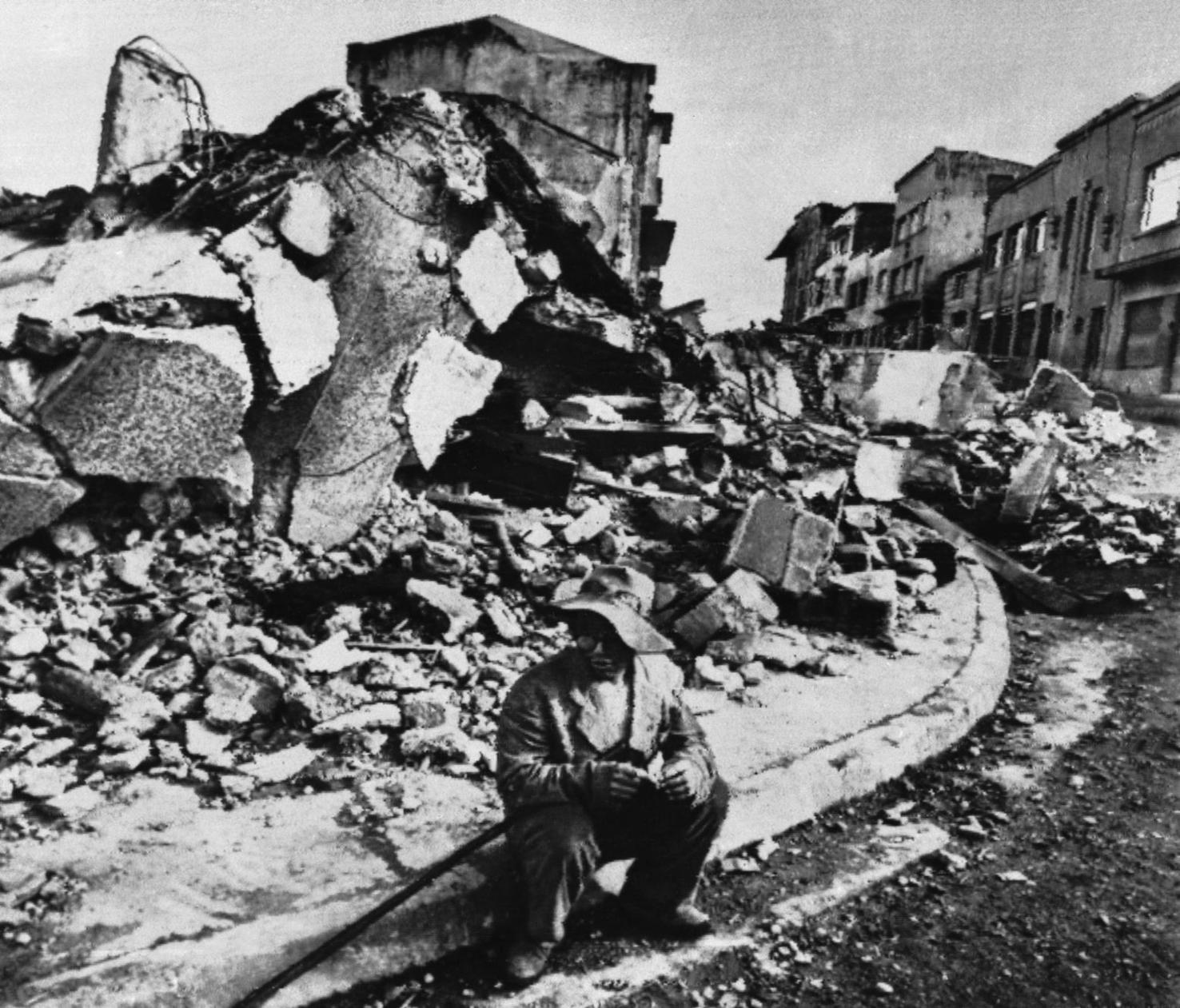
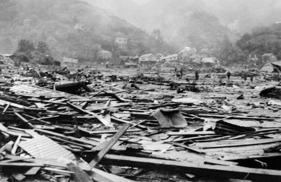
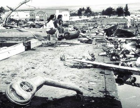
In 1948, the Pacific Tsunami Warning System was established in response to another deadly tsunami. It worked properly and warnings were issued to Hawaiians six hours before the deadly wave was expected to arrive. Unfortunately, some people ignored the warnings, as always seems to happen. Some other people actually headed to the coast in order to view the wave…like the warning was actually an announcement of a coming attraction. The tsunami arrived only a minute after it was predicted, and it absolutely destroyed Hilo Bay on the island of Hawaii.
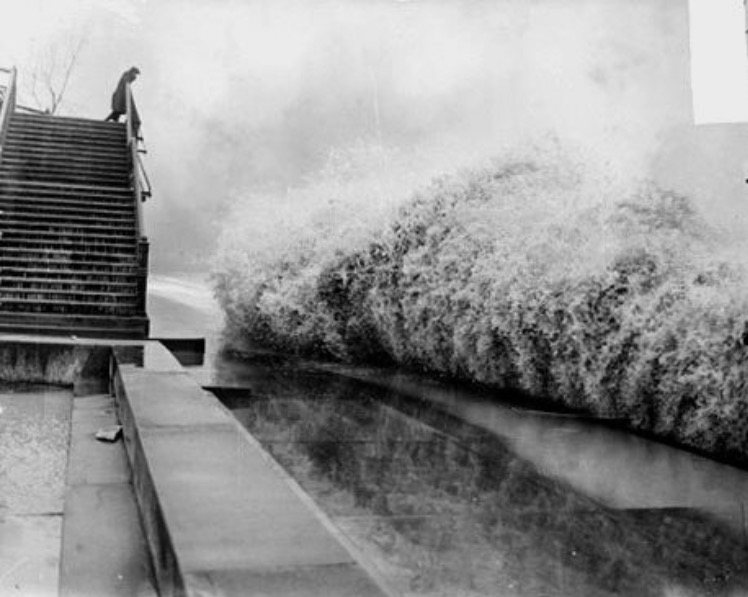
People really don’t fully understand just how much destructive power water has, until they see it in action. When the waves hit Hilo Bay, they were thirty-five-feet high. They were so strong that they bent parking meters to the ground and wiped away most of the buildings. When the wave hit a 10-ton tractor, it was swept out to sea like it was made of Styrofoam. you would think that boulders would be sturdy enough to hold back the waves, but the 20-ton boulders that made up the seawall were easily moved 500 feet. The 61 people who lost their lives were in Hilo…the hardest hit area of the island chain.
With all of that destruction, you might be inclined to think that the waves would have lost power, and to a degree, I suppose they did. Nevertheless, the tsunami continued to race further west across the Pacific. Even given a ten-thousand-mile distance from the earthquake’s epicenter, Japan still wasn’t able to provide enough warning time to get the people out of harm’s way. The wave hit Japan at about 6:00pm, more than a full day after the earthquake. The tsunami struck the Japanese islands of Honshu and Hokkaido. The wave’s power was still enough to crushing 180 people, and to leave 50,000 more homeless. In Japan, it caused $400 million in 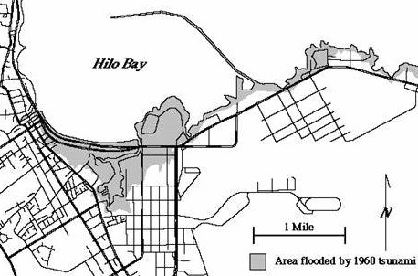
 damages. With everything destroyed by this one earthquake and the subsequent tsunami, you would think that people would finally learn to stay away from the shore during a tsunami warning, but every year people lose their lives because they decided to cross paths with waves…be it from tsunamis, hurricanes, and other floods. Water is a force to be reckoned with. It should be considered very dangerous.
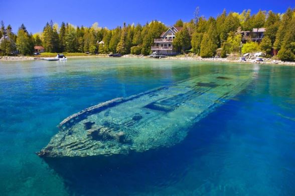 In September of 1975, my husband, Bob Schulenberg and I made a trip to Superior, Wisconsin to visit my Uncle Bill Spencer and his family. Uncle Bill and I had always been close, and it was a trip I thoroughly enjoyed. Part of the trip included driving around the shores of Lake Superior, while Uncle Bill gave us some history of the area, including the many shipwrecks that had occurred in the lake. Lake Superior is the largest fresh water lake in the world, and in reality it is more a sea than a lake. The lake experiences treacherous storms, especially in November when the Winter gales sweep over the it. With a huge shipping industry operating on the lake every year, accidents are bound to happen periodically, especially if a ship is caught out on the lake too late in the season. Listening to Uncle Bill tell us about the ghosts of Lake Superior, as the wrecks were called, and how you could see them beneath the water if you flew over the lake, peeked my curiosity about when and where the ships had lost their battles with the lake.
Just a month later, on November 10, 1975, while driving around the lake on his way back from a gun show, Uncle Bill experienced the gales of November from the lake shore, not knowing at the time that the SS Edmond Fitzgerald was fighting for its life, in a losing battle on the lake. The ship had made a run for it from Superior, Wisconsin, but found itself in serious trouble the next day. This was not going to be a battle the ship or her 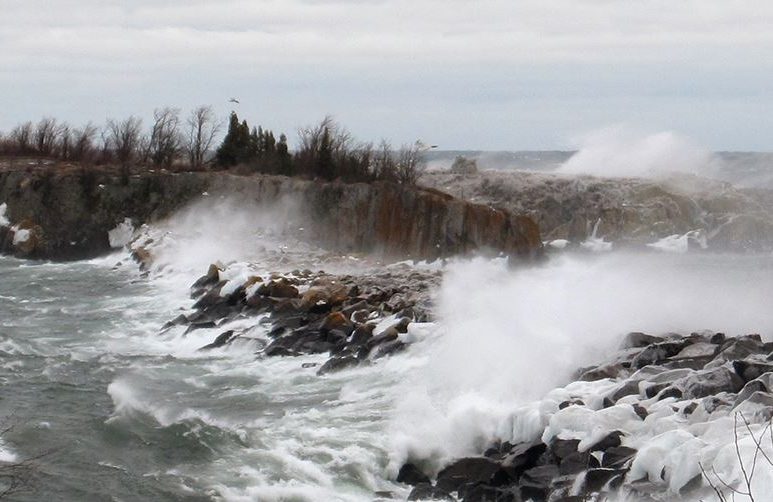 crew would survive. The SS Edmund Fitzgerald had once been the largest and fastest ship on the Great Lakes, at 729 feet in length. First launched in 1958, its service would be cut short that fateful day in 1975.
The ship left Burlington Northern Railroad Dock, Number 1 at Superior, Wisconsin on November 9th, carrying 26,116 tons of iron ore pellets. The next day it was hit with a storm packing 60 mile per hour winds and waves in excess of 15 feet. Captain Ernest McSorley steered north, trying to make it to safety in Whitefish Bay, but then the radar failed and the storm took out the power at Whitefish Bay taking with it Whitefish Point’s radio beacon. McSorley was traveling blind. The huge wave swept over the ship, and it began taking on water. A ship taking on water is never a good thing, but when you add to that 26,116 tons of iron ore pellets, that ship is in trouble. Another ship, the Anderson stayed in radio contact with the Fitzgerald, trying to help it reach the bay, but to no avail. Just after 7pm on November 10th, 17 miles from Whitefish Bay, the Fitzgerald made its last radio transmission. The ship, sunk lower and lower from the added weight of the water until its bow pitched down into the lake and the vessel was unable to recover. The ship broke in two, either from waves and water or on its way to the bottom, taking with it cargo and crew. None of the 29 men aboard survived.
It’s not hard to imagine why the shipwrecks are called the Ghosts of Lake Superior, because many, if not all of 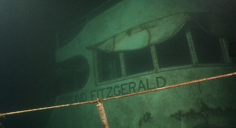
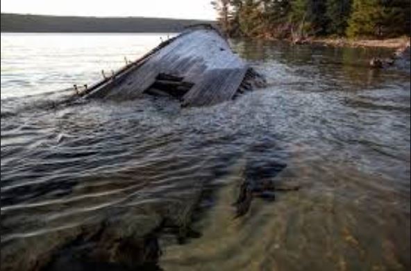 them took with them the men and women who had been their crew. Most of those lost souls are still there in a watery grave, because it is too difficult to recover the bodies. The Edmund Fitzgerald now lies under 530 feet of water, broken in two sections. It is just one of at least 52 ships that litter the bottom of the lake. On July 4, 1995, the ship’s bell was recovered from the wreck, and a replica, engraved with the names of the crew members who perished in this tragedy, was left in its place. The original bell is on display at the Great Lakes Shipwreck Museum at Whitefish Point in Michigan.
 When we think of hurricanes, we think of the ocean, but on November 7, 1913, there was a storm over the Great Lakes that would go down in United States history as the largest inland maritime disaster, in terms of number of ships lost. The storm was nicknamed the White Hurricane. The storm system brought blizzard conditions to areas all around the Great Lakes, with hurricane force winds. The nature of the storm was unique and powerful, and caught even the most seasoned captain by surprise. Two low pressure centers merged and rapidly intensified over the Lake Huron, with periods of storm-force winds occurring over a four day period. Surrounding ports signaled it was a level-four storm, but for some vessels, it was already too late. Major ship wrecks took place on all the Great Lakes except for Lake Ontario. Vessels at that time could withstand 90 mile per hour winds and 35 foot waves, but it was the whiteout conditions and accumulation of ice on the ships that turned an already dangerous situation into a deadly one. Ship captains were unable to maintain navigation, resulting in 12 shipwrecks, 19 ships stranded, and an estimated 250 lives lost. On land, 24 inches of snow shut down traffic and communication, causing millions of dollars in damage.
The storm took place before the time when weather forecasters had the luxury of computer models, the detailed surface and upper air observations, weather satellites, or radar needed to make the most accurate predictions. Had weather forecasters then been able to access modern forecasting equipment, they may have been able to determine the likely development of this type of storm system in advance, as they did with Superstorm Sandy in 2012. As part of the forecast for Sandy forecasters were able to predict storm force winds over the lower Great Lakes five days in advance. The technology and forecast models available to forecasters today led to a more accurate forecast which saved mariners, recreational boaters, and businesses millions, as they were able to make preparations in advance of Sandy’s storm force winds and near 20 foot waves.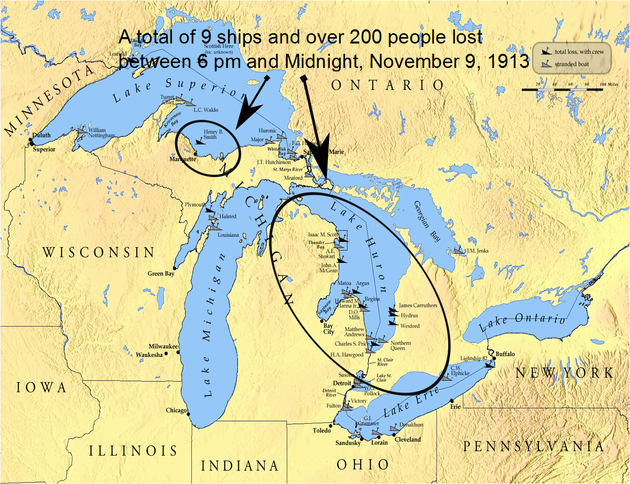
One hundred years later, the National Oceanic and Atmospheric Administration, in the Great Lakes is commemorating the Storm of 1913, not only for the pivotal role it played in the history of the Great Lakes, but also for its enduring influence. Modern systems of shipping communication, weather prediction, and storm preparedness have all been fundamentally shaped by the events of November 1913. It’s strange to think that one storm could make such a lasting impact on so many systems, but then it is the need for something better that spurs great inventive minds to invent a solution to a serious problem.
The National Oceanic and Atmospheric Administration plays a major role in protecting maritime relics of the past. Included are many of the ships lost in 1913. They have remained preserved deep below the surface of the Great Lakes. The National Oceanic and Atmospheric Administration’s Thunder Bay National Marine Sanctuary is a 48-square-mile area of protected territory with one of America’s best preserved and nationally significant collections of shipwrecks. Located in northwestern Lake Huron, Thunder Bay is adjacent to one of the most treacherous stretches of water within the Great Lakes system. Unpredictable weather, murky fog banks, sudden gales, and rocky shoals earned the area the name “Shipwreck Alley.” To date, more than 50 shipwrecks have been discovered within the sanctuary including the Isaac M. Scott, a 504 foot steel freighter lost in the storm of 1913.
This storm holds an interest for me, because at that time in history, my grandparents, Allen and Anna Spencer were living in the Great Lakes area. My grandfather was not part of the crew of any ship, and so any effect to them would have come in the form of very deep snow. My Aunt Laura would have been just 16 months old at 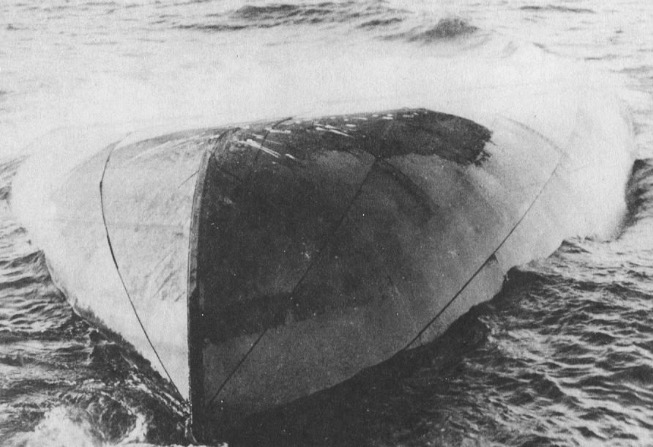 the time. I’m sure that the thought of being stranded in her home, was not a pleasant one for my grandmother, considering Aunt Laura’s very young age, but they survived the White Hurricane, as did most other people, at least those on land anyway. It still seems incredible to me that a storm of that magnitude could have brewed in an inland setting, but then anyone who knows the Great Lakes will tell you that they are so big that they might just as well be considered a sea. The November Gales have long been known as killers, especially over Lake Superior, the largest of the Great Lakes. I’m glad that modern weather forecasting equipment had at least lessened the possibility of ships and lives being lost in the Great Lakes, as well as the oceans.

