grand canyon
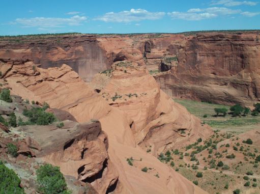
 Arizona…home of the Grand Canyon and Monument Valley, is famous for its red dirt and colorful formations, but these places aren’t the only famous places in the area. In fact, the Canyon de Chelly National Monument, which is located in Apache County, Arizona, and is in the current day Navajo Nation, is one of the most visited national monuments in the United States. The strange thing is that there are many people who have never heard of it…me included, and I have been to the Four Corners region. I guess that at the time my family went there, the Four Corners (the spot where four states meet) was more interesting to us. Or maybe it was that we were headed to the Grand Canyon. Anyway, I had not heard of the Canyon de Chelly. My older sister, Cheryl Masterson might find that amusing, and might even tell me that we have been there, but for some reason, if we have been there, I don’t recall.
The name, Canyon de Chelly is an unusual name for the United States, even in the Southwest. It sounds a bit French, but in reality, it is universal Spanish. “Chelly” is actually derived from the Navajo word tseg, which means “rock canyon” or “in a canyon.” Spanish explorers and government officials began to utilize a “Chelly,” “Chegui,” and even “Chelle” in order to try to replicate the Navajo word in the early 1800s. Eventually, the name was standardized to “de Chelly” by the middle of the 19th century. It is thought that the canyons of de Chelly contain the artifacts and homes of Native Americans as far back as 5,000 years. At first, they lived in caves and the only real evidence of their existence is the hieroglyphics etched into the red rock walls. These people were more nomadic, and so only visited the canyons while on hunting expeditions.
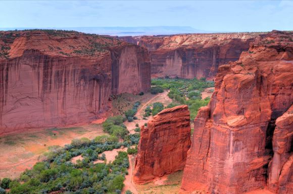
Later the people who lived there were more established, and so began the period of time when the adobe structures were formed. I think that anyone who has seen adobe home, in pictures or in person would have to admit that they are very interesting. It seems so amazing to me that these people could not only make a structure that could withstand the elements as well as these structures have, but to build them on the face of the cliffs is even more amazing. Adobe, of course, is a type of construction material made from a mixture of mud, straw, and water. It is commonly used in hot, dry climates, such as in the southwestern United States. Like any home, renovation took place over the years, strengthening and changing the structures. The structures have names such as Standing Cow (named for the hieroglyphic white bull on the wall above the home), white house (so named because of a white wall in the back of the structure), Mummy Cave (I don’t believe any mummies were found there, so I’m not sure how it got its name), and Antelope House (named for the hieroglyphic carvings of antelope above it). The homes in Canyon de Chelly were abandoned around 1300, although no one really knows why. Over the past century, archaeologists, historians, and scientists have tried to pinpoint the root causes of the massive abandonment of settlements like Hovenweep, Chaco Canyon, and Mesa Verde, but there is no single consensus among experts. It might have been due to warfare, severe drought, food shortages, infectious diseases, or the emergence of new religious and cultural centers. Whatever the 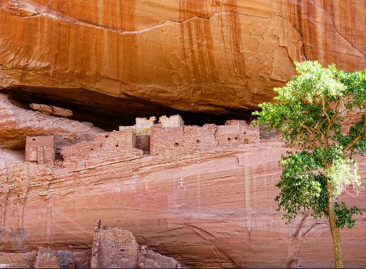
 reasons, Canyon de Chelly’s people left the area and migrated south toward the more fertile Rio Grande Valley in present-day New Mexico or toward the Little Colorado River Basin in what is present-day Arizona. That is known because of the homes built in the same fashion in the Pueblos of New Mexico, the Zuni, and the Hopi Indian areas, where the structures still have the rich traditions in artistic and architectural design.
 It seems like every year, right about Christmastime, I start feeling a longing for the trails and my summertime early morning walks. During the winter, my walking moves from the outdoor trails and particularly the Sage Trail at the end of my block to the now famous (at least for those who know me well) carpet trail that runs through a section of my house. I have a treadmill, but I seldom use it, because it doesn’t feel like a “trail” to me. The Sage Trail is really a walking path nestled between an alley and a creek bed with the Sage Creek, now contained in a blocks-long culvert to keep it mostly in check…unless we get a lot of rain, after which, the Sage Creek overflows its containment through the grates provided for such overflow events.
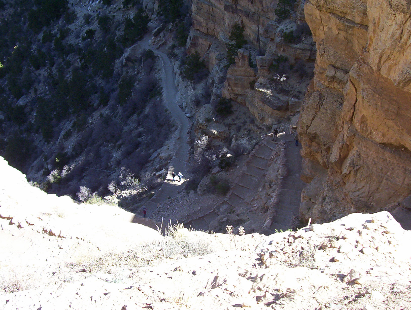
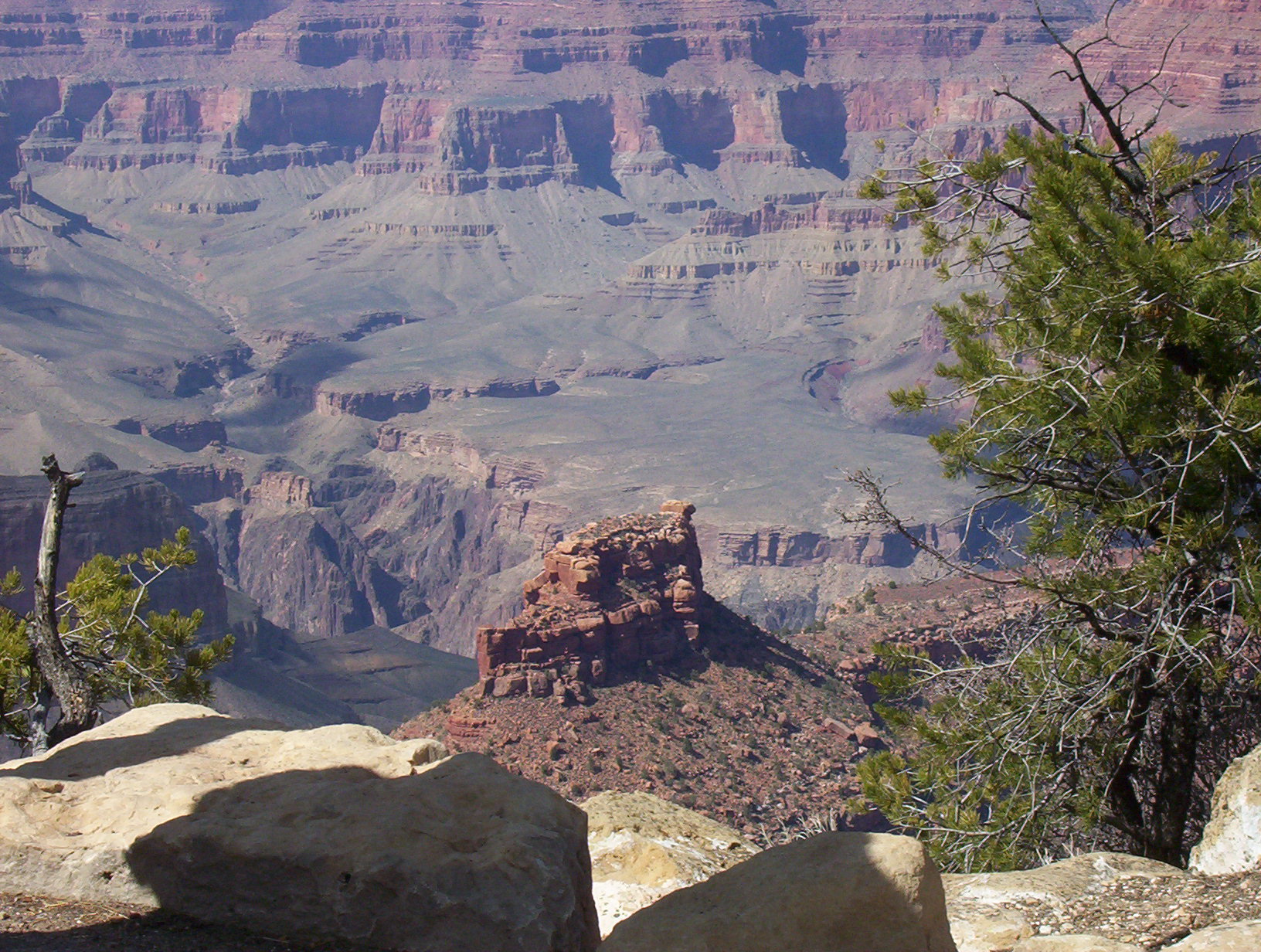
It is during this time, that my mind turns to trail pictures, trail information, and basically looking for the next 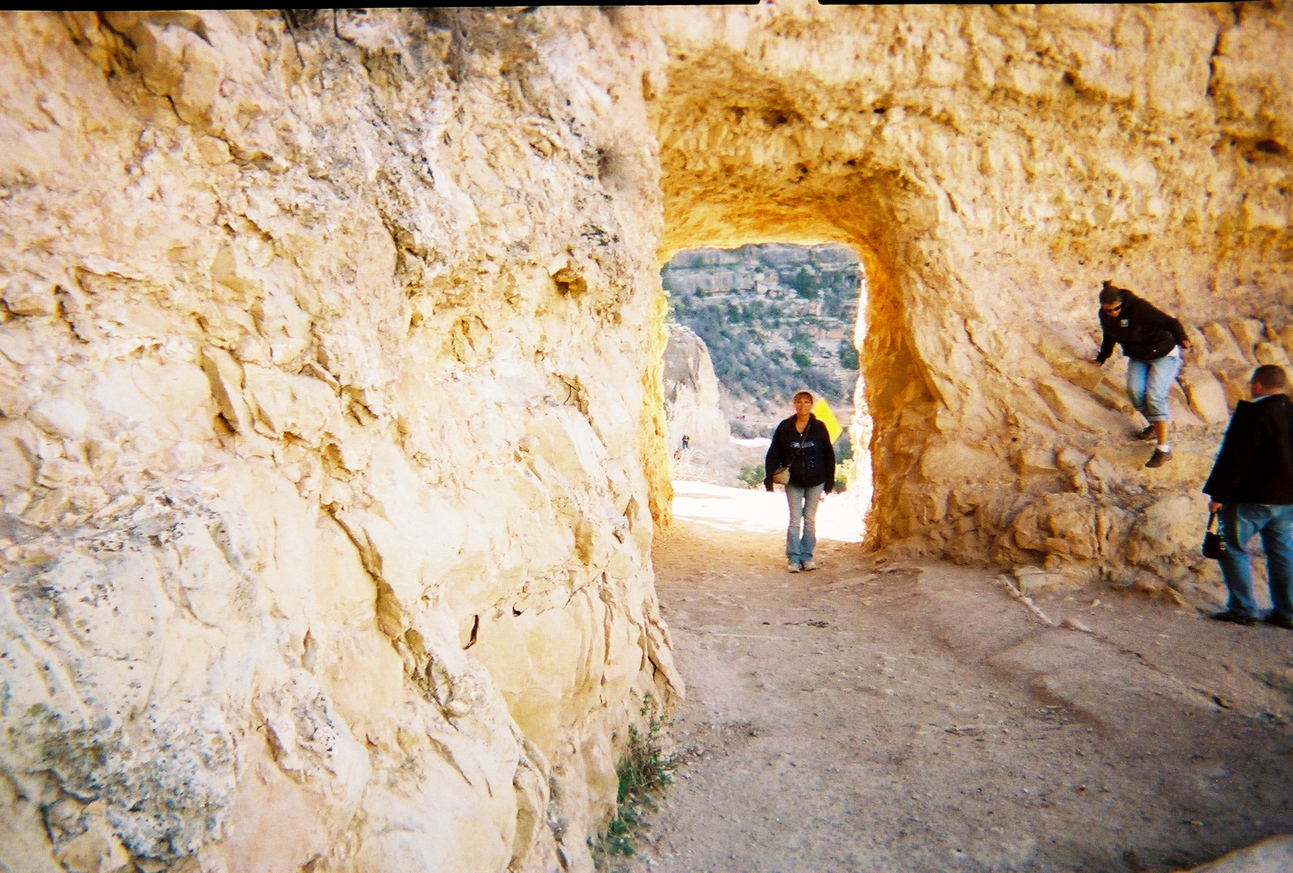 trail challenge. The trail that has come to mind this time is the Bright Angel Trail at the Grand Canyon in Arizona. Of course, we will not be hiking this trail anytime soon, but with tools like Google Earth, you can actually take a “hike” without leaving the comfort of your own home…which is the “hike” I can do at this time of year in Wyoming. My Husband Bob and I, during a visit to the Grand Canyon a few years ago, walked down into the canyon on the Bright Angel Trail for a very short distance. We weren’t really prepared for a long hike, and especially one that went down into the canyon and then, of course, back up the trail again. The signs warned people, not saying “What goes up, must come down,” but rather that “What goes down, must come up!!!” In other words, if you can’t hike out of the canyon, you had better not hike into the canyon. While we were is good shape, and probably could have hiked down and then back up, we simply didn’t have enough time to hike it. The trail is 8.1 miles…one way, and 8.1 miles back. The downhill version is said to take about 3.5 hours and the uphill version 4.8 hours. I guess that is why most people who hike the trail do it over a two-day timeframe. There is a ranch at the bottom that provides a place to sleep and meals, so it really would be a cool hike to take someday, but I don’t know if we will ever get around to it. Nevertheless, I can always dream, and the virtual views provided by Google Earth make me feel like I’m there…almost.
 Summer will be here before I know it, and while most of my hikes will be taken on the Sage Trail, and maybe the nearby Platte River Trail, I know I will feel much better about it all, because while I’m fine with walking the “Carpet Trail,” the scenery leaves something to be desired. While I love my house, it just doesn’t have the classic scenic views of hiking or walking in the great outdoors.
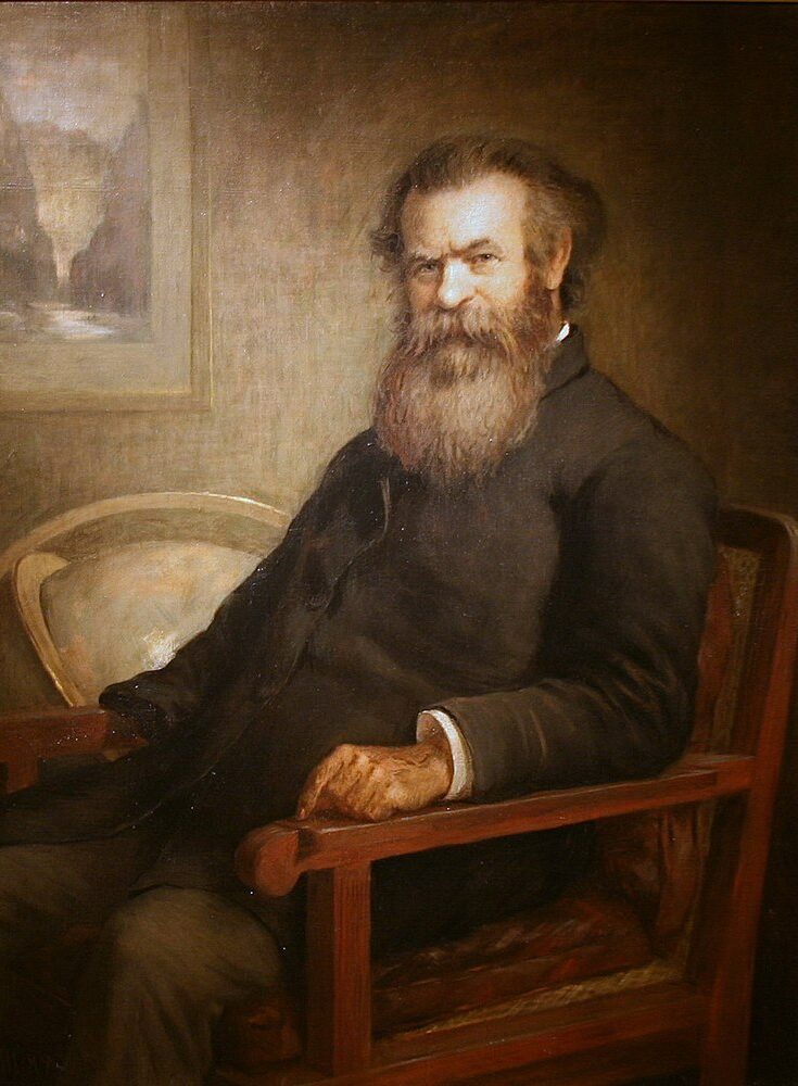 John Wesley Powell was an American geologist, US Army soldier, explorer of the American West, professor at Illinois Wesleyan University, and director of major scientific and cultural institutions. As if that accreditation wasn’t enough, Powell was most famous leading an 1869 geographic expedition. The expedition was a three-month river trip down the Green and Colorado rivers, which included the first official US government-sponsored passage through the Grand Canyon. While it was successful, the expedition was not without issue. During the trip, three men became convinced that they would have a better chance surviving the desert than the raging rapids that lay ahead of them. So, a bit of a mutiny ensued, in which the three men left Powell’s expedition through the Grand Canyon and decide to scale the cliffs to the plateau above.
As with many mutinies, the men quickly found out that they didn’t necessarily know as much as they thought. In fact, theirs was a serious mistake. Still, their fears were not totally unfounded. The men feared that the plan to float the brutal rapids was suicidal. To make matters worse, Powell was a one-armed Civil War veteran and self-trained naturalist. One arm and those rapids could prove catastrophic. Powell was, however, accompanied by 11 men, which could have helped, but they were in four wooden boats, meaning that all hands were needed. Powell was fearless, and he led the expedition through the Grand Canyon and over punishing rapids that many would hesitate to run even with modern rafts.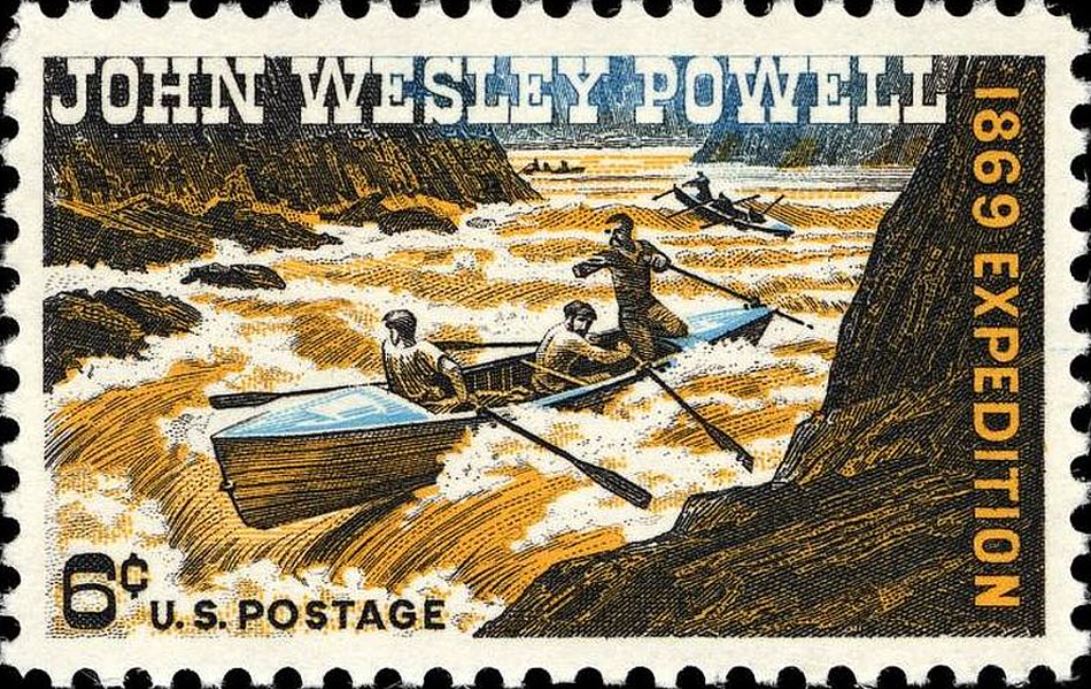
For the group, the worst was yet to come. Near the lower end of the canyon, the party heard the roar of giant rapids. They decided to explore the situation further, before they took that plunge. The party moved to shore, and then walked down river to explore the river first. The men saw was could only be referred to as “the worst rapids yet” and Powell agreed, writing that, “The billows are huge, and I fear our boats could not ride them…There is discontent in the camp tonight and I fear some of the party will take to the mountains but hope not.”
Overnight, the fears grew, and the next day, three of his men left to take their chances in the desert above, because they were sure that the rapids an impossible barrier for the boats. So, on August 28, 1869, Seneca Howland, O G Howland, and William H Dunn said goodbye to Powell and the other men and began the long climb up out of the Grand Canyon. The rest of the party mustered their courage, climbed into the boats, and 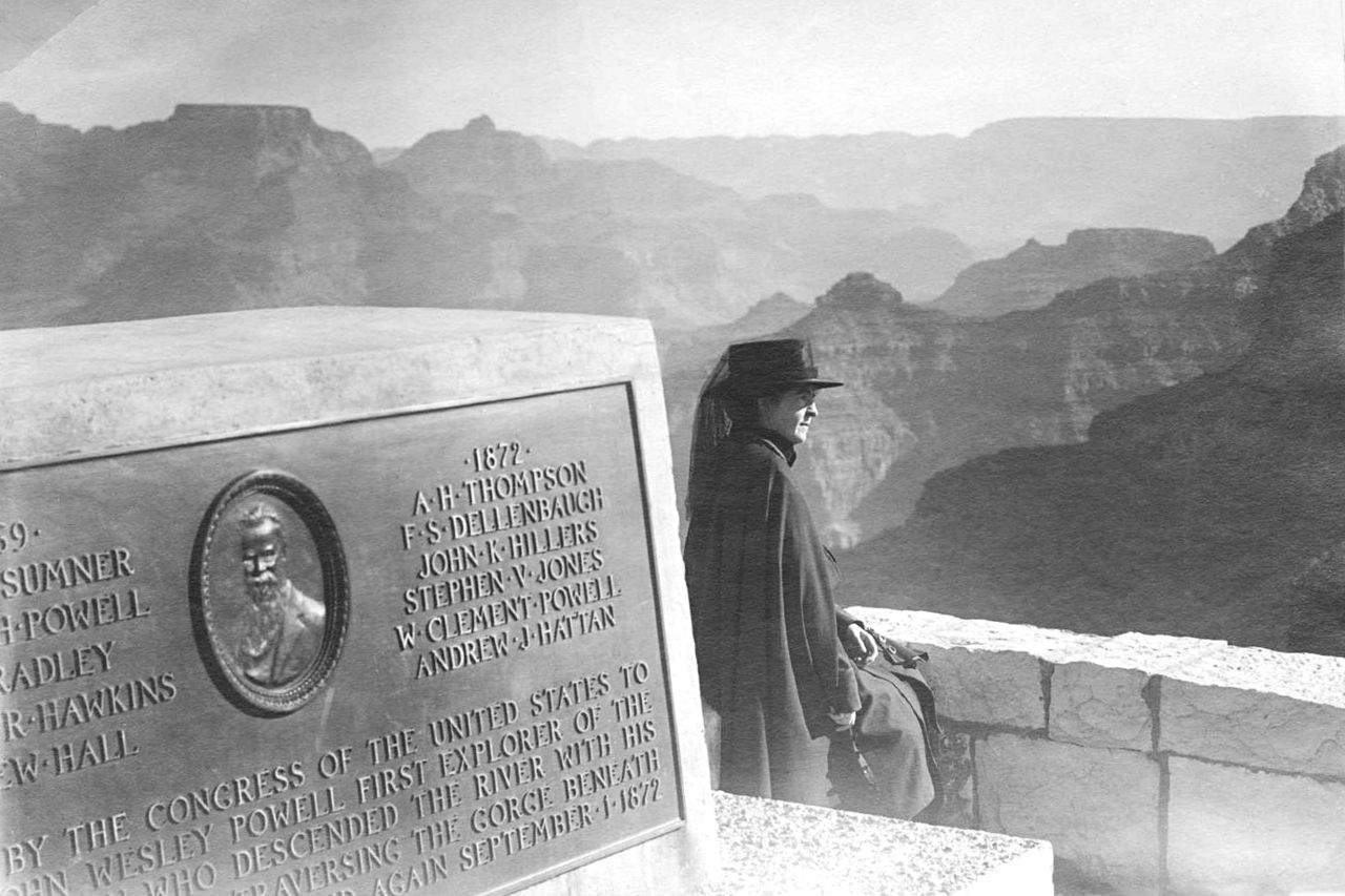 pushed off into the wild rapids.
Amazingly, all of the river crew survived, and the expedition emerged from the canyon the next day. The three men who left the group were not so fortunate. Upon reaching the nearest settlement, Powell learned that the three men who left the group, had encountered a war party of Shivwit Indians and were killed. While the killings overshadowed the excitement of the successful expedition, the next expedition through the Grand Canyon in 1871, was much better funded than had been the first. I suppose knowing that it can be done, made it easier to donate to the second trip.
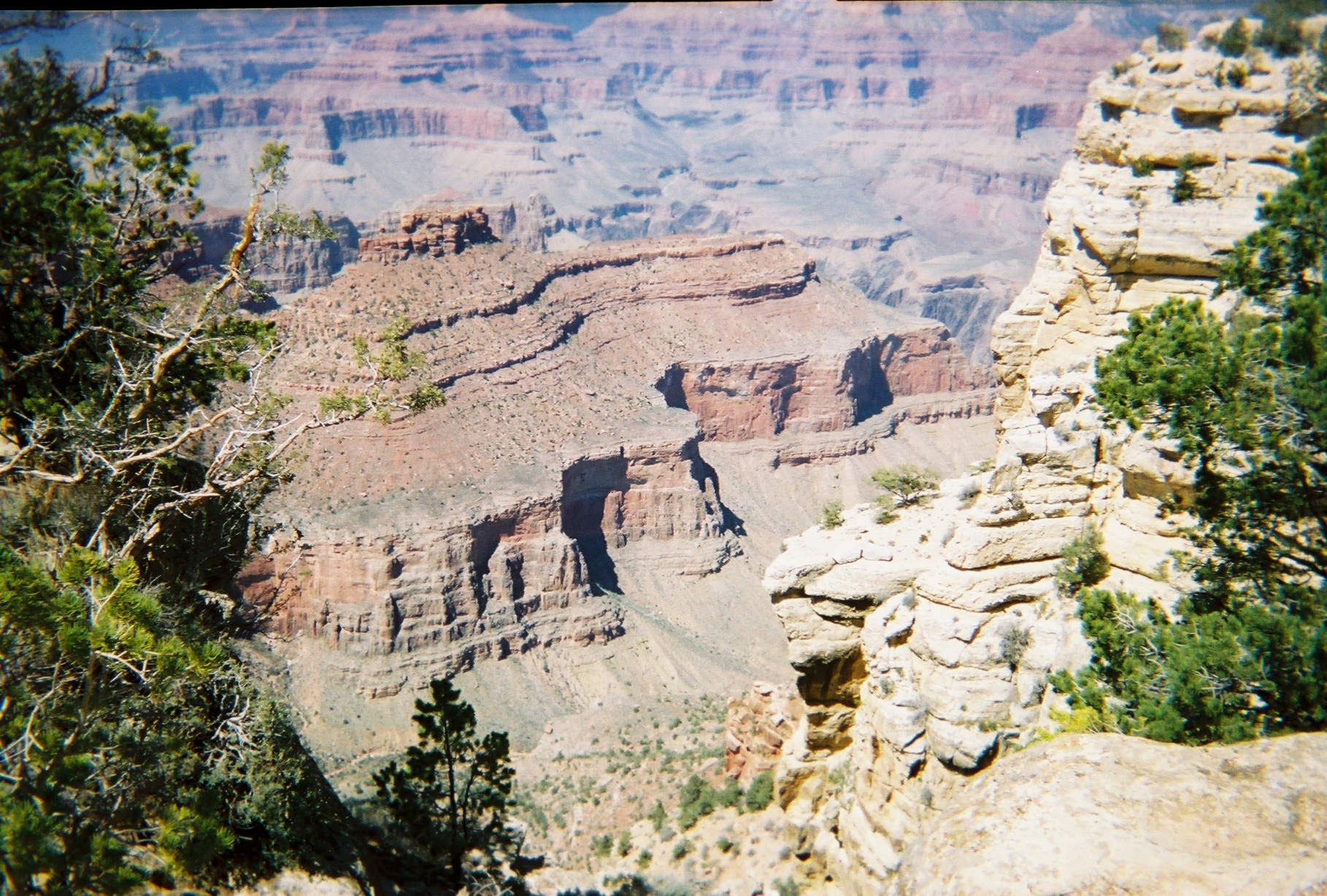
In this country, we have been blessed to have people who recognize a national treasure for what it is, and make sure that it gets preserved for people in generations to come to be able to enjoy it too. In my life, I have been blessed to visit many of these treasures, like Yellowstone National Park, Mount Rushmore, Crazy Horse Mountain, Glacier National Park, Niagara Falls, and the Grand Canyon…which was made a national monument on this day, January 11, 1908. Of course, the Grand Canyon was formed thousands of years ago, but it wasn’t until someone looked at it and saw the beauty it could share with so many people, if it was protected from land developers, mining companies, and other such developers who could only see it for its monetary value.
In my lifetime, I have had the opportunity to visit the Grand Canyon three times. Each time was significantly different from the others. The first time was as a child, and that trip stands out in my mind as the discovery trip. This was a place I had never seen before and probably hadn’t even thought about, but my parents knew of its existence, and that they wanted their girls to be able to see its glorious beauty. I don’t recall feeling wary of it edges, but that was probably because I was the kid, and not the parent who had the task of watching the kids. I just remember that its red walls were gorgeous, especially at sunset. It was a trip taken almost fifty years ago, but I can still remember how amazing it was.
The second trip I took to the Grand Canyon was in 1986, when my husband, Bob Schulenberg and I took our girls, Corrie and Amy to see it. The trip taken as a mother was one that felt a bit different. My girls weren’t so little, and eleven and ten, that they didn’t stay right with us, but nevertheless, Amy found herself just a little too close to the unfenced edge, and she slipped a little. By the grace of God, she didn’t fall in, but it is an event she still talks about to this day. I think she would go back again, because she was not really afraid, once the moment passed, but she gained a respect for edges like that. As the mom, I determined to put myself between the children and the edge from that point on. We still very much enjoyed that trip, but it was very different from either of the others.
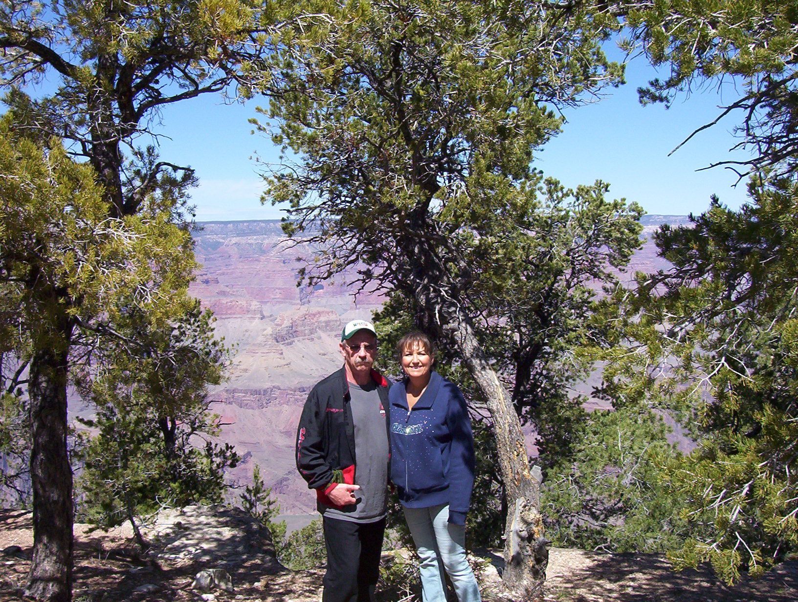
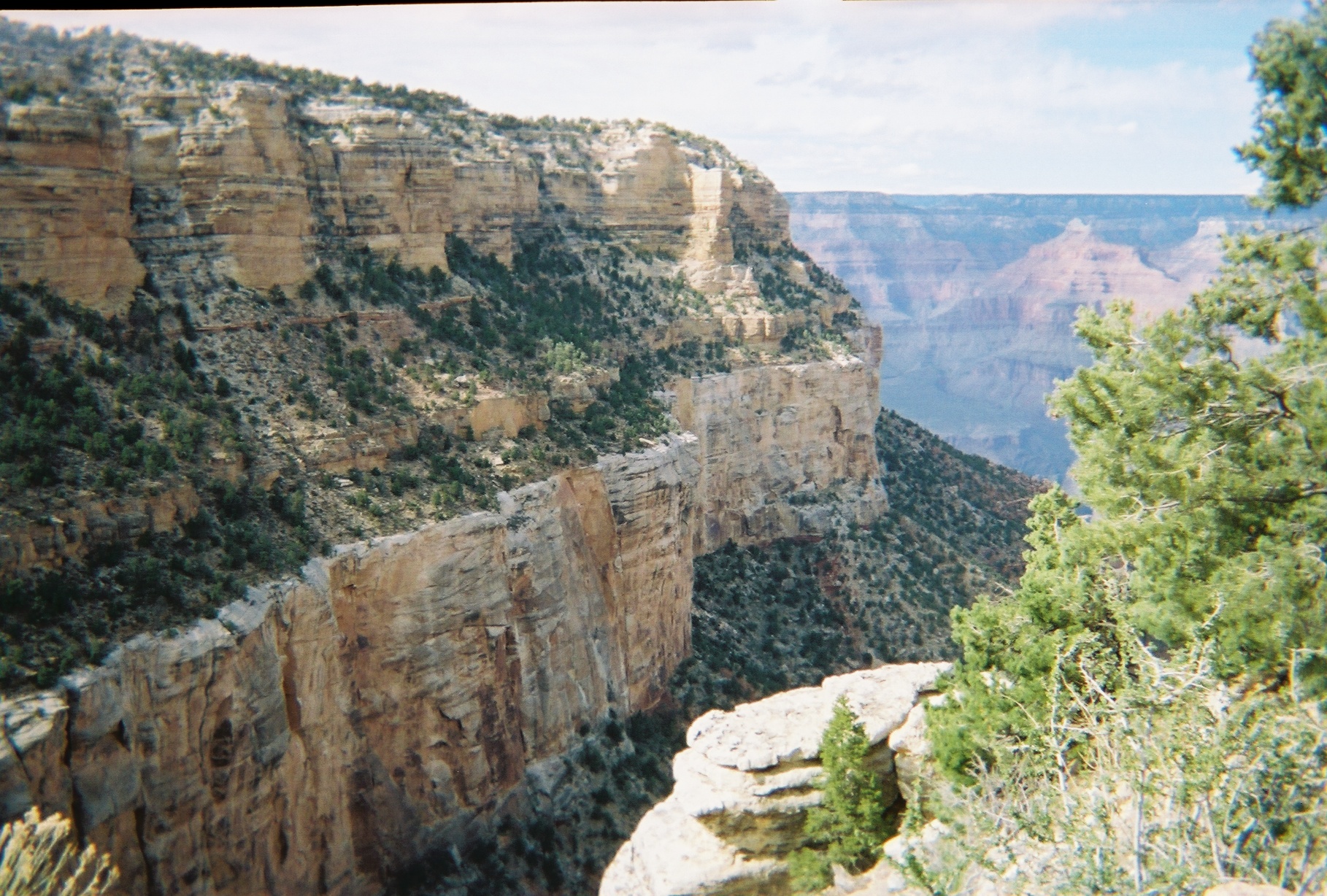
The most recent trip Bob and I took to the Grand Canyon was in April of 2009, and it was probably the most fun trip of the three. We didn’t have to worry about little ones, and we were both in good shape. We hiked the 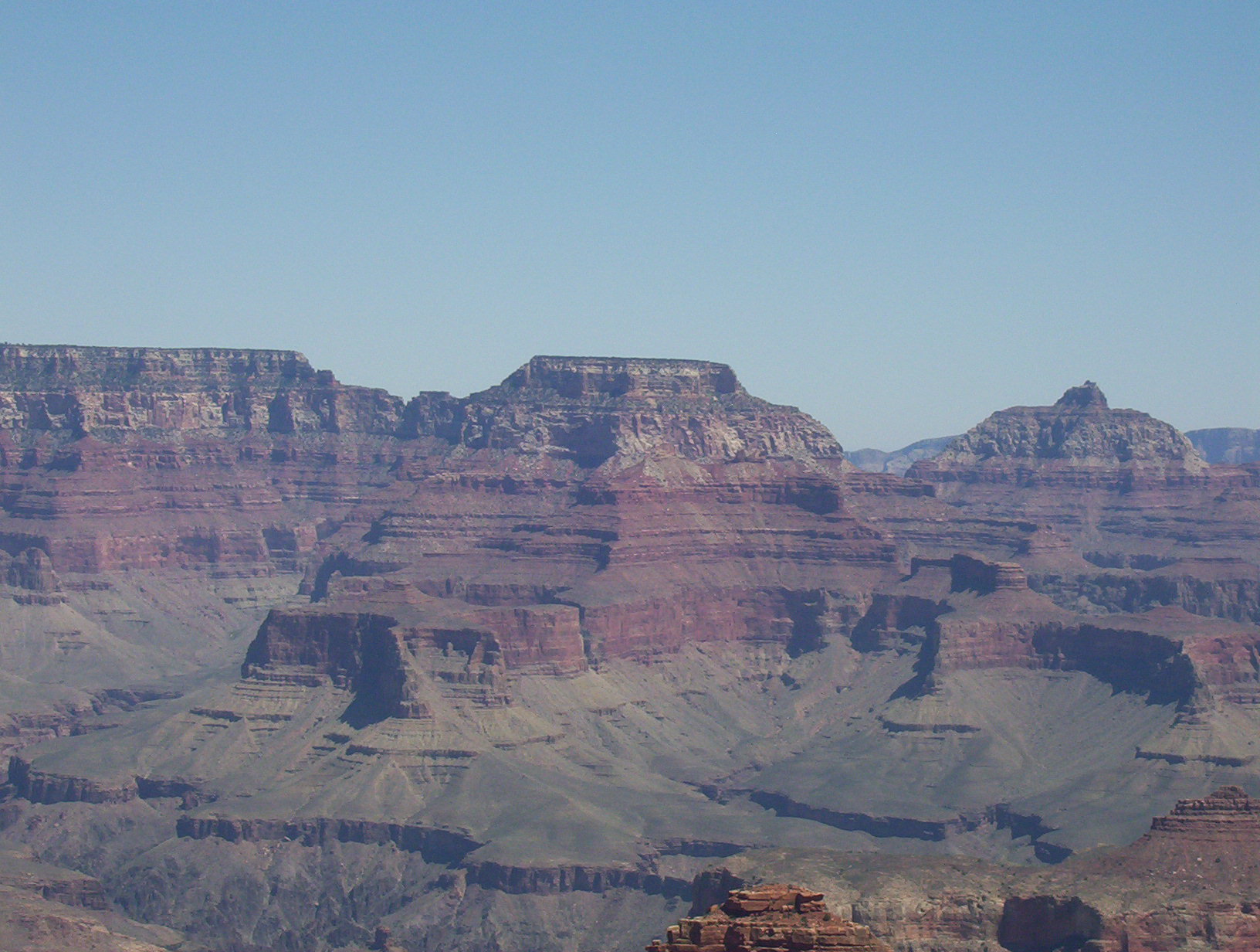
 southern edge of the canyon, and went down into it at both ends of the trail. It was an amazing trip. Looking at the canyon from the top is awesome, but there is something about being down inside it that will always live in my memory files. It wasn’t that the canyon looked so very different when you were inside, but rather that you were inside the Grand Canyon that made that event special. I loved being able to go down the trails and through the tunnel we found there, and see the magnificent beauty up close. It was an amazing trip, and I happily would go again. The Grand Canyon is unforgettable.

