gold
 The town of Guffey, Colorado got its start in 1890 with the promise of gold and big money. It quickly attracted prospectors from all over the country. The Cripple Creek mine was just 30 miles away from town, and so the town was the perfect supply hub for mining claims that were expected to spring up between Cripple Creek and Guffey. When Guffey was established, the mining camp was called Idaville, but shortly thereafter its name was changed to Freshwater.
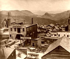
Guffey was actually legally incorporated in 1895, and it was immediately booming as a mining, lumbering, and ranching community. The Freshwater Mining District wasn’t just about gold mines. The area also produced copper, lead, and other minerals. The minerals that could be mined in the area made Guffey a center of activity. For most, gold was the big draw, mostly because they didn’t understand the value of the other minerals, like we do now, with new technologies and new uses for minerals. On August 31, 1896, the Colorado Daily Chieftain reported, “All of the arrangements have been completed, and negotiations closed for the construction of a cyanide mill on Currant Creek, of a capacity of 60-tons per day. The mill is now assured beyond any doubt, and ground will be broken for its construction within a fortnight. The capitalists behind the enterprise are Roadhaven and Vanderpool, of Saint Louis, who have visited the camp several times, investigating our mines and ores, with William Goodman of Cripple Creek, who has been largely instrumental in consummating this enterprise. They claim to be able to treat $7 ore at a profit, which it is claimed will make of Freshwater the biggest camp in the world. The townspeople have guaranteed the company 50 tons of ore per day. This step locates Freshwater beyond the boundary of a prospecting camp and places it in the list of producers.”
The town would receive another name change in the late 1890s, this time due to the fact that there was another town with the same name in California. In honor of James McClurg Guffey, an oilman and capitalist, the town was named Guffey. The town was known throughout the region for its dances, which included lots of fiddlers and other musicians. Guffy reached its peak during this period, with over 500 residents and 40 businesses…most of which were brought in with the promise of gold.
While there were many mines and prospects around Guffey, the total production recorded was disappointingly minor. The cattle ranches and lumber operations located nearby supported Guffey while mining wasn’t profitable. In reality, the town was probably more suited for ranching anyway. Soon many of the businesses began to leave. The Park County Bulletin, dated January 17, 1902, stated, “With this issue, the GUFFEY PROSPECTOR will cease publication. This is due in part to the fact that the camp has another paper and to the additional fact that the Freshwater districts have failed, so far, to develop sufficiently to support a newspaper. The PROSPECTOR has for some time been published from the BULLETIN office, and while working faithfully for the camp, it has never been a paying investment. Those in the Freshwater districts who wish to settle their accounts with the paper can do so with Captain Sylvis at the Guffey post office. To those who wish it, the BULLETIN will be continued to their address, and we will try to make it meet their requirements as always up with the news of Park County. We still have faith in the Freshwater districts and believe that, when sufficient depth has been obtained, there will be pay mines made and profitable mining is done.”
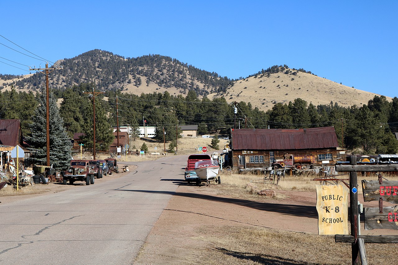
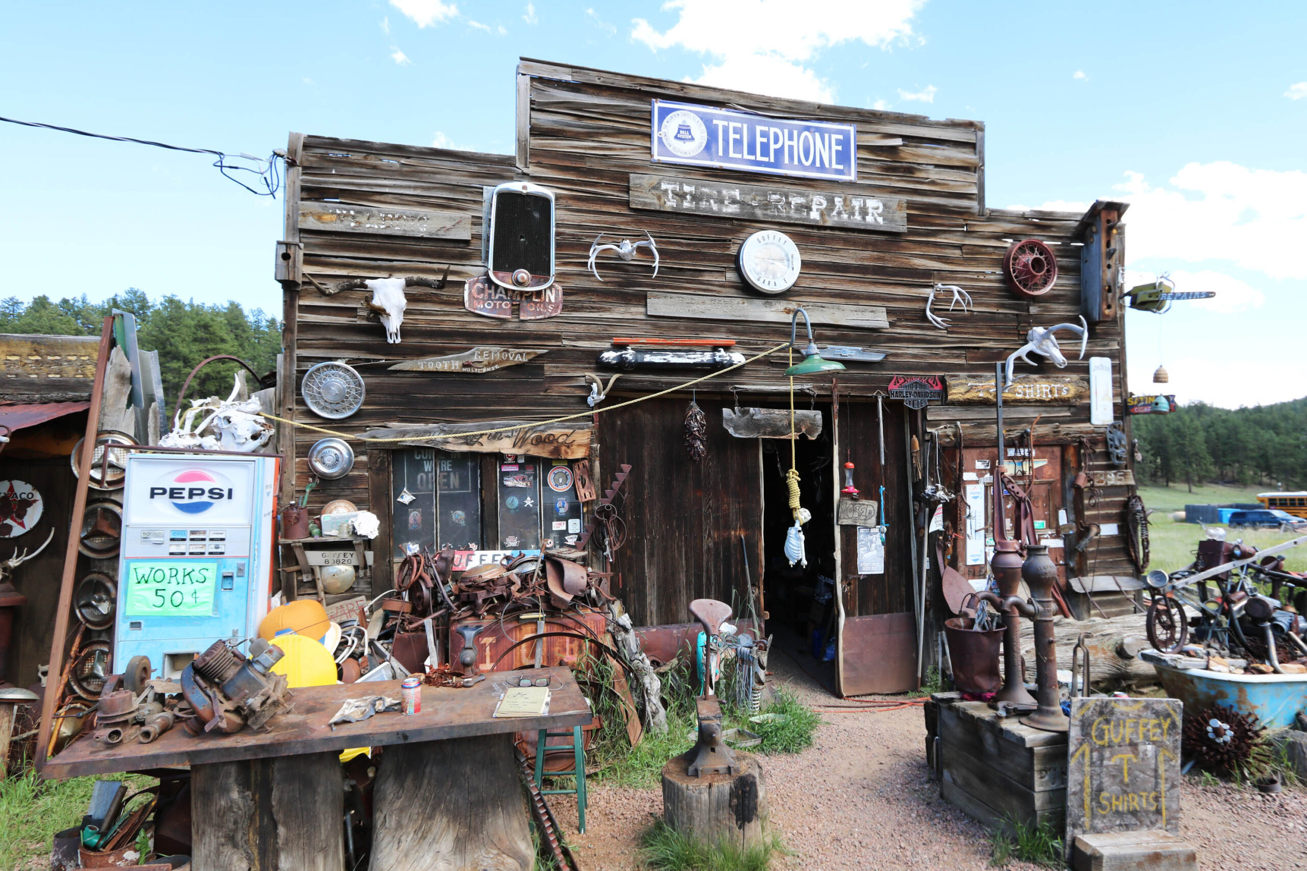
Before long, the people started to move away too. While Guffey still exists today, the community has only around 49 residents and relies heavily on tourism. There are still several of the original structures remaining and are actually occupied. The others have been kept up, though empty, so that the town can keep its historic value and possible income potential for the future. The town currently has a charter school, restaurant, small museum, and more. Guffey continues to be the center of activity for nearby ranches, some of which are Park County Historic Landmarks, including the Aspen Creek/Bener/Moore Ranch, Campbell Ranch, and Thirty-One-Mile Ranch. So, while the town’s size has dwindled, its usefulness has not. Guffey also sits in a very scenic area created by three ancient volcanoes. The Guffey volcanic center is part of the Thirty-nine Mile Volcanic area, the largest remnant of the Central Colorado volcanic field. There are two mineral springs just a mile south of Guffey, that feature spring waters bubbling up from large mounds over 20 feet high and 50 feet across.
Sadly, not all is well in Guffey. As in any town, crime can happen. In January 2001, the bodies of three members of the Dutcher family were found near Guffey. They had been murdered. Later, three teenagers were convicted of the crime. Apparently these three boys had decided to form a paramilitary organization. They were supposedly practicing for future action they planned to take in the country of Guyana. The murders were part of their “practice sessions.” The brutal nature of the crime and its bizarre motive attracted national attention, but really not the kind of attention that the town wanted to be famous for.
The town does have some real oddities that it doesn’t mind being famous for. It would be considered a “somewhat ghost town” and strangely, has a habit of electing animals as Mayor. In fact, while the two main political parties are the Democrats and the Republicans, the current Mayor, Monster the Cat was elected in 
 1998. Lydia Reynolds of Guffey’s 31 Mile Ranch and Bill Sioux of Guffey Garage left us a comment confirming Monster was still alive and well…as of November 2019 anyway. I suppose that in a small town, you could get away with an animal as mayor, but for most of us, that would definitely be odd. Nevertheless, I guess it just adds to the charm of this quaint, old town.
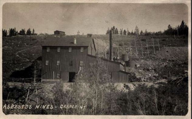
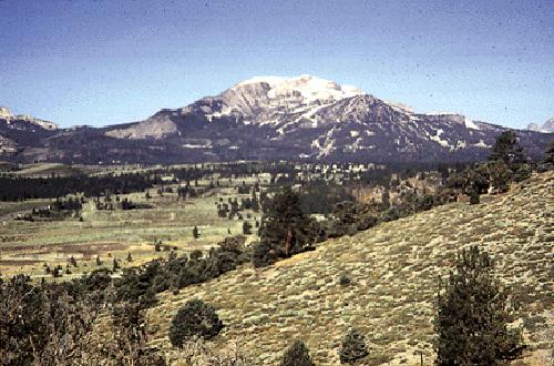
 For people who live in Casper, Wyoming, the mountain to the south has long been a great recreation area. They are campgrounds and a ski resort, not to mention the trails that dot the mountain top. While the mountain is mostly recreational today, along with a number of people who live on the mountain full-time, that wasn’t always the case. In 1890, a gold strike on Casper Mountain brought a little gold rush to the area…along with many different kinds of people, looking to strike it rich. The mountain was crawling with people from all walks of life, but while they looked until 1895, they didn’t find much gold. The materials found were mostly asbestos and other non-profitable minerals.
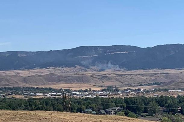
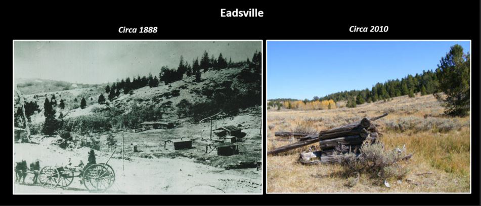
Nevertheless, there arose a need for a town and supply stores, so the town of Eadsville was formed. It was located 12 miles due south of Casper on top of Casper Mountain. It was founded by Charles W Eads in 1891 after he had staked a 600-foot x 1,500-foot mining claim around a large spring. The town was named for one Charles W Eads, who was the second person to settle in Casper, following a Mr. Merritt, who was credited with being the first to locate to Casper. Eads appeared in the Natrona County Tribune, May 13, 1908, and was apparently accused of being a horse thief. He would go on to do time in prison.
It was thought that there were large deposits of precious minerals, such as gold, silver, lead, and copper. The town continued to develop, with lots being sold in the town during 1891 – 1892. During that time, about a dozen cabins were built. While the town became a ghost town before very long, the foundations of three cabins still remain today. During the boom years, some 40 to 50 people lived there, all hoping to make their millions in gold and silver. Some traces of gold and silver were found, and copper was also mined, but asbestos and feldspar were the most economical to mined. The “spar” was still being mined after nearly 100 years. It’s no longer being mined, but it could be again, if there was a need.
After a time of trying unsuccessfully to make a living, the miners finally gave up and abandoned the town 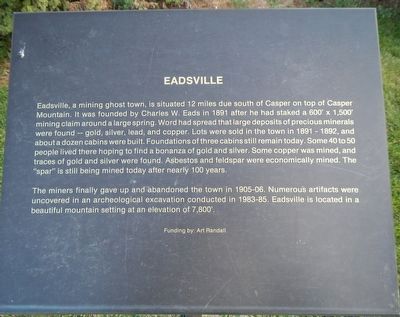
 between 1905 and 1906. The site was rediscovered in the 1980s, and numerous artifacts were uncovered during an archeological excavation that was conducted between 1983 and 1985. At one time it was surveyed as a stamp mill. Eadsville was located on Casper Mountain at an elevation of 7,800 feet and covered an area 20 acres.
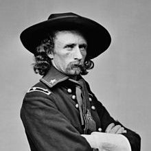
 There was so much controversy over the control of the Black Hills. The Indians were told that the White man would stay out of the Black Hills, but when gold was discovered there, all bets were off. Before his defeat at the Battle of Little Big Horn, while he was still a Lieutenant Colonel, George Custer rode with his crew to the Black Hills of South Dakota in search of a location for a fort. That Custer Expedition of 1874 became a defining moment in the story of the Black Hills coming under the control of the United States. Things really got started in 1872, when Secretary of the Interior Columbus Delano, basically set the stage for the expedition to the Black Hills. Delano was responsible for the Sioux territorial rights in the region. Delano sent a letter dated March 28, l872, which stated, “I am inclined to think that the occupation of this region of the country is not necessary to the happiness and prosperity of the Indians, and as it is supposed to be rich in minerals and lumber it is deemed important to have it freed as early as possible from Indian occupancy. I shall, therefore, not oppose any policy which looks first to a careful examination of the subject… If such an examination leads to the conclusion that country is not necessary or useful to Indians, I should then deem it advisable…to extinguish the claim of the Indians and open the territory to the occupation of the whites.”
It was the beginning of major trouble in the Black Hills, because Delano’s remarks were in direct contradiction of terms defined in the 1868 Laramie Treaty which states: “…no persons except those designated herein … shall ever be permitted to pass over, settle upon, or reside in the territory described in this article.” Delano singlehandedly broke the treaty with the Indians and blew up the situation in the Black Hills. Basically, he thought the Indians wouldn’t see the value in the Black Hills that he saw…gold. Well, the gold didn’t interest them, but the land did. Delano stated that the major reasons for exploration was that “Americans and representatives in Dakota Territory felt that there was too much land allotted for too few Sioux (estimated to number from 15 to 25,000 in 1872); and the existence of mineral and natural resources in the area.”
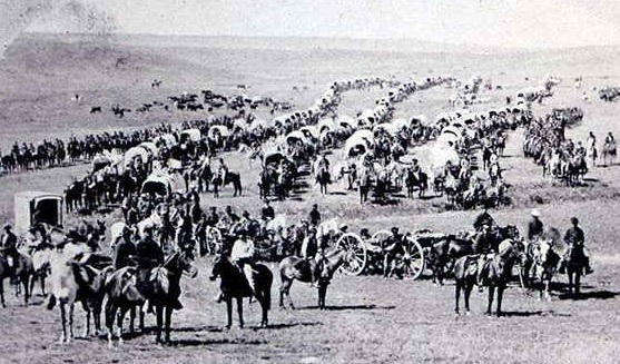
The American economy wasn’t in good shape at that time. Experts think that the Delano letter and other previous reports and rumors regarding the wealth of the Black Hills were the real forces behind the expedition of the following year. General Alfred H. Terry of the Headquarters of the Department of Dakota in Saint Paul formally ordered the exploration of the Black Hills on June 8, 1874. Enter Custer…who was told to look for a site for Fort Abraham Lincoln, Dakota Territory, which ended up being located 7 miles south of Mandan, North Dakota, not in the Black Hills at all. Of course, the fort was likely to be used to protect the settlers and prospectors who were expected to flood the Black Hills. Custer’s expedition departed on July 2, 1874. Custer’s expedition, which was a mile long, included Custer, wearing a buckskin uniform, on his favorite bay thoroughbred at the head of ten Seventh Cavalry companies, followed by two companies of infantry, scouts, and guides. In all they were more than 1000 troops and one black woman, Sarah Campbell, the expedition’s  cook. The 110 canvas-topped wagons were pulled by six mule teams. In addition, they had horse-drawn Gatling guns and cannons, and three hundred head of cattle brought along to provide meat for the troops. The expedition even had a “Scientific corps” with them, which included a geologist and his assistant, a naturalist, a botanist, a medical officer, a topographical engineer, a zoologist, and a civilian engineer. Two miners, Horatio N. Ross and William T. McKay, were attached to the scientific corps. In addition, Custer brought a photographer, newspaper correspondents, the company’s band, hunting dogs, the son of US President Ulysses S. Grant, as well as his younger brothers, Tom and Boston. All to look for a site for a fort!!!
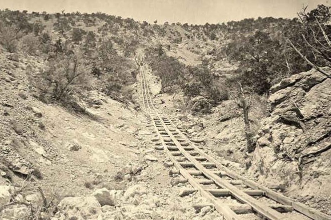 Gold mining was, without a doubt, a profitable business, but it wasn’t an easy business to be in, especially in the early days. The miners-turned-innovators had to figure out ways to speed work up in order to make a profit. Gold is a tricky metal to find and mine, as are most precious metals. One thing that was needed, especially in underground mining, was a way to get the ore out of the mine, and the tools and workers into the mine. It is a waste of time to have workers walking long distances into the mines., their tools are heavy, and carrying all that in makes for slow going…if the miners
 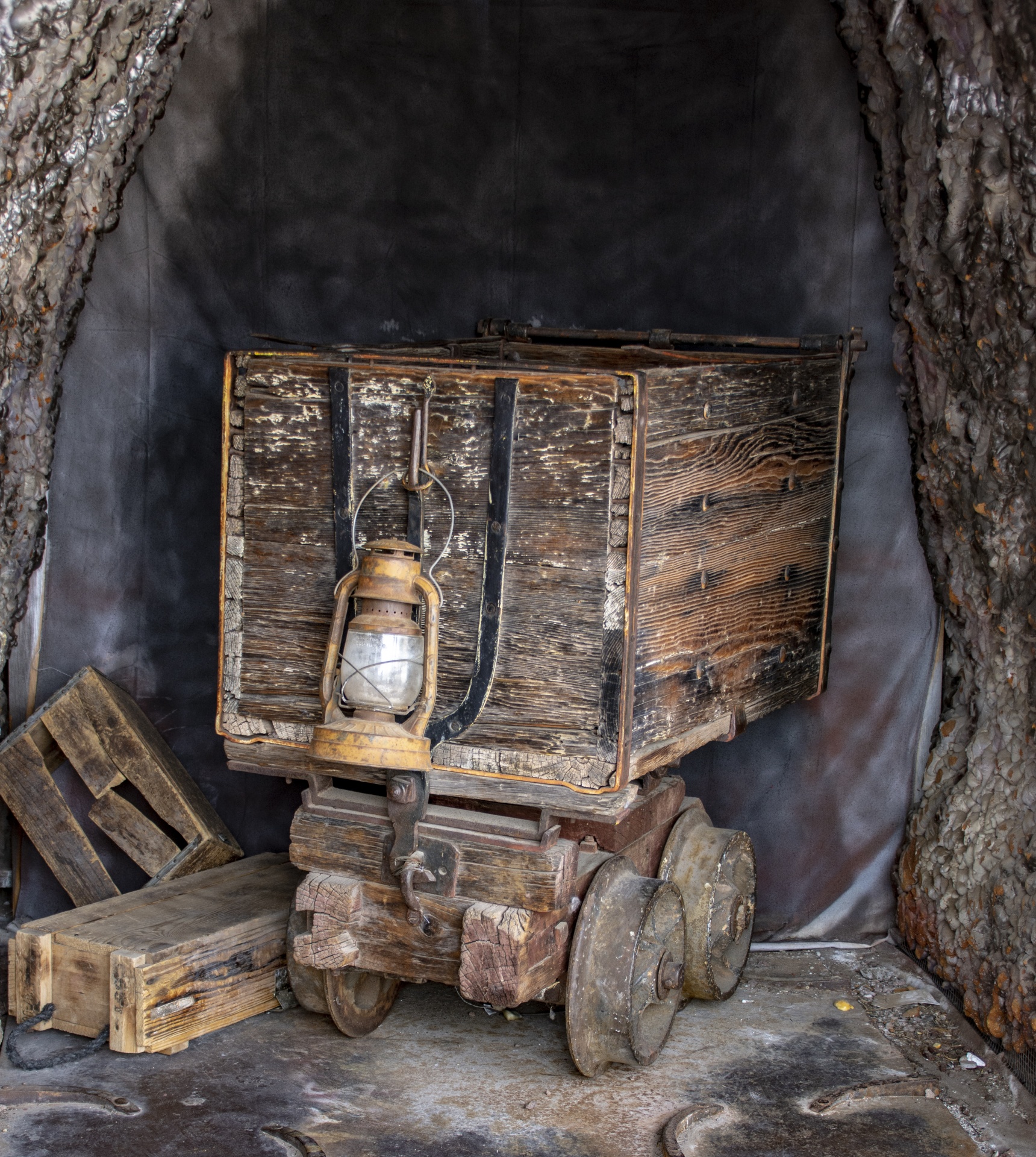 are walking anyway. A mine railway, also called mine railroad or sometimes pit railway, is a railway constructed to carry materials and workers in and out of a mine. Few people would remember, but the mix of heavy and bulky materials which had to be hauled into and out of mines gave rise to the first several generations of railways. The first rails, like this one, photographed in Illinois by Timothy O’Sullivan leading to a gold mine, was made of wooden rails. Eventually they added protective iron, steam locomotion by fixed engines and the earliest
 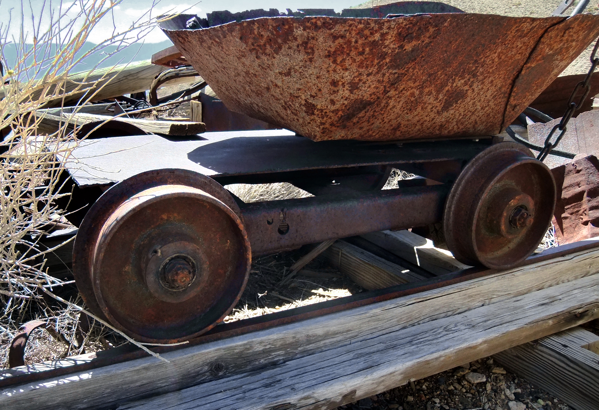 commercial steam locomotives. All these came about because of the mines.
The old wooden rails worked very well. Gold carts, or ore cars, were moved up and down the railway using a pulley. The original design of these carts was used in Colorado mines in the late 1800s. The system even had a 360° operating turntable, which allowed the car to dump in any direction. The wheels were exclusive, with a curved five spoke cast iron design. Running the ore carts along the railway wasn’t easy either. There may have been a steam engine to work the pulley later on, but at first, it was all human muscle, and it wasn’t easy.
 One of the criminal acts of Hitler and the Third Reich was to confiscate the riches of the countries they were occupying. It was not the worst of the atrocities, but it was up there. By confiscating the food and money of these countries, the Nazis left the people in those countries broke and starving. Even as the Third Reich began to know they were losing the war, there was hope that they would go into hiding, re-group, and rise again. If that was going to happen, they were going to need money, and the only way to insure that was to begin mass confiscation and hiding of the riches of these nations.
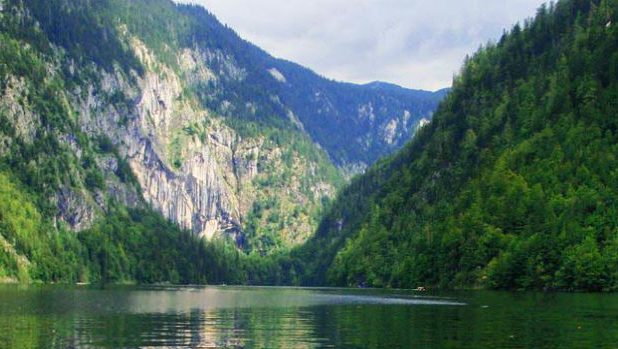
Lake Toplitz was located in a very remote area of Austria, southeast of Salzburg. In modern day Austria, the area is appropriately called The Dead Mountains. Basically, if you’re looking for somewhere to get away from it all, Lake Toplitz is a good choice. During the war, the lake’s remoteness made it the perfect place for the Nazis to test weapons…including torpedoes. It was also one of the places the Nazi elite fled to when it came time to make their last stand. That fact, in and of itself, makes it a logical place to hide funds for a future comeback of the Third Reich.
In 1945, Hitler’s Germany had only a few more weeks before their horrific reign ended, found themselves stuck in the middle, being crushed by the Russian tanks coming in from the east, and the Americans and British from the north. As their fronts collapsed, the Nazis made several efforts to hide their stolen wealth and treasure. The practice of hiding the wealth is well known, because a lot of that hidden wealth has already been discovered in mines, underground bunkers, and hastily buried fortifications.
Everyone seemed to be looking for the buried treasure left by the Nazis. At one time, a pair of treasure hunters announced they found the location of a buried German armored train in the hills of Poland. Their claim seemed 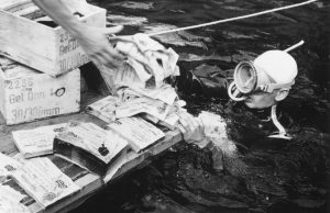 possible, so a search was held. In the end, it was determined that the “train” was nothing more than an ice covered rock formation. Still, the possibility of a treasure train is very real. Unfortunately, the big news about the “train” caused such a stir that another find was all but lost to the world.
There had been stories about plunder the Nazis may have hidden in the cold, deep waters of Lake Toplitz, as the Allies closed in. Reports came out that the lake held iron boxes full of counterfeit British currency and the printing plates to make more…a part of Hitler’s Operation Bernhard, which was a plan to wreck the British economy by flooding the world with fake bank notes. That report turned out to be true, when dive crews recovered several chests stuffed with counterfeit cash in 1959. The divers reported there were more chests stuck in the mud, but they were too deep to recover. More stories about Nazi plunder at the bottom of Lake Toplitz surfaced. The nephew of one German officer made the claim that the Nazis sank chests loaded with gold into the lake. Plates from the lost fabled Russian Imperial Amber Room, which had also been rumored to be on the Nazi gold train in Poland, are also thought by others to be on the bottom of the icy lake. Along with treasure there are stories of weapons components, ammunition, rocket fuel, and maps showing the locations of even more stolen Nazi loot.
There have been many attempts to salvage treasure from the bottom of the lake over the years, with most of them ending in death. The lake is deep and cold, and has many tangled trees and branches that can trap a person. In 1983 the Austrian government declared the lake had been completely searched and anything of value removed. That turned out to be a fake story designed to discourage treasure hunters. Biologists studying the lake have turned up more boxes of counterfeit currency, rocket parts, weapons, mines and even a torpedo 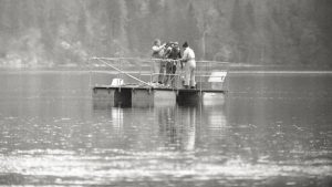 since the government report. Later, photographs from a submerged bunker surfaced, showing boxes with Cyrillic lettering. These are what led to the speculation that the boxes might contain panels from the Amber Room. The exact location of the bunker has been hidden from the public.
I expect that people will continue to try to find the treasures, even though claims will most likely be laid upon them immediately after they are located. The people who find them will probably only get the recognition for the find, rather than the right to keep the treasure. Maybe with an attorney who is good enough, they will walk away with a finders fee.
 Most kids have, at one point or another, imagined that they were hunting for lost treasure. Some people, however, continue to be treasure hunters well into adulthood. Such was the case with two Michigan-based treasure hunters in 2011. The men were hunting for gold in Lake Michigan. Of course, that doesn’t mean they were looking for gold nuggets, like the gold rush days of old. They were looking for gold in the many shipwrecks of the Great Lakes.
On this particular treasure hunting expedition, Kevin Dykstra and Frederick Monroe were searching for $2 million in gold that had, according to local legend, fallen from a ferry crossing Lake Michigan in the 1800s. While moving their sonar over the lake, it caught a mass below. Dykstra dove into the water to video the mass. “I didn’t go down there with the expectation of seeing a shipwreck–I can tell you that,” Dykstra told Live Science. Nevertheless, there beneath the cold waves of Lake Michigan was an aging shipwreck. Brown and gray zebra mussels, encrusted the wooden planks of the old ship. When Dykstra and Monroe reviewed the video, they realized that the ship might be the remnants of a 17th-century ship called the Griffin, or Le Griffon. French explorer René-Robert Cavelier, Sieur de La Salle built the ship in 1679. It was lost in Lake Michigan the same year.
Some experts were not convinced that the men had indeed found the Griffin. The experts thought it might be the remnants of a tugboat that was scrapped after “steam engines became more economical to operate,” said Brendon Baillod, a Great Lakes historian, who has written scholarly papers on the Griffin. More evidence was needed to prove that this ship was the Griffin. State archaeologists reviewed the footage, and “They’ve been very diligent to say, ‘This is really interesting; these are some neat pictures,'” Dykstra said. “Can we call this the Griffin? Certainly not–not without a lot more information–but these are very compelling.”
La Salle apparently sailed the Griffin through the Great Lakes and crossed into Lake Michigan in an effort to reach the mouth of the Mississippi River, according to Baillod. Running out of money, he disembarked with the other expedition leaders, leaving the ship and its crew to pay off his debts with furs. “La Salle never saw the Griffin again. La Salle returned to the area in 1682, to try again to locate the Mississippi’s mouth. But members of the Potawatomi tribe brought pieces of the ship to the explorer, including some moldy beaver furs and a pair of sailor’s britches,” said Baillod, who translated La Salle’s journal from French to English.
The Native Americans told La Salle that the crew planned to sail toward the Straits of Mackinac in stormy weather. “The [American] Indians told the captain not to sail out, to wait the storm out, but he wouldn’t listen to them,” Baillod said. Of course, because of his haste to set sail, the captain lost control of the ship in the strong winds. The ship was blown away from shore, southward, toward some islands in the distance. “They lost the ship from sight,” Baillod said, “and that’s the last anybody has ever seen the Griffin.”
About 30 various adventurers have claimed to have found the Griffin, but have never really been able to prove their claim. “They’re looking for something else, they find an old ship and they’ve heard of the Griffin, so they pronounce it the Griffin,” Baillod said. According to Baillod, none of these adventurers were looking near the Beaver Island area, which was most likely the area the ship went down. But the latest finding, made popular again by Wreck Diving Magazine in its latest issue, holds a number of clues about the ship’s past. “There was no rudder on the boat,” Dykstra said. “That was kind of telling to us that the ship probably weathered a storm; otherwise, there would probably be a rudder on it.” They also found a part of the ship that they said could be a mussel-covered griffin, the mythical beast carved onto the ship’s bow.
Dykstra was so intrigued that he went back to have another look. He took a magnet with him to help determine the metal composition of the ship. Purely by accident, a nail attached itself to the magnet. The treasure hunters discovered it later, once they were above water. “When we had it looked at, they [the archaeologists] could tell that the nail was very old,” Dykstra said. “It was a hand-forged nail, which helps date it back to that time period, we feel.” Of course, this accident could have landed the men in hot water with the state of Michigan, which has rules stipulating that artifacts found on state land, including the land at the bottom of the Great Lakes, are state property. “The two men did not bring up the nail on purpose, and they plan to return it to the state,” said Dean Anderson, the state archaeologist for Michigan.
About 1,500 shipwrecks have been found on the bottom of Lake Michigan, Anderson said, and it’s unclear whether this one is the Griffin. “It’s very difficult to access a wreck based on photo and film footage,” Anderson said. If the state underwater archaeologist were to look at the wreck, he would look for artifacts that could be 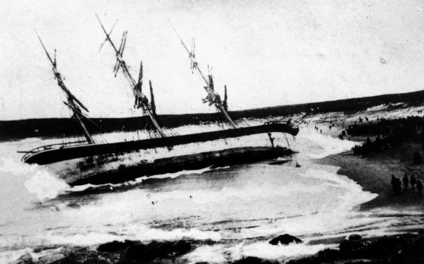 dated, such as ceramics or glass. Baillod is “99 percent sure” that the wreck is not Le Griffon. The figurehead likely isn’t the remains of a griffin, but a “big encrustation of zebra mussels,” on burned wood. He noted that the wreck is near the western Michigan coast, not near Beaver Island, the area mentioned in La Salle’s journal. Nevertheless, Dykstra and Monroe said they’ll wait until they hear the final word. They’re not going back to the wreckage for a while, so they don’t make the site vulnerable to other treasure seekers. In the meantime, the duo plans to continue their hunt for the gold bullion. “It’s a mystery ship that got in our way,” Dykstra said, “and now, we’re going for the gold.”
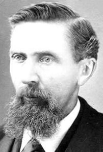 When Conrad Kohrs, immigrated to the United States at the age of 15, he was seeking his fortune like so many other immigrants were. The year was 1850, and while it is odd these days to think of a 15 year old boy immigrating to America alone now, it wasn’t entirely unheard of then. Kohrs was a native of Denmark, and had planned to head west to make his fortune in gold or silver. Unfortunately, while he had some small success in California and British Columbia, try as he might, the “big strike” always eluded Kohrs.
Kohrs tended to follow the crowd, and in 1862, he joined the latest western gold rush and headed for western Montana, where rich gold deposits had been found at Grasshopper Creek. It might be true that gold was plentiful at Grasshopper Creek, but Kohrs realized that he could make more money mining the miners than mining for gold. Miners need lots of supplies, and the man who was able to supply the needs, was the one who made money. He established a butcher shop in the mining town of Bannack and began to prosper.
His work as a butcher led Kohrs into the cattle business. Cattle were a big commodity, being in relatively short supply in frontier Montana. Much has changed today, and Kohrs had a big part in that. Kohrs traveled around the territory to purchase prime animals. He had several brushes with the highwaymen who plagued the isolated roads of Montana. Determined to stop these murderous bandits, Kohrs joined a group of Virginia City vigilantes, and helped track down and hang the outlaws. By 1864, robberies in the territory had plummeted. Proper or not, vigilante justice, got the point across very well.
Whether he was good at being part of a vigilante group or not, it couldn’t be what made his living. Kohrs began shifting the focus of his meat processing business to the supply side. In 1864, he established a large ranch near the town of Deer Lodge, where he fattened his cattle for market. Kohrs was pretty much the only major rancher in the western region of the territory. This caused his business to boom as Montana grew. As always happens, eventually, competition from cattle driven overland into the territory from Texas began to challenge Kohrs’ monopoly. Nevertheless, he continued to prosper, and remained the largest cattle rancher in Montana for several decades. 
Kohrs entered the political arena in 1885, translating his economic strength into political power. He was elected to the Montana Territorial Legislature. Kohrs and his fellow ranchers had considerable influence over Montana in the years to come, and Kohrs went on to become a state senator in 1902. The big ranchers never had a free hand in Montana, however, because mining interests and farmers always kept the ranchers in check, but it wasn’t for a lack of trying. Kohrs was widely celebrated as one of the greatest pioneers in Montana history. He died on July 23, 1920 at the age of 85 in Helena.
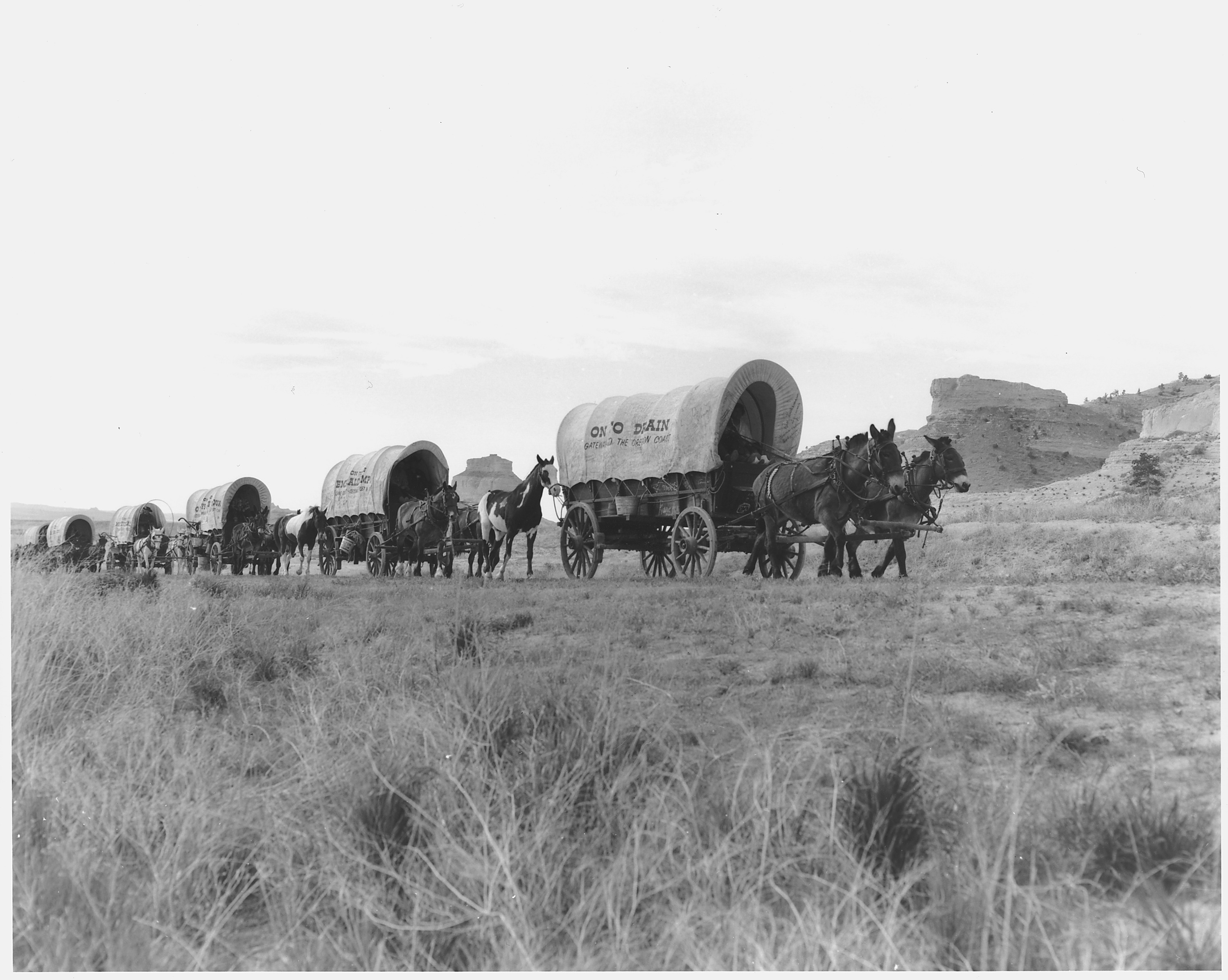 Lots of people would love to find a gold mine, stake a claim, and get rich. And if that didn’t work, they would love to stumble on a hidden or long lost treasure. Of course, for most of us that will never happen but that does not mean that those things don’t exist. In 1845, a group of pioneers were traveling by wagon train from Iowa to Oregon. They got as far as the Malheur River about a mile below the present-day Vale, Colorado. They had already traveled about 1,500 miles. They were tired and more than ready to reach their destination, they camped at a spring to rest for the night. The trip had been hard, and they had lost several oxen that had apparently died from poison. When one of the members of the party examined a carcass, his hand was infected and he too died. Tempers flaring within the group of travelers. It was time to bring their journey to a close. They were tough, but this was possibly more than they had bargained for.
Part way through their journey, the wagon train was joined by a man named Stephen Meek. He joined the party somewhere in present-day Montana or Idaho, claimed that he had been to Oregon and knew a shortcut. Along the trail, many of the men had begun to distrust Meek and when the party set out westward from the springs, they split into two groups. One group followed the known route, and the other group went on to Meek’s promised shortcut. The Meek party swung to the south toward the Steen Mountain country. As it turned  out, Meek didn’t really know where he was going and soon the group became angry at him, so he fled the wagon train in fear of his life, after only one week. The fighting among the members of the group caused them to split once again at the headwaters of Willow Creek. Part of the group headed towards Huntington and down the Columbia River, while the rest of the party continued to travel along the Malheur River.
Along the way, the party met with trouble again as one member was stricken with fever and died, and just a few miles later, several of the oxen were lost. Their journey seemed to be destined to fail. On August 25, 1845, three of the young men soon went out in search of the stock, walking all day and well into the late afternoon before coming to a small stream. After quenching their thirst, they picked up 15 to 20 pebbles in the creek that displayed an unusual color. Finally finding their oxen, they then returned to the train. They showed their stones to the older men in the train, and the “more seasoned” travelers said they were “copper.” When someone asked, “Was there much of it?”, one of the boys replied, “We could have filled one of these blue buckets.” One of the train’s members, Mrs Fisher, kept a single nugget and the train continued its journey, leaving behind the other stones.
Stephen Meek made it to The Dalles and returned to the train with a party of rescuers in order to save them. 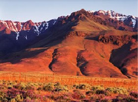 The wagon train finally reached its destination at The Dalles in October 1845. The people began the work of settling into their new home, and forgot about the stones until three years later when gold was discovered in California. Then someone mentioned the 15 to 20 “copper” stones found near the spring on their journey west. They re-examined the stone kept by Mrs Fisher, and soon discovered that it was actually gold. Thus began the search for the mythical or long lost Blue Bucket Mine. Though the location of the gold continues to remain a mystery to this day, it is believed to be at a tributary of the John Day River. I’m sure the people of the wagon train were sorry that they didn’t take the initial find more seriously. I have no idea how big the stones were, but I’m sure they left a sizable amount of money on the prairie that day.
 During the gold rush years, in 1857, to be exact, two German men who had been traveling with a wagon train headed to California, decided to leave the rest of the group and headed out on their own. They wound up in the Mono Lake region of northern California. One of the men would later describe the area as “the burnt country.” While crossing the Sierra Nevada near the headwaters of the Owens River, they sat down to rest near a stream. Looking around, they noticed a curious looking rock ledge of red lava filled with what appeared to be pure lumps of gold “cemented” together. That was how their “mine” got its name.
The ledge of that hillside was literally loaded with the ore. The excited men couldn’t believe their eyes. One of the men was laughing at the other as he pounded away about ten pounds of the ore to take with him…because he did not believe it was really gold. The man who believe that it was gold drew a map to the location and the two men continued their journey. Along the way, the disbeliever died and since he was laden with so much ore, the believer tossed the majority of the samples. Then, after crossing the mountains, he followed the San Joaquin River to the mining camp of Millerton, California. After a long, weary journey, the German had become ill and soon went to San Francisco for treatment. He was diagnosed and cared for by a Doctor Randall who told the man he was terminally ill with consumption (tuberculosis). With no money to pay the doctor and too ill to return to the treasure, he paid his caretaker with the ore, the map he had drawn, and provided him with a detailed description.
Doctor Randall shared this knowledge with a few of his friends and together they decided to go for the gold. They arrived at old Monoville in the spring of 1861. After enlisting additional men to help, Randall’s group began to prospect on a quarter-section of land called Pumice Flat. Their claim is thought to have been some eight miles north of Mammoth Canyon…the 120 acres were near what became known as Whiteman’s Camp. Word of possibly a huge cache of gold spread quickly and before long miners flooded the area hunting for the gold laden red “cement.” One story tells that two of Doctor Randall’s party had in fact found the “Cement Mine,” taking several thousand dollars from the ledge. Unfortunately, for those two men, the area was filled with the Owens Valley Indian War which began in 1861. The Paiute Indians, who had heretofore been generally peaceful, were angered at the large numbers of prospectors who had invaded their lands. The two miners who  had allegedly found the lost ledge were killed by the Indians before they were able to tell of its location.
Though the “cement” outcropping was never found again, the many prospectors who flooded the eastern Sierra region did find gold. Apparently there was a huge cache there after all. This resulted in the mining camps of Dogtown, Mammoth City, Lundy Canyon, Bodie, and many others. The lost lode is said to lie somewhere in the dense woods near the Sierra Mountain headwaters of the San Joaquin River’s middle fork. If it really exists, it must be very well hidden.
 Gold brought miners from the east to multiple areas of the American west…all looking to make their fortune in the gold fields. Unfortunately, it wasn’t just gold and silver miners who flooded Nevada, or any other gold rush area, in the late 1800s in search of their fortunes. The West was indeed wild, and it and the gold also attracted plenty of outlaws and bandits, looking to make their fortune too, but not willing to do the work to mine the gold. Nevada, like other states of the Wild West, attracted its share of outlaws and bandits. One such man, named Andrew Jackson “Jack” Davis, led a gang of thieves involved in robbing stage stops, bullion wagons, and trains in Western Nevada.
Davis first arrived in the area in 1859. His plan was to lead two different lives, 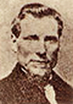 and he carried it out quite well. To the outside world he looked like a legitimate business man when he set up a livery stable in Gold Hill. However, in his “spare” time, Davis and his gang took to the bandit road, taking gold and bullion from any source they could find. Davis built a small bullion mill in Six Mile Canyon east of Virginia City, Nevada. There, he melted down his stolen gold, selling it as legitimate gold bars. He then buried his proceeds so people would not notice or catch on to how wealthy he really was, because after all, how rich could a livery stable owner be.
On November 4, 1870 the gang robbed the express car of the Central Pacific Railroad near Verdi, Nevada taking some $40,000 in gold coins and bullion. Pursued by lawmen, they were said to have buried the stolen cache along the north bank of the Truckee River, between Reno and Laughton’s Hot Springs west of town, near the site of the long-abandoned River Inn. The entire gang was apprehended and all were sent to the Nevada State Prison, but would not tell where they had hidden their stolen loot. In 1875, Davis was paroled but two 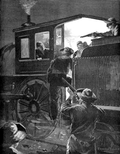 years later, he was shot in the back during a Wells Fargo stagecoach robbery near Warm Springs, Nevada. If Davis ever returned for his cache is unknown, but many believe it is still hidden in Six-Mile Canyon or in the vicinity of the Truckee River. Treasure hunters have long searched these two locations without success. If the money is still there, it may never be found.
Another legend abounds that the ghost of Jack Davis protects his treasure in the canyon. Many who have looked for the treasure have been frightened away by the white screaming phantom that is said to sometimes sprout wings and rise into the air. I suppose some would say I shouldn’t be so skeptical, but since I don’t believe in ghosts, my guess is that people just get freaked out, and their imagination runs away with them. Nevertheless, those who think they have seen what they believe to be a ghost, would not be persuaded by my disbelief in same.

