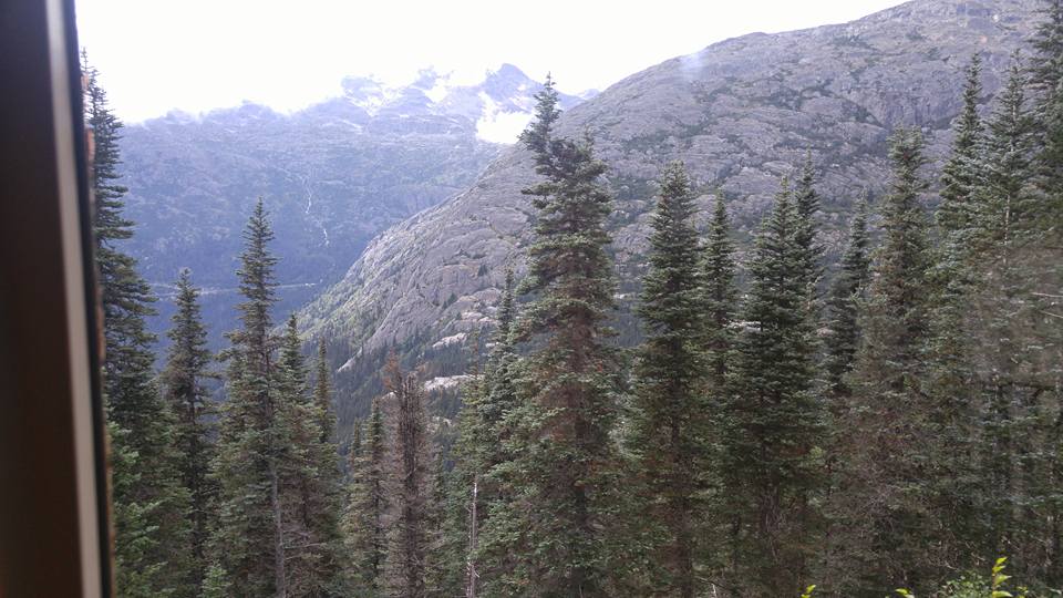
alaska
 The Gold Rush affected many states and many people. Everyone headed west to try their luck, hoping to strike it rich. While the big strikes seemed to be in California, the Black Hills, and Alaska, there were many other places where miners struck it rich…and just as many where the miners went bust. It takes a special group of people to persevere in the gold rush years, and many went home broke, or found another way to cash in on the god rush, such as stores where the miners could buy supplies, or saloons, where they could drown their sorrows.
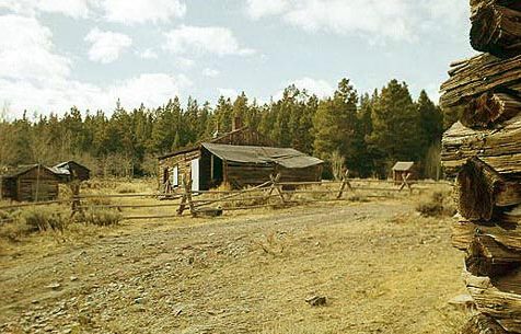
Wyoming had it’s share of gold mines and gold strikes too. Atlantic City was located in west central Wyoming, it was one of three mining towns in the area. The others were South Pass City, and Hamilton City. These towns sprung up as a result of the gold discovery at Spring Gulch in 1867. Hamilton City is located about three miles east of Atlantic City, but it could prove very difficult to locate, because early on in the town’s history, the townspeople unofficially renamed it to Miners Delight after the area’s largest and most productive mine, which carried the same name and was located on Peabody Hill.
The Miners Delight mine was founded by Jonathan Pugh. After a while, the town was officially changed to Miners Delight, since no one called it Hamilton City anyway. At first the mine was a rich enough producing mine to warrant a 10-stamp mill to be erected to crush the rock. The first mention of the town in newspapers appeared in July 1868 with the Sweetwater Mines newspaper describing it as: “…some thirty buildings are up, and more in course of construction. Spring Gulch is turning out the bright ore in very comfortable quantities,” and continues “Ten companies are at work in Spring Gulch…and all appear content with the result of their labors.”
Strangely, the owners of the Miners Delight mine found that recovering gold is more expensive than the gold is worth. After a short few years, the town’s population fell dramatically from its peak of some 75 residents. The Miners Delight Mine shut down in 1874, but soon reopened again…only to close again in 1882. The mining camp would endure good times and bad times over the next several decades, including the Great Depression. Over the years the mine produced over $5 million in gold ore…a relatively small amount as gold goes. The town was inhabited as late as 1960, but today it is nothing but abandoned ruins.
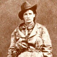
If you go there, you can expect to see rusting iron equipment, such as this old stove, and a couple of iron box screens, around the cabins of Miners Delight, Wyoming. It all seems like nothing much, but in the town’s heyday, it was even home to a couple of famous residents. Henry Tompkins Paige Comstock, would later discover the famous Comstock Lode in Nevada, and a young orphaned girl named Martha Jane Canary, who became known a Calamity Jane. As a child, Marth was adopted and moved with her new parents to Miners Delight. She liked the wild life in both Atlantic City and Miners Delight, and then in Deadwood, South Dakota.
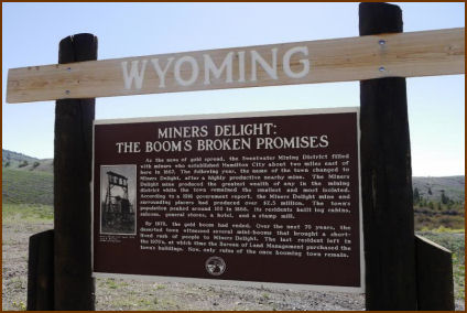
 Today, the site is located on Bureau of Land Management property. Some preservation work has been done in order to keep the few remaining buildings standing, but the site is not being restored. Miners Delight is listed on the National Register of Historic Places. The site continues to preserve several cabins, one building that was said to have been a saloon, a baker, a barn, and a couple of outhouses. They are the last remnants of a long ago era.

 I never thought that I would have much interest in how a guitar was made, but my grandson, Caalab Royce is interested in building guitars, so of course, I became interested too. You do that with your children and grandchildren. Caalab showed me pictures of the guitars he wanted to make, and told me that he could buy a kit to build one, that would include all the parts. I truly believe there will come a day that he will build a guitar, and it will be beautiful, and sound beautiful. I might be
 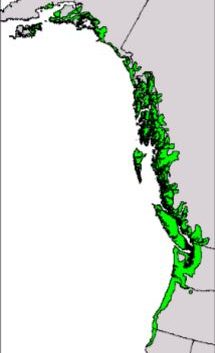 biased, but if my grandson makes it, I know it will be perfect.
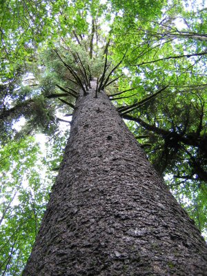
Recently, I stumbled across an article about a musical wood. That caught my attention. I wondered how wood could be musical. Of course, it couldn’t, as I already knew and went on to find out, but the Sitka Spruce tree is, nevertheless, the wood used for the vast majority of acoustic guitar, piano, violin, and other musical-instrument soundboards. That told me that the wood must have some kind of musical importance. I found out that the wood has excellent acoustic properties. The wood is light, soft, and yet, relatively strong and flexible. The Sitka Spruce is also used for general construction, ship building, and plywood.
Found mostly in Southeast Alaskan forests, the Sitka Spruce is being harvested at such a rate that the end of the instrument-quality supply is in sight. That doesn’t mean that the Sitka Spruce was becoming extinct, but it takes time to grow to some size, so the instrument-quality is becoming less available. The population of the Sitka Spruce is stable at this point, and it grows in Alaska, as well as Washington, Oregon, and California, 
 meaning that there is plenty of places to re-seed this important tree. It really is just a matter of waiting for the growth, and when you are talking about a tree, it’s very different than a puppy. You are talking years for a tree. A Sitka Spruce grows to around 88 feet in height after 50 years, to 157 feet after 100 years. That means that by the time the trees grow to usable size, the guitar builders of today will be long gone, so a new generation will be the ones to use the new growth. I hope that Caalab will have a chance to build a guitar out of Sitka Spruce before the wood is no longer available.
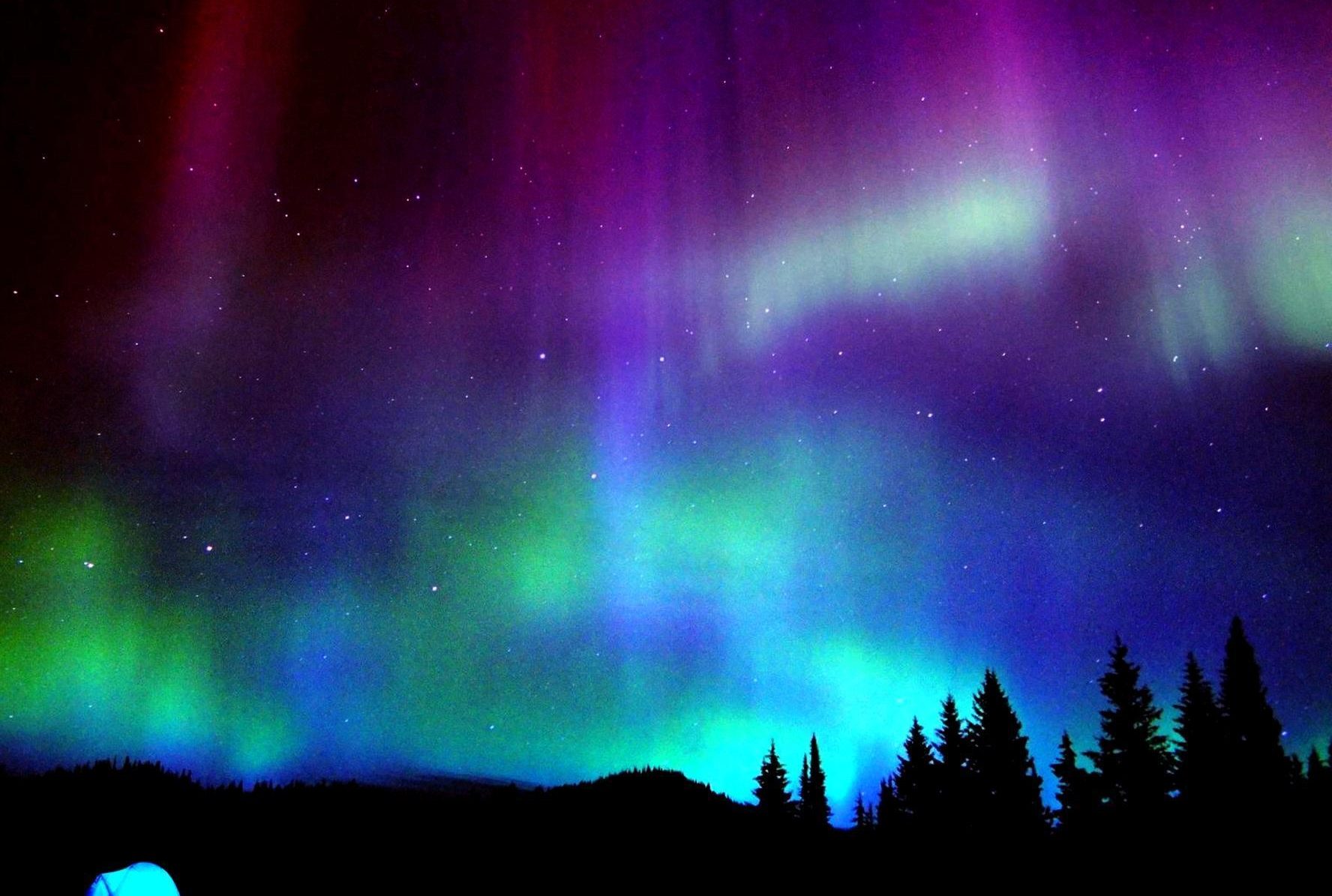
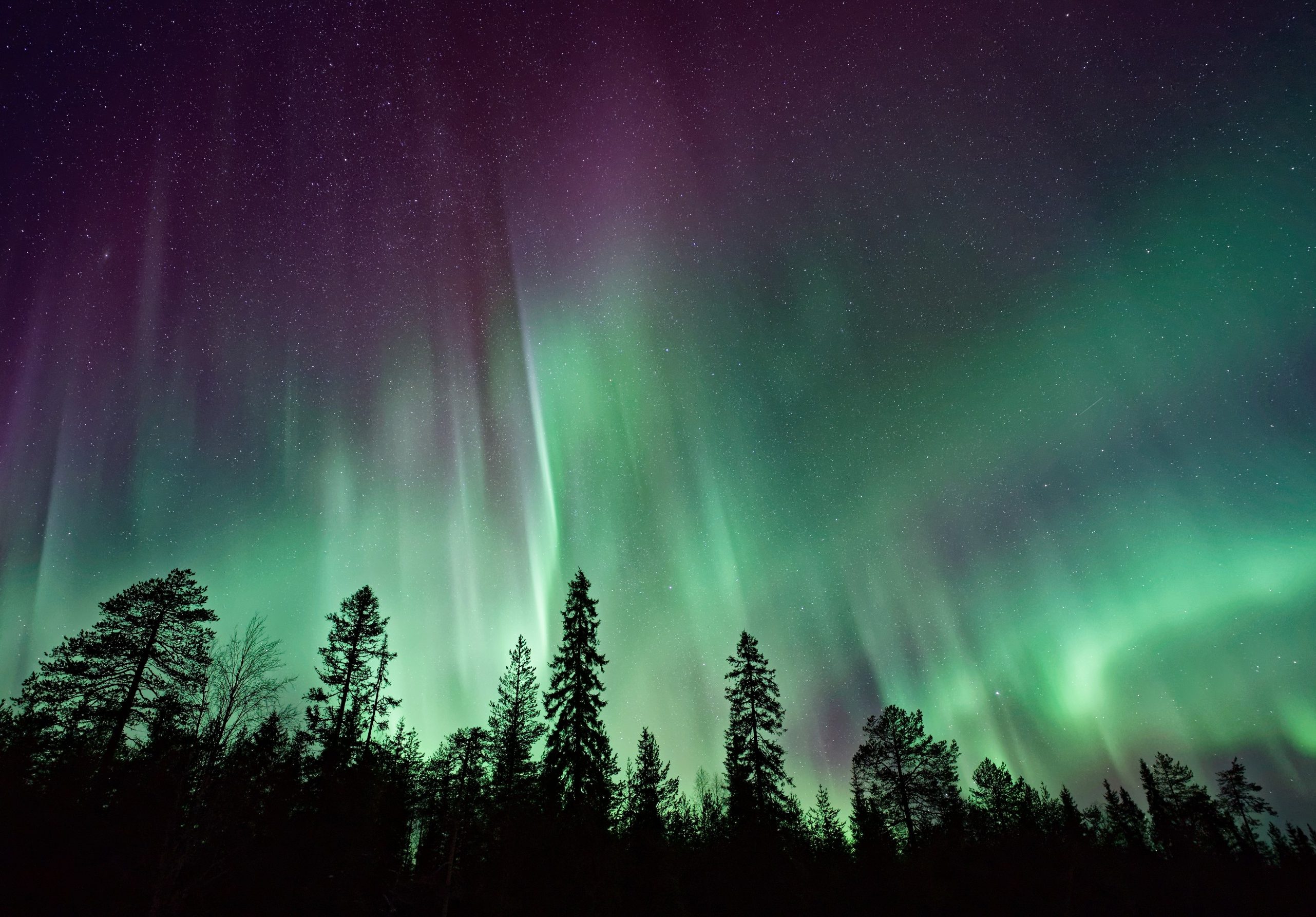 When my husband, Bob and I went to Alaska a few years ago, I was hoping against hope that we would be able to see the Aurora Borealis. The likelihood was slim, of course, because they are most often visible in the winter and we were there in the summer. The Aurora Borealis is caused by solar flares, which occur when pent up magnetic energy on the sun’s surface is unleashed in blasts of radiation and charged particles. The resulting explosions are equivalent to the force of millions of hydrogen bombs, and the solar winds they create have the ability to wreak havoc on Earth’s atmosphere. That was precisely what happened in late August and early September of 1859, when the planet was bombarded by the largest solar storm on record. The so-called “Carrington Event” was named for the British astronomer, Richard Carrington, and it made the skies glow with shimmering, multi-colored auroras as far south as Hawaii. In Colorado, it was so bright that one witness reported people “could easily read common print” at night. And that was in August and September!! Why couldn’t I have been around to see that one?
Most of us have seen pictures of the Northern Lights, also known as the Aurora Borealis. The scene is unforgettable offering an entrancing, dramatic, magical display of dancing lights that are varying in color and fascinate all who see it. It’s hard to believe that an explosion on the sun that sends out radioactive magnetic particles into the atmosphere is responsible for this dazzling natural phenomenon. Of course it is quite complicated. If all those particles were able to just hit the Earth, the event would be disastrous. “The aurora is caused by the interaction of high-energy particles (usually electrons) with neutral atoms in earth’s upper atmosphere. This process is similar to the discharge in a neon lamp, or the fluorescence of a television screen. The strongest auroras are quite bright, comparable to moonlight. At the center of the sun, the temperature is 27 million degrees Fahrenheit (15 million degrees Celsius). As the temperature on its surface rises and falls, 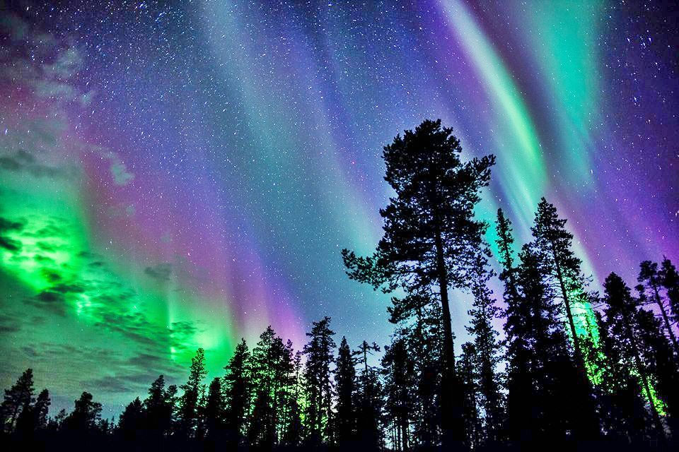
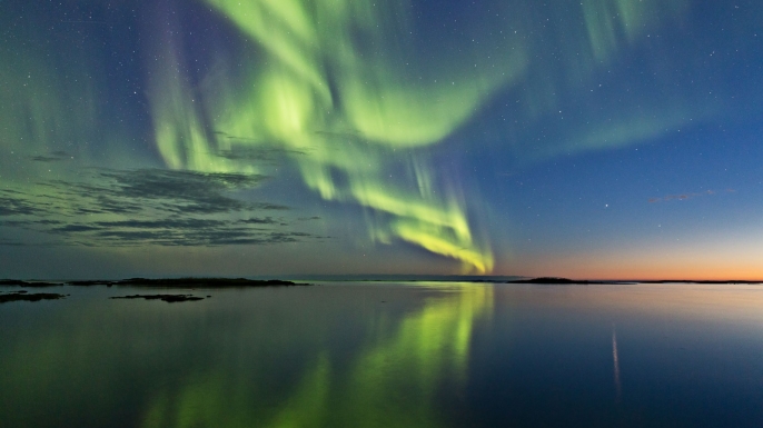 the sun boils and bubbles. Particles escape from the star from the sunspot regions on the surface, hurtling particles of plasma, known as solar wind, into space. It takes these winds around 40 hours to reach Earth. When they do, they can cause the dramatic displays known as the aurora borealis.” However it all happens, is pretty much irrelevant to most of us, we just like the beauty of the Aurora Borealis, and we will continue to be mesmerized by them.
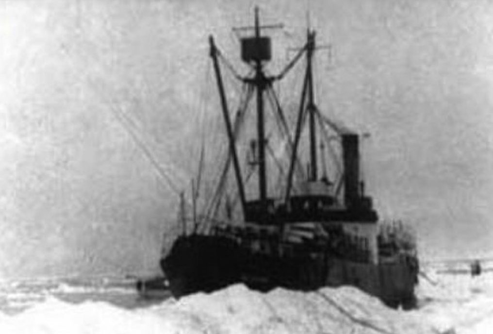 Ghost ships have been a prominent tale of mystery over the years. Many say that seeing a ghost ship is an omen of doom, which I do not believe in, nor do I believe in ghosts or ghost ships, but there was a ship that was dubbed a ghost ship, and has had the longest standing as a possible ghost ship in history, at least to my knowledge. The SS Baychimo was a cargo ship that was built in 1914 in Sweden. It was used for trading routes between Hamburg and Sweden. After World War I, the ship was sold to the Hudson’s Bay Company. The ship made numerous sailings for Hudson’s, mostly carrying cargo to and from the Arctic region.
The Baychimo had a lucrative career until October 1, 1931, when it was on a routine voyage, filled with recently acquired furs. An unexpected storm blew in, trapping the ship in a sea filled with ice. The closest city was Barrow, Alaska, the northern most city in the United States, and almost like being on top of the world, but it was too far to get to in the blowing snow and high winds. The captain and crew had to stay inside the trapped ship, where they hoped to wait out the storm. This storm was the beginning of the more bizarre part of Baychimo’s life.
When October 15th rolled around, the ship could still be found stuck in the ice, so 15 of the crew members were airlifted to safety. The captain and 14 other crew members made a temporary camp on the ice near the stranded ship…which turned out to be a very wise decision. The terrible weather continued to pound the crew and the “temporary” camp became home for weeks. Then, on November 24th, a fierce blizzard hit the area, and the snow was so heavy that the campers could no longer see the Baychimo, which was still trapped in the ice…or so they thought. The next morning, it was just as the expected. The ship had vanished. They assumed that it had been sunk by the preceding blizzard. The remaining crew made their way back to civilization.
Then, less than a week later, a hunter told the captain that the Baychimo could not have sunk, as he had just seen it floating in the icy waters almost fifty miles from the location where it had been abandoned. The captain was, understandably reluctant to battle the snows to try and find the ship, knowing that it could be miles for the last known location. Nevertheless, he gathered his crew and went looking. Just as the hunter had said, they found the Baychimo in the location the hunter had described. The ship looked like it was no longer seaworthy, so the captain didn’t think it would stay afloat much longer and would soon break apart and sink, so the crew gathered the cargo of furs and had everything, including the captain and the crew, airlifted out of the area.
The captain was wrong. The SS Baychimo was spotted again and again. In March of 1933, some Eskimos, trapped by a storm, took shelter in the Baychimo for a week until the weather improved enough to journey back to their homes. In November of 1939, another ship came close enough to the Baychimo that they were 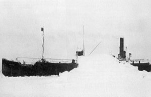 able to board the abandoned ship, but due to the approaching ice floes, the captain did not have the time to bring it back to a port, although he did report the empty ship’s location. In 1969, the Baychimo was spotted at a distance, once again trapped in an ice pack. This was the last recorded sighting of the ship, and after a few years it was commonly believed that the ship did eventually give in to its deteriorating condition and sank to the bottom of the frigid seas. Not everyone agreed though, because in 2006, seventy-five years after the ship was first abandoned, the state of Alaska formally began an effort to find the mysterious SS Baychimo, the Arctic’s elusive wandering ship.
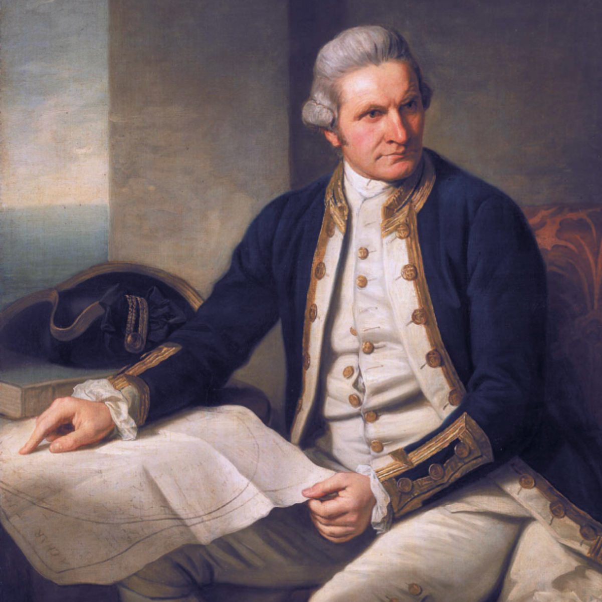 While visiting Alaska a few years ago, Bob and I kept hearing about Captain James Cook. I suppose I had probably heard a little about him at one point or another during my school years, but as often happens with kids, I wasn’t really interested…at least not until I saw Alaska for myself. Then, the places that were discussed in history actually came to life, because I was there in person. In reality, Captain Cook had a direct impact on several areas of the west coast of the United States, including the Puget Sound in Washington and areas of Oregon. Cook’s two ships, the Discovery and Resolution, had worked their way northwest from what is now Oregon and Puget Sound, along the British Columbia and Alaska coast, hoping to find the long sought after Northwest Passage to Europe.
In early June 1778, Captain Cook and his men were in the Cook Inlet, hoping it would lead to the imagined passageway to Europe. It didn’t, of course, but once again Cook sent his crew exploring in small boats. Their adventures there led to the naming of Turnagain Arm, which Captain Cook originally called River Turnagain. It was so named because it was a disappointing “turn again” for Cook’s crew. The problem they were having was because Turnagain is subject to climate extremes and large tide ranges. During high tide, taking a boat in is simple, but if you don’t get out before low tide, you will find yourself fighting the quicksand-like mudflats that make up the beaches along Turnagain Arm in low tide.
In the times that Captain Cook was exploring for England, it was customary to name places after places and people in England. The visit to Cook Inlet was part of Cook’s longer exploration of the Alaska coast from which included a stop in Prince William Sound, which Cook named, along with Bligh Reef in the Sound. Bligh Reef would become famous in 1989 when the tanker Exxon Valdez ran aground on it and spilled millions of gallons of crude oil. Prince William Sound, interestingly, was almost named “Sandwich Sound” by Cook after the Earl of 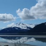 Sandwich in England, and who also, by the way, invented the sandwich as a food item. The Sound was renamed by Cook after Prince William, a descendent of the royal family when his journal was published. Leaving Prince William Sound, Cook ventured west along the Alaska coast to explore further, and after leaving Cook Inlet, he named Bristol Bay after Admiral Earl of Bristol, and Norton Sound after Sir Fletcher Norton, then Speaker of the British House of Commons. As he continued his quest for the Northwest Passage, Cook entered the Chukchi Sea through the Bering Strait and, amazingly, got as far as Icy Cape, on Alaska’s northwest coast, before being stopped by ice. In fact, the two ships were almost trapped by ice the off of Icy Cape.
During his travels, Captain Cook named many other places, including Mount Edgecumbe and Cape Edgecumbe after George, Earl of Edgecumbe. He broke from protocol in naming Mount Fairweather and Cape Fairweather, using the fact that he had good weather at the time of his exploration, as inspiration for the names. Cross Sound was so named because he found it on May 3, designated on his calendar as Holy Cross day. Cape Suckling was named after Maurice Suckling, comptroller of the Royal Navy when Cook left England. Controller Bay was probably also named after Maurice Suckling, but the Russians translated the name to Zal Kontrolyer on the Hydrogaphy Department Chart 1378, dated 1847, and so it remained Controller Bay. Cape Hinchinbrook was named after Viscount Hinchinbroke. Snug Corner Cove was so named because Captain Cook thought, “And a very snug cove it is.” Montague Island was named after John Montagu, Earl of Sandwiche, the son of Viscount Hinchinbroke. The list of names and their origins goes on and on, but I find these the most interesting.
During his third visit to the Sandwiche Islands, which we now know as Hawaii, Captain James Cook lost his life  in a mob fight with the Hawaiian natives, who wanted one of his boats. As the men came ashore, the Hawaiians greeted Cook and his men by hurling rocks at them. They then stole a small cutter vessel from the Discovery. Negotiations with King Kalaniopuu for the return of the cutter collapsed after a lesser Hawaiian chief was shot to death, and a mob of Hawaiians descended on Cook’s party. The captain and his men fired on the angry Hawaiians, but they were outnumbered. Only a few managed to escape to the safety of the Resolution. Captain Cook was killed by the mob on February 14, 1779. A few days later, the Englishmen retaliated by firing their cannons and muskets at the shore, killing some 30 Hawaiians. The Resolution and Discovery eventually returned to England.
![]()
 Dependency on foreign oil has long been a problem for the United States, keeping us always at the mercy of foreign oil companies. When we are dependent on foreign oil, we are subject to their prices and their shortages, or their refusal to sell to us. This nation has always needed to be dependent on our own production of oil, and as an oil rich nation, there is no reason for us to look elsewhere for our oil supply. Of course, the environmentalists would disagree with me, and I don’t want oil spills any more than anyone else does. Still, foreign nations have us at a disadvantage, not to mention that oil production in the United States would provide a lot jobs in the United States.
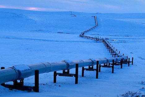
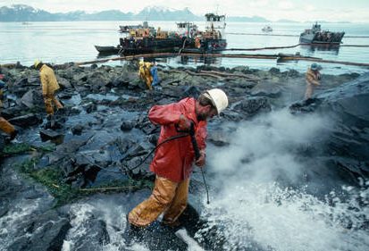
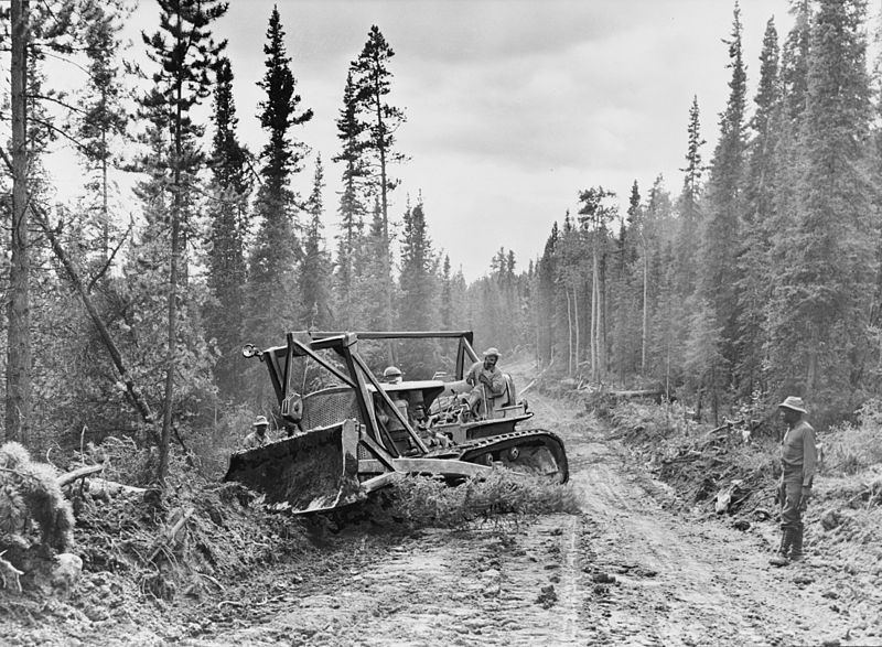
I’m not the only one who thinks this way either. In 1968, a massive oil field was discovered on the north coast of Alaska near Prudhoe Bay, which is north of the Arctic Circle, but the ice-packed waters of the Beaufort Sea are inaccessible to oil tankers. In 1972, the Department of the Interior authorized drilling there, and after the Arab oil embargo of 1973 plans moved quickly to begin construction of a pipeline. The Alyeska Pipeline Service Company was formed by a consortium of major oil companies, and in 1974 construction began. The steel pipeline is 48 inches in diameter, and it winds through 800 miles of Alaskan wilderness, crossing three Arctic mountain ranges and hundreds of rivers and streams. Environmentalists fought to prevent its construction, saying it would destroy a pristine ecosystem, but they were ultimately overruled by Congress, who saw it as a way of lessening America’s dependence on foreign oil. The trans-Alaska pipeline was the world’s largest privately funded construction project to that date, costing $8 billion and taking three years to build. The conservation groups argued that the pipeline would destroy caribou habitats in the Arctic, melt the fragile permafrost (which is permanently frozen subsoil), along its route, and pollute the salmon-rich waters of the Prince William Sound at Valdez. Under pressure, Alyeska agreed to extensive environmental precautions, including building 50% of the pipeline above the ground to protect the permafrost from the naturally heated crude oil and to permit passage of caribou underneath.
On June 20, 1977, with the flip of a switch in Prudhoe Bay, crude oil from the nation’s largest oil field began flowing south, down the trans-Alaska pipeline to the ice-free port of Valdez, Alaska. It wasn’t without its glitches, however. Power supply problems, a cracked section of pipe, faulty welds, and an unsuccessful dynamite attack on the pipeline outside of Fairbanks delayed the arrival of oil at Valdez for several weeks. Finally, in August, the first oil tanker left Valdez en route to the lower 48 states. The trans-Alaska pipeline was great for the Alaskan economy. Today, about 800,000 barrels move through the pipeline each day. Altogether, the pipeline has carried more than 14 billion barrels of oil in its lifetime. For its first decade of existence, the pipeline was quietly applauded as an environmental success, much to the chagrin of the environmentalists. Caribou populations in the vicinity of the pipeline actually grew, partly because many of the grizzly bears and wolves were scared off by the pipeline work, and the permafrost remained intact. The only major oil spill on land occurred when an unknown saboteur blew a hole in the pipe near Fairbanks, and 550,000 gallons of oil spilled onto the ground. Then, on March 24, 1989, the worst fears of environmentalists were realized when the Exxon Valdez ran aground in the Prince William Sound after filling up at the port of Valdez. Ten million gallons of oil were dumped into the water, devastating hundreds of miles of coastline. In the 1990s, the Alaskan oil enterprise drew further controversy when the Alyeska Pipeline Service Company attempted to cover up electrical and mechanical problems in the aging pipeline.
In 2001, President George W. Bush proposed opening a portion of the 19 million acre Arctic National Wildlife 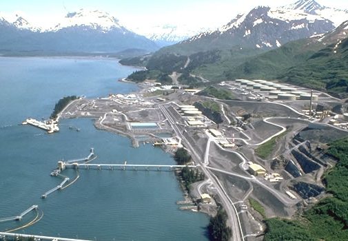
 Refuge, east of Prudhoe Bay, to oil drilling. The environmental groups immediately opposed the proposal and it was initially defeated. Then, in 2006, the Senate voted 51-49 in favor of a budget resolution that included billions for Arctic drilling. Environmental groups are still fighting the legislation. I think, drilling at home is the best way to protect American jobs, and our economy, and as we all know, it could certainly use a serious boost right now.
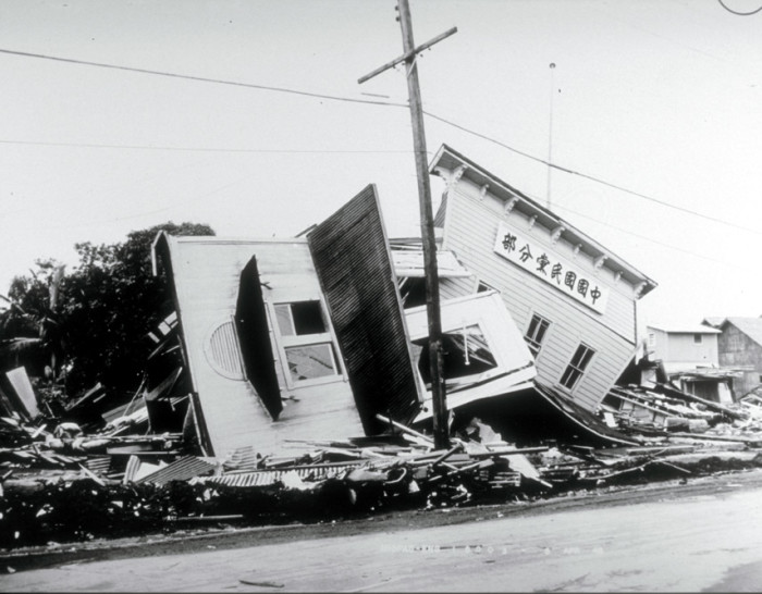
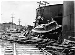
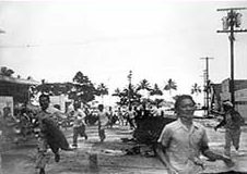 When most of us think about April Fool’s Day, we think of playing some funny prank on our family or friends, but on April Fool’s Day 1946, the Earth played a prank, if it could be called that, on Hawaii. It was a prank that wasn’t funny, and it would claim the lives of 159 people. Early in the morning of that April Fool’s Day, a 7.4 magnitude earthquake struck in the North Pacific, 13,000 feet beneath the ocean surface, and off Unimak Island in the Aleutian chain, that makes up the tail of Alaska. The quake triggered devastating tidal waves throughout the Pacific, and particularly aimed at Hawaii. The first tidal wave hit Unimak Island shortly after the quake struck. The wave was estimated to be almost 100 feet, and it crashed into a lighthouse 30 feet above sea level. Five people lived in the lighthouse. It was smashed to pieces, and all five were killed instantly. The wave then headed toward the Southern Pacific at 500 miles per hour. The situation was like a freight train carrying an atomic bomb.
Hawaii was 2,400 miles south of the quake’s epicenter, and Captain Wickland of the United States Navy was the first person to spot the coming wave at about 7:00am, four and a half hours after the quake struck in the Aleutian Islands. His position on the bridge of a ship, 46 feet above sea level, put him at eye level with a “monster wave” that he described as two miles long. The first wave came in and receded, then the water in Hilo Bay seemed to disappear. The boats that were docked there, settled on the sea floor, surrounded by flopping fish. Then…the second wave hit…and it was massive!! The city of Hilo was hit by a 32 foot wave that devastated the town. Nearly a third of the city was completely destroyed. The bridge that crossed the Wailuku River was picked up by the wave, and pushed 300 feet away. In Hilo, 96 people lost their lives in the tsunami. Other parts of Hawaii were hit even worse. In some places, the waves reached heights of 60 feet. A schoolhouse in Laupahoehoe was crushed by the tsunami, killing the teacher and 25 students inside.
The massive wave was seen as far away as Chile, where, 18 hours after the quake near Alaska, unusually large waves crashed ashore, but there were no casualties. This tsunami prompted the United States to establish the Seismic SeaWave Warning System two years later, which is now known as the Pacific Tsunami Warning System. 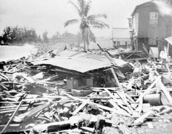
 It uses undersea buoys throughout the ocean, in combination with seismic-activity detectors, to find possible killer waves. The warning system was used for the first time on November 4, 1952. That day, an evacuation was successfully carried out, but the expected wave never materialized. Still, like the fire drills we all know about from school, maybe Tsunami Drills wouldn’t be a bad thing either, especially if it would prevent the kind of loss of life that Hawaii experienced on that awful April Fool’s Day in 1946.
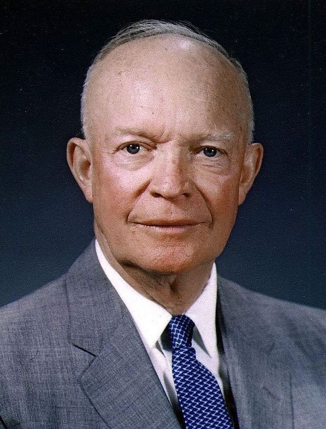 Recently, I found out that President Dwight D Eisenhower is my sixth cousin six times removed. We are connected on my mother’s side through her Pattan roots, which is her mother’s side. Eisenhower was the 34th president of the Unites States, serving from January 20, 1953 to January 20, 1961. He was also a five-star general in the United States Army during World War II and served as Supreme Commander of the Allied Expeditionary Forces in Europe. Eisenhower was responsible for planning and supervising the invasion of North Africa in Operation Torch in 1942 – 1943 and the successful invasion of France and Germany in 1944 – 1945 from the Western Front. In 1951, he became the first Supreme Commander of NATO.
With everything else that he did, it seems odd, I suppose, to mention the fact that on March 18, 1959, he signed the Admission Act. Basically, the act dissolved the Territory of Hawaii and established the State of Hawaii as the 50th state to be admitted into the Union. Statehood became effective on August 21, 1959…the last state to join the United States. Eisenhower, in fact, was the president who signed the last two states into the United States. To me that must have been such an awe inspiring thing to get to do. My guess is that Eisenhower really had no idea that Hawaii would forever be the last state in the United States, and I suppose that it is still possible that 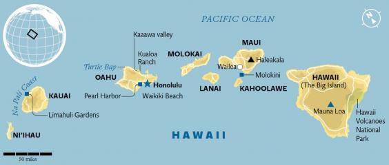 another may join, but it has been almost 58 years, so it seems highly unlikely that there will be another. I wonder if, as his life was drawing to a close, Eisenhower gave any thought to the fact that he got to do that…to bring in the final two states in the United States. I also wonder if anyone thought there would ever be more states after Arizona and New Mexico were added in 1912, almost 47 years earlier. Maybe, adding another state to our country didn’t seem like such an important thing for a president to do, but I think it is. And to be the president to add the last two states…well, I just think that is very cool.
 My nephew, Dave Chase, who married my niece Toni on December 18, 2012, loves to travel. It is a passion they both share. A lot of their travel time includes hiking or ball games, but the trip they took this last fall was a little bit different. They were taking a trip that would take them to the same places that Toni’s grandparents, my parents, Al and Collene Spencer, had gone…Alaska. It was my parents dream trip, and Toni wanted to take it too. Dave was totally on board…literally, in fact, since it was a cruise, after all. They took the same cruise my parents had gone and had a wonderful time.
Some of Dave’s family joined them for the cruise, including his brother, Dan. These guys are both very competitive, and so naturally they entered every contest on the cruise ship. Trivia, bean bag toss, basketball, golf…you name it, they got in on it. And not only did they get in on it, the won almost every contest they entered. At first everyone was great about it, but by the end of the cruise, there were a number of people who did not like them, because of it. What do you do…sit out the fun because someone might get upset. In the end, they took home seven trophies…with they call “Our Little Golden Ships.” I guess I find it hard to think that people didn’t like the brothers, because while I don’t personally know Dan, I do know Dave, and I would find it impossible not to like Dave.
Dave and Toni are so perfect together. The are active, and outgoing. Dave is so supportive in the business Toni has started, and he runs any errands she needs done, and helps with the shipping. He is a hard worker, and is 
 willing to help out whenever he is asked to. The day Dave married into this family, he took that to mean that he was a full fledged part of it, and all that entailed. He is right of course, he is a full fledged part of the family, but he takes that to mean more…such as taking on any of the responsibilities that go along with being a family member. Not everyone who marries into a family feels that way, but that is something I have seen in Dave from the very start, and it makes me very proud to call him my nephew. Today is Dave’s birthday. Happy birthday Dave!! Have a great day!! We Love you!!
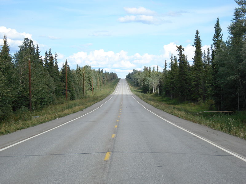
 For as long as I can remember, the Alaskan Highway, known as the ALCAN Highway, has been something my parents, and especially my dad had been interested in…for most of his adult life, in fact. Construction began on the highway during World War II for the purpose of connecting the contiguous United States to Alaska through Canada. The highway begins in Dawson Creek, British Columbia, at the junction of several Canadian highways, and runs to Delta Junction, Alaska, via Whitehorse, Yukon. The highway was completed in 1942 at a length of 1,700 miles, but as of 2012, it is only 1,387 miles long. The difference is due to constant reconstruction of the highway, which has included rerouting and straightening numerous sections. The highway formally opened on November 21, 1942, but only for military use. It was not opened to the public until 1948. The highway has been legendary for decades as being a rough and challenging drive, probably because parts of it were not paved. Now however, the entire length is paved, so I suppose that took much of the difficulty out of it.
My dad has always loved to travel, and the ALCAN Highway literally called his name. It was his dream for all of his daughters and their families to caravan to Alaska by way of the ALCAN Highway. I think that needed to be a trip taken when we were all still single, and living at home, because it ended up being an unrealized dream 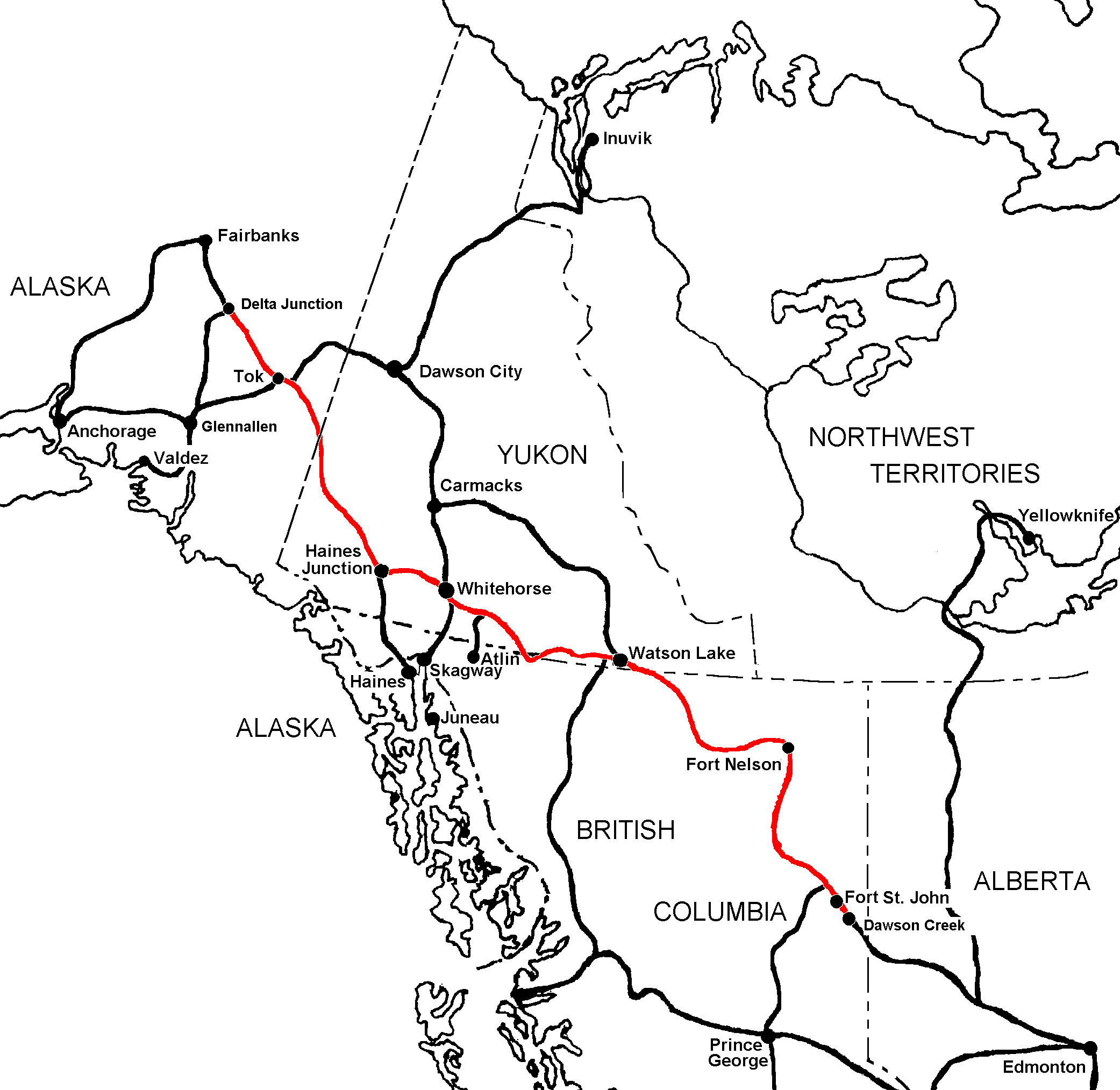
 from my dad’s life. I think Dad would have made the trip anytime we could all get our plans together, but that simply never happened. If one of us could have done it, some of the others couldn’t have, and Dad couldn’t fathom the idea of leaving anyone out. When their 50th wedding anniversary rolled around in 2003, my sisters and I decided that we needed to send them on an Alaska cruise, and while it was not the drive on the ALCAN Highway that Dad had wanted, it did let them visit Alaska, and that was the main thing…I suppose. They had a wonderful time, but I’m sure that it was a little bittersweet too, because they were there without their family. My husband, Bob and I, and my niece Toni Chase and her husband, Dave have since taken cruises to Alaska too, and I know my parents would be happy about that, but looking back now, I wish we could have figured out a way to make their dream of the drive on the ALCAN Highway a reality. I really do continue to regret that.
Over the years, informal historic mileposts have been added to denote major stopping points in the highway’s construction. Dawson Creek sports the milepost marker for the start of the ALCAN Highway. Delta Junction, which is the end of the highway, makes reference to its location at Historic Milepost 1422. The Alaska Highway meets the Richardson Highway at this point. The Richardson Highway continues 96 miles to the city of 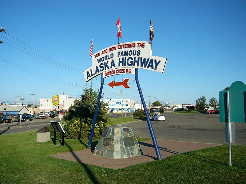
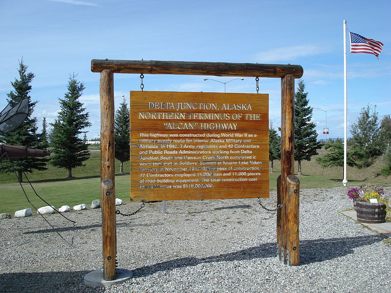 Fairbanks. This is often regarded, though unofficially, as the northern portion of the Alaska Highway, with Fairbanks at Historic Milepost 1520. It makes sense, but was not part of the original construction. The mileposts on this stretch of highway are measured from Valdez, rather than the Alaska Highway. Another oddity is that, the ALCAN Highway is popularly, though not officially, considered part of the Pan-American Highway, which extends south to Argentina, despite its discontinuity in Panama. It’s quite an amazing system, and I think I can see why my dad was so fascinated by it.

